
Landlord's Agent in 2025
Andrea Rockey
BHHS Professional Realty
(937) 677-0007
1 in this area
44 Total Sales
Estimated Value: $120,000 - $192,422
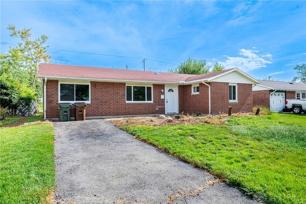
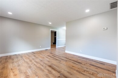
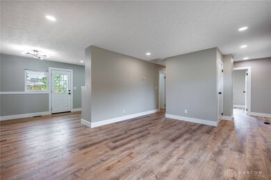
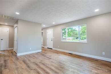
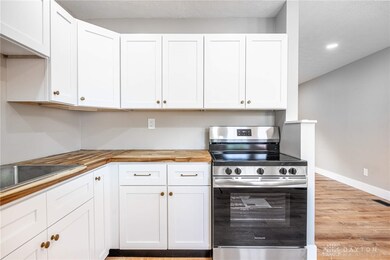
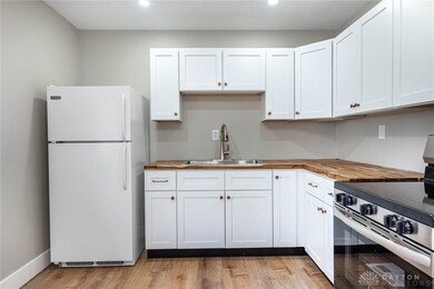
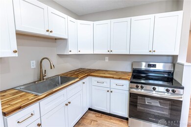
This freshly renovated 3-bedroom, 1.5-bath house in Xenia has all the updates you’ve been looking for—and the bonus room makes it feel even bigger, easily working as a 4th bedroom, extra living space, or a home office. Inside you’ll find brand-new LVP flooring throughout, fresh paint, a fully updated kitchen with modern white cabinets, butcher block countertops, a large sink, and new lighting that ties it all together. Outside, enjoy a fenced-in backyard with plenty of room to relax or play. Tucked right next to the brand-new Warner Middle School, this home is move-in ready and waiting for you. Tenant pays all utilities. Pets welcome, with owner approval (fees apply). Application covers credit, criminal, and eviction checks. Security deposit = one month's rent. DO NOT FALL VICTIM TO RENTAL SCAMS!! NO MONEY will EVER be requested via Venmo/CashApp/etc. Only applications sent by property manager to be used. Agent Owned. Don't wait! Call to schedule your private tour today!
Last Agent to Rent the Property
BHHS Professional Realty Brokerage Phone: (937) 426-7070 License #2017005698 Listed on: 09/04/2025
Last Renter's Agent
BHHS Professional Realty Brokerage Phone: (937) 426-7070 License #2017005698 Listed on: 09/04/2025
| Date | Buyer | Sale Price | Title Company |
|---|---|---|---|
| Harlow Jacob | $128,000 | Northwest Fidelity Title Llc |
| Date | Status | Borrower | Loan Amount |
|---|---|---|---|
| Open | Harlow Jacob | $102,400 |
| Date | Event | Price | List to Sale | Price per Sq Ft |
|---|---|---|---|---|
| 10/10/2025 10/10/25 | Rented | $1,695 | 0.0% | -- |
| 09/04/2025 09/04/25 | For Rent | $1,695 | -- | -- |
| Year | Tax Paid | Tax Assessment Tax Assessment Total Assessment is a certain percentage of the fair market value that is determined by local assessors to be the total taxable value of land and additions on the property. | Land | Improvement |
|---|---|---|---|---|
| 2024 | $1,565 | $47,340 | $11,140 | $36,200 |
| 2023 | $1,565 | $47,340 | $11,140 | $36,200 |
| 2022 | $1,213 | $33,550 | $6,550 | $27,000 |
| 2021 | $1,229 | $33,550 | $6,550 | $27,000 |
| 2020 | $1,011 | $33,550 | $6,550 | $27,000 |
| 2019 | $1,011 | $28,820 | $6,370 | $22,450 |
| 2018 | $1,015 | $28,820 | $6,370 | $22,450 |
| 2017 | $889 | $28,820 | $6,370 | $22,450 |
| 2016 | $889 | $26,010 | $6,370 | $19,640 |
| 2015 | $376 | $26,010 | $6,370 | $19,640 |
| 2014 | -- | $26,010 | $6,370 | $19,640 |
Landlord's Agent in 2025
Andrea Rockey
BHHS Professional Realty
(937) 677-0007
1 in this area
44 Total Sales
Source: Dayton REALTORS®
MLS Number: 942920
APN: M40-0001-0029-0-0081-00
Disclaimer: Certain information contained herein is derived from information provided by parties other than Homes.com. All information provided is deemed reliable, but is not guaranteed to be accurate and should be independently verified.
![]() The information is being provided by Dayton Area Board of Realtors MLS. Information deemed reliable but not guaranteed. Information is provided for the consumer's personal, non-commercial use, and may not be used for any purpose other than the identification of potential properties for purchase. Copyright 2025 Dayton Area Board of Realtors MLS. All Rights Reserved.
The information is being provided by Dayton Area Board of Realtors MLS. Information deemed reliable but not guaranteed. Information is provided for the consumer's personal, non-commercial use, and may not be used for any purpose other than the identification of potential properties for purchase. Copyright 2025 Dayton Area Board of Realtors MLS. All Rights Reserved.