Estimated Value: $158,000 - $187,000
3
Beds
1
Bath
999
Sq Ft
$177/Sq Ft
Est. Value
About This Home
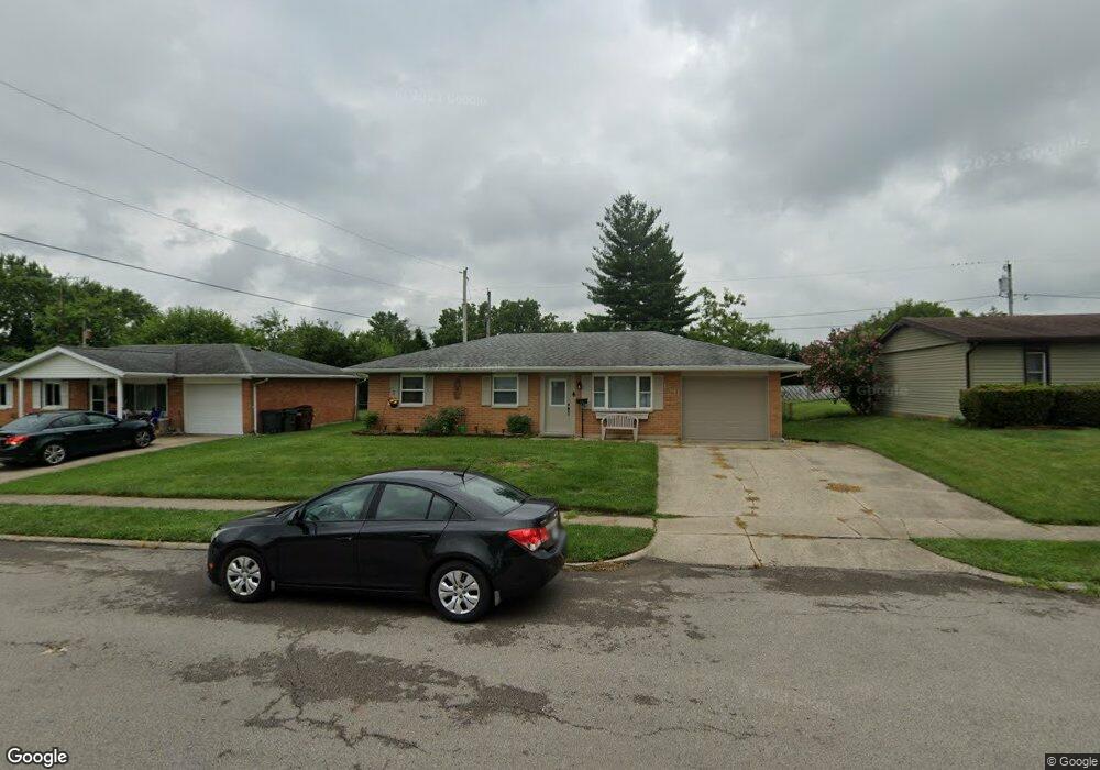
This home is located at 1541 Arrowhead Trail, Xenia, OH 45385 and is currently estimated at $176,624, approximately $176 per square foot. 1541 Arrowhead Trail is a home located in Greene County with nearby schools including Xenia High School, Summit Academy Community School for Alternative Learners - Xenia, and Legacy Christian Academy.
Ownership History
Date
Name
Owned For
Owner Type
Purchase Details
Closed on
Sep 4, 2019
Sold by
Bearlake Rentals Llc
Bought by
Rodgers Robin L and Rodgers Kimberly K
Current Estimated Value
Purchase Details
Closed on
Jun 27, 2017
Sold by
Kellenbarger Betty
Bought by
Rodgers Robin L and Rodgers Kimberly K
Purchase Details
Closed on
Mar 6, 2009
Sold by
Hilderbrand Charles Keith and Hilderbrand Phyllis M
Bought by
Rodgers Robin L and Rodgers Kimberly K
Home Financials for this Owner
Home Financials are based on the most recent Mortgage that was taken out on this home.
Original Mortgage
$62,400
Interest Rate
5.09%
Mortgage Type
Unknown
Purchase Details
Closed on
Sep 26, 2003
Sold by
Hilderbrand Dana
Bought by
Hilderbrand Charles K and Whitt Linda S
Create a Home Valuation Report for This Property
The Home Valuation Report is an in-depth analysis detailing your home's value as well as a comparison with similar homes in the area
Home Values in the Area
Average Home Value in this Area
Purchase History
| Date | Buyer | Sale Price | Title Company |
|---|---|---|---|
| Rodgers Robin L | -- | None Available | |
| Rodgers Robin L | -- | None Available | |
| Rodgers Robin L | $78,000 | Attorney | |
| Hilderbrand Charles K | -- | -- |
Source: Public Records
Mortgage History
| Date | Status | Borrower | Loan Amount |
|---|---|---|---|
| Previous Owner | Rodgers Robin L | $62,400 |
Source: Public Records
Tax History Compared to Growth
Tax History
| Year | Tax Paid | Tax Assessment Tax Assessment Total Assessment is a certain percentage of the fair market value that is determined by local assessors to be the total taxable value of land and additions on the property. | Land | Improvement |
|---|---|---|---|---|
| 2024 | $1,893 | $44,250 | $11,050 | $33,200 |
| 2023 | $1,893 | $44,250 | $11,050 | $33,200 |
| 2022 | $1,568 | $31,250 | $6,500 | $24,750 |
| 2021 | $1,589 | $31,250 | $6,500 | $24,750 |
| 2020 | $1,522 | $31,250 | $6,500 | $24,750 |
| 2019 | $1,316 | $25,430 | $6,370 | $19,060 |
| 2018 | $1,321 | $25,430 | $6,370 | $19,060 |
| 2017 | $1,206 | $25,430 | $6,370 | $19,060 |
| 2016 | $1,206 | $22,790 | $6,370 | $16,420 |
| 2015 | $1,210 | $22,790 | $6,370 | $16,420 |
| 2014 | $1,158 | $22,790 | $6,370 | $16,420 |
Source: Public Records
Map
Nearby Homes
- 1208 Bellbrook Ave
- 1272 Bellbrook Ave
- 1144 Rockwell Dr
- 1618 Navajo Dr
- 1778 Arapaho Dr
- 1653 Seneca Dr
- 1568 Cheyenne Dr
- 1342 Kylemore Dr
- 1769 Gayhart Dr
- 1866 Roxbury Dr
- 1829 Gayhart Dr
- 1233 June Dr
- 1283 June Dr
- 1223 June Dr
- 1391 June Dr
- 1908 Whitt St
- 2758 Wyoming Dr
- 121 S Progress Dr
- 1255 Colorado Dr
- 523 Newport Rd
- 1553 Arrowhead Trail
- 1527 Arrowhead Trail
- 1540 Wigwam Trail
- 1565 Arrowhead Trail
- 1550 Wigwam Trail
- 1526 Wigwam Trail
- 1538 Arrowhead Trail
- 934 Moccasin Trail
- 1552 Arrowhead Trail
- 1526 Arrowhead Trail
- 1556 Wigwam Trail
- 1514 Arrowhead Trail
- 1589 Arrowhead Trail
- 1491 Arrowhead Trail
- 887 Tomahawk Trail
- 1564 Wigwam Trail
- 1583 Wigwam Trail
- 882 Moccasin Trail
- 1490 Arrowhead Trail
- 927 Moccasin Trail