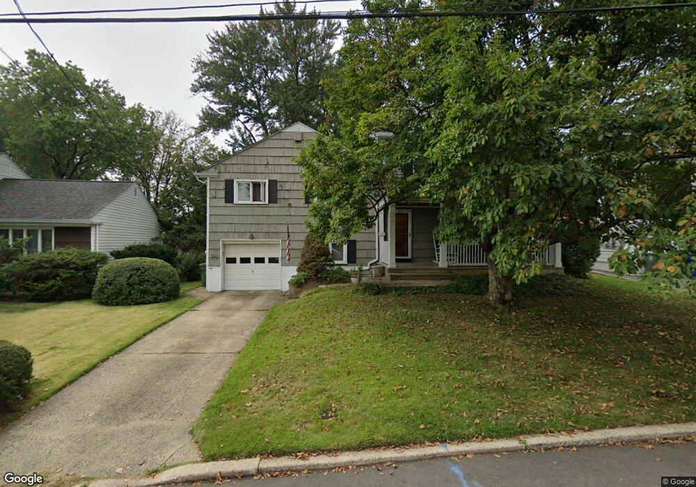
1541 Cornell Dr Linden, NJ 07036
Estimated Value: $558,000 - $674,000
--
Bed
--
Bath
1,120
Sq Ft
$528/Sq Ft
Est. Value
About This Home
This home is located at 1541 Cornell Dr, Linden, NJ 07036 and is currently estimated at $591,180, approximately $527 per square foot. 1541 Cornell Dr is a home located in Union County with nearby schools including Deerfield Terrace School No. 9, Myles J. McManus Middle School, and Linden High School.
Ownership History
Date
Name
Owned For
Owner Type
Purchase Details
Closed on
Mar 15, 2001
Sold by
Metz William H and Metz Carol A
Bought by
Picaro Joseph and Picaro Dorothy
Current Estimated Value
Home Financials for this Owner
Home Financials are based on the most recent Mortgage that was taken out on this home.
Original Mortgage
$135,000
Outstanding Balance
$49,121
Interest Rate
7.01%
Estimated Equity
$542,059
Purchase Details
Closed on
Dec 19, 1997
Sold by
Metz William H and Metz Carol A
Bought by
Metz William H and Metz Carol A
Create a Home Valuation Report for This Property
The Home Valuation Report is an in-depth analysis detailing your home's value as well as a comparison with similar homes in the area
Home Values in the Area
Average Home Value in this Area
Purchase History
| Date | Buyer | Sale Price | Title Company |
|---|---|---|---|
| Picaro Joseph | $215,000 | -- | |
| Metz William H | -- | -- |
Source: Public Records
Mortgage History
| Date | Status | Borrower | Loan Amount |
|---|---|---|---|
| Open | Picaro Joseph | $135,000 |
Source: Public Records
Tax History Compared to Growth
Tax History
| Year | Tax Paid | Tax Assessment Tax Assessment Total Assessment is a certain percentage of the fair market value that is determined by local assessors to be the total taxable value of land and additions on the property. | Land | Improvement |
|---|---|---|---|---|
| 2025 | $10,675 | $151,800 | $63,000 | $88,800 |
| 2024 | $10,441 | $151,800 | $63,000 | $88,800 |
| 2023 | $10,441 | $151,800 | $63,000 | $88,800 |
| 2022 | $10,495 | $151,800 | $63,000 | $88,800 |
| 2021 | $10,549 | $151,800 | $63,000 | $88,800 |
| 2020 | $10,492 | $151,800 | $63,000 | $88,800 |
| 2019 | $10,458 | $151,800 | $63,000 | $88,800 |
| 2018 | $10,454 | $151,800 | $63,000 | $88,800 |
| 2017 | $10,228 | $151,800 | $63,000 | $88,800 |
| 2016 | $9,906 | $151,800 | $63,000 | $88,800 |
| 2015 | $9,528 | $151,800 | $63,000 | $88,800 |
| 2014 | $9,343 | $136,100 | $63,000 | $73,100 |
Source: Public Records
Map
Nearby Homes
- 1405 Kent Place
- 614 Inwood Rd
- 1915 Crescent Pkwy
- 1717 Crescent Pkwy
- 1000 Academy Terrace
- 426 Edgewood Rd
- 565 Valley Rd
- 1015 Georgian Dr
- 357 Edgewood Rd
- 1174 Debra Dr
- 1 Crestwood Ln
- 2316 Old Grove Rd
- 718 Midvale Place
- 601 Birchwood Rd
- 783 Riverbend Dr
- 1611 Dewitt Terrace
- 1017 Karen Terrace
- 617 Livingston Rd
- 1720 Dewitt Terrace
- 545 Livingston Rd
- 1533 Cornell Dr
- 1549 Cornell Dr
- 1614 Lenape Rd
- 1620 Lenape Rd
- 1525 Cornell Dr
- 1555 Cornell Dr
- 1606 Lenape Rd
- 1628 Lenape Rd
- 1540 Cornell Dr
- 1526 Cornell Dr
- 711 Fairway Rd
- 1601 Cornell Dr
- 1600 Lenape Rd
- 1632 Lenape Rd
- 1515 Cornell Dr
- 722 Princeton Rd
- 1548 Lenape Rd
- 1607 Cornell Dr
- 716 Princeton Rd
- 1642 Lenape Rd