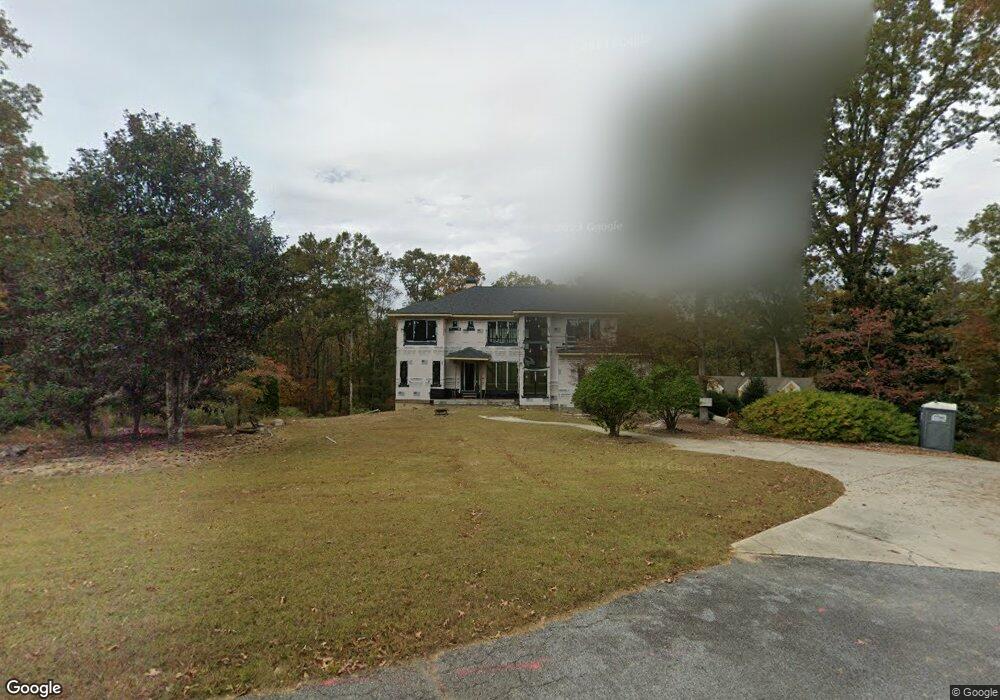
1541 Mcconnell Rd Grayson, GA 30017
Estimated Value: $412,000 - $533,840
2
Beds
5
Baths
2,104
Sq Ft
$221/Sq Ft
Est. Value
About This Home
This home is located at 1541 Mcconnell Rd, Grayson, GA 30017 and is currently estimated at $464,960, approximately $220 per square foot. 1541 Mcconnell Rd is a home located in Gwinnett County with nearby schools including Starling Elementary School, Couch Middle School, and Grayson High School.
Ownership History
Date
Name
Owned For
Owner Type
Purchase Details
Closed on
Dec 12, 2003
Sold by
Stephens David A and Stephens Cmilla E
Bought by
Abouzeidan Zeidan
Current Estimated Value
Home Financials for this Owner
Home Financials are based on the most recent Mortgage that was taken out on this home.
Original Mortgage
$322,700
Outstanding Balance
$150,473
Interest Rate
5.97%
Mortgage Type
New Conventional
Estimated Equity
$314,487
Create a Home Valuation Report for This Property
The Home Valuation Report is an in-depth analysis detailing your home's value as well as a comparison with similar homes in the area
Home Values in the Area
Average Home Value in this Area
Purchase History
| Date | Buyer | Sale Price | Title Company |
|---|---|---|---|
| Abouzeidan Zeidan | $480,000 | -- |
Source: Public Records
Mortgage History
| Date | Status | Borrower | Loan Amount |
|---|---|---|---|
| Open | Abouzeidan Zeidan | $322,700 |
Source: Public Records
Tax History Compared to Growth
Tax History
| Year | Tax Paid | Tax Assessment Tax Assessment Total Assessment is a certain percentage of the fair market value that is determined by local assessors to be the total taxable value of land and additions on the property. | Land | Improvement |
|---|---|---|---|---|
| 2024 | -- | $169,680 | $80,200 | $89,480 |
| 2023 | $4,761 | $169,680 | $80,200 | $89,480 |
| 2022 | $4,265 | $126,080 | $40,320 | $85,760 |
| 2021 | $4,335 | $126,080 | $40,320 | $85,760 |
| 2020 | $8,922 | $251,600 | $40,320 | $211,280 |
| 2019 | $7,610 | $209,200 | $29,960 | $179,240 |
| 2018 | $7,630 | $209,200 | $29,960 | $179,240 |
| 2016 | $7,645 | $209,200 | $29,960 | $179,240 |
| 2015 | $7,187 | $193,698 | $36,720 | $156,978 |
| 2014 | $8,303 | $227,880 | $43,200 | $184,680 |
Source: Public Records
Map
Nearby Homes
- 89 Oatgrass Dr
- 145 Millennial Ct
- 91 Gates Mill Dr
- 449 Oatgrass Dr
- 1437 Leach Dr
- 191 Gates Mill Dr
- 157 Silvergrass Pass
- 490 Brackin Trace
- 391 Gates Mill Dr
- 122 Sweet Branch Ct
- 1345 Chandler Rd Unit 1
- 85 Annie Chandler Trail
- 120 Whitegrass Way
- 101 Whitegrass Way
- 35 Leighs Grove Way
- 1480 Chandler Rd
- 1640 Wheat Grass Way
- 1540 Mcconnell Rd
- 1615 Millennial Ln
- 1625 Millennial Ln
- 1403 Sutters Walk
- 119 Oatgrass Dr
- 119 Oatgrass Dr Unit 13
- 1605 Millennial Ln
- 1635 Millennial Ln Unit 2
- 109 Oatgrass Dr
- 109 Oatgrass Dr Unit 14
- 60 Millennial Ct
- 1393 Sutter Walk
- 129 Oatgrass Dr Unit 12A
- 129 Oatgrass Dr
- 1382 Sutters Walk
- 1591 Mcconnell Rd
- 139 Oatgrass Dr Unit 11
- 139 Oatgrass Dr
- 1393 Sutters Walk
- 1595 Millennial Ln