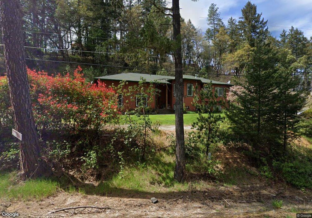
1542 Applegate Ave Grants Pass, OR 97527
Estimated Value: $619,718 - $656,000
5
Beds
4
Baths
1,394
Sq Ft
$458/Sq Ft
Est. Value
About This Home
This home is located at 1542 Applegate Ave, Grants Pass, OR 97527 and is currently estimated at $637,859, approximately $457 per square foot. 1542 Applegate Ave is a home located in Josephine County with nearby schools including Ft. Vannoy Elementary School, Lincoln Savage Middle School, and Hidden Valley High School.
Ownership History
Date
Name
Owned For
Owner Type
Purchase Details
Closed on
Nov 16, 2006
Sold by
Egger Susan H
Bought by
Hageman Brian S and Hageman Shannon R
Current Estimated Value
Home Financials for this Owner
Home Financials are based on the most recent Mortgage that was taken out on this home.
Original Mortgage
$374,000
Interest Rate
6.37%
Mortgage Type
Construction
Purchase Details
Closed on
May 25, 2005
Sold by
Egger Paul and Egger Yvette
Bought by
Egger Susan H
Create a Home Valuation Report for This Property
The Home Valuation Report is an in-depth analysis detailing your home's value as well as a comparison with similar homes in the area
Purchase History
| Date | Buyer | Sale Price | Title Company |
|---|---|---|---|
| Hageman Brian S | $120,000 | Ticor Title | |
| Egger Susan H | -- | -- |
Source: Public Records
Mortgage History
| Date | Status | Borrower | Loan Amount |
|---|---|---|---|
| Closed | Hageman Brian S | $374,000 |
Source: Public Records
Tax History
| Year | Tax Paid | Tax Assessment Tax Assessment Total Assessment is a certain percentage of the fair market value that is determined by local assessors to be the total taxable value of land and additions on the property. | Land | Improvement |
|---|---|---|---|---|
| 2025 | $2,203 | $303,380 | -- | -- |
| 2024 | $2,203 | $294,550 | -- | -- |
| 2023 | $1,802 | $285,980 | $0 | $0 |
| 2022 | $1,820 | $277,660 | -- | -- |
| 2021 | $1,706 | $269,580 | $0 | $0 |
| 2020 | $1,779 | $261,730 | $0 | $0 |
| 2019 | $1,709 | $254,110 | $0 | $0 |
| 2018 | $1,732 | $246,710 | $0 | $0 |
| 2017 | $1,732 | $239,530 | $0 | $0 |
| 2016 | $1,470 | $232,560 | $0 | $0 |
Source: Public Records
Map
Nearby Homes
- 5250 Redwood Ave
- 2587 Woodland Park Rd
- 6181 Lower River Rd
- 1100 Riverbanks Rd
- 2868 Woodland Park Rd
- 170 Pine Ridge Dr
- 0 Redwood Hwy Unit 220200455
- 0 Redwood Hwy Unit 677188456
- 3201 Helms Rd
- 4945 Lower River Rd
- 1290 Ojai Ave
- 3424 Amber Ln
- 1627 Southgate Way
- 2593 Midway Ave
- 250 Cambridge Dr
- 3340 Redwood Hwy
- 550 Marcy Loop Rd
- 442 Ashwood Dr
- 445 Ashwood Dr
- 139 Sloan Mountain Ln
- 241 Pauldine Way
- 111 Karral Dr
- 133 Karral Dr
- 1599 Applegate Ave
- 215 Karral Dr
- 306 Pauldine Way
- 205 Karral Dr
- 317 Pauldine Way
- 1531 Applegate Ave
- 200 Karral Dr
- 235 Karral Dr
- 1500 Applegate Ave
- 210 Karral Dr
- 1456 Applegate Ave
- 370 Pauldine Way
- 391 Pauldine Way
- 1407 Applegate Ave
- 240 Karral Dr
- 245 Karral Dr
- 1715 Applegate Ave
Your Personal Tour Guide
Ask me questions while you tour the home.