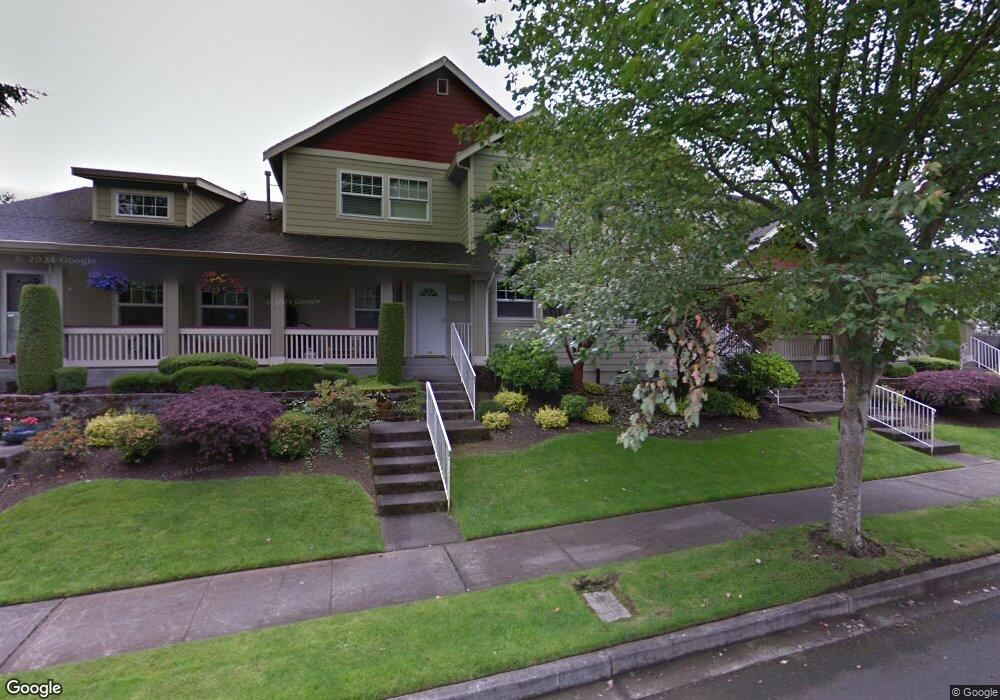
1542 McDonald Ave Unit 20C Dupont, WA 98327
Estimated Value: $413,959 - $440,000
3
Beds
3
Baths
1,332
Sq Ft
$319/Sq Ft
Est. Value
About This Home
This home is located at 1542 McDonald Ave Unit 20C, Dupont, WA 98327 and is currently estimated at $424,490, approximately $318 per square foot. 1542 McDonald Ave Unit 20C is a home located in Pierce County with nearby schools including Chloe Clark Elementary School, Saltars Point Elementary School, and Pioneer Middle School.
Ownership History
Date
Name
Owned For
Owner Type
Purchase Details
Closed on
Feb 28, 2002
Sold by
Hundsnurscher Edwin J
Bought by
Hundsnurscher Sonia
Current Estimated Value
Home Financials for this Owner
Home Financials are based on the most recent Mortgage that was taken out on this home.
Original Mortgage
$118,600
Outstanding Balance
$49,124
Interest Rate
6.94%
Estimated Equity
$375,366
Purchase Details
Closed on
Feb 2, 1998
Sold by
Carino Homes Inc
Bought by
Kendall Rodney P and Kendall Deborah J
Create a Home Valuation Report for This Property
The Home Valuation Report is an in-depth analysis detailing your home's value as well as a comparison with similar homes in the area
Home Values in the Area
Average Home Value in this Area
Purchase History
| Date | Buyer | Sale Price | Title Company |
|---|---|---|---|
| Hundsnurscher Sonia | -- | -- | |
| Hundsnurscher Sonia | $154,000 | -- | |
| Kendall Rodney P | $165,144 | Rainier Title Company |
Source: Public Records
Mortgage History
| Date | Status | Borrower | Loan Amount |
|---|---|---|---|
| Open | Hundsnurscher Sonia | $118,600 |
Source: Public Records
Tax History Compared to Growth
Tax History
| Year | Tax Paid | Tax Assessment Tax Assessment Total Assessment is a certain percentage of the fair market value that is determined by local assessors to be the total taxable value of land and additions on the property. | Land | Improvement |
|---|---|---|---|---|
| 2025 | $3,107 | $379,700 | $220,600 | $159,100 |
| 2024 | $3,107 | $369,700 | $212,500 | $157,200 |
| 2023 | $3,107 | $382,900 | $201,900 | $181,000 |
| 2022 | $3,103 | $391,200 | $201,900 | $189,300 |
| 2021 | $2,916 | $287,600 | $128,200 | $159,400 |
| 2019 | $2,527 | $258,500 | $106,900 | $151,600 |
| 2018 | $2,600 | $245,100 | $106,900 | $138,200 |
| 2017 | $2,234 | $221,000 | $91,800 | $129,200 |
| 2016 | $2,361 | $209,600 | $77,500 | $132,100 |
| 2014 | $2,444 | $208,000 | $77,500 | $130,500 |
| 2013 | $2,444 | $198,400 | $79,100 | $119,300 |
Source: Public Records
Map
Nearby Homes
- 1680 Kennedy Place Unit A4
- 1607 Kincaid St Unit E-8
- 1856 Spencer Ct Unit 12F
- 2147 Hammond Ave Unit B10
- 605 Louviers Ave
- 2176 McDonald Ave
- 2176 Palisade Blvd Unit F-3
- 504 Dupont Ave
- 403 Louviers Ave
- 205 Brandywine Ave
- 1975 Garry Oaks Ave Unit C
- 2237 Tolmie St
- 2055 Garry Oaks Ave Unit B
- 1331 Rowan Ct Unit 1331
- 1373 Hudson St Unit 1373
- 1285 Griggs St
- 2420 Simmons St Unit B
- 1263 Hudson St
- 2699 Erwin Ave Unit 2699
- 3114 Walker Rd
- 1536 McDonald Ave Unit 20B
- 1530 McDonald Ave Unit 20A
- 1518 McDonald Ave Unit D19
- 1512 McDonald Ave Unit C19
- 1506 McDonald Ave Unit 198
- 1506 McDonald Ave Unit 19B
- 1541 McDonald Ave
- 1537 McDonald Ave Unit 21B
- 1463 Heath Ct Unit 17C
- 1457 Heath Ct Unit 17B
- 1451 Heath Ct Unit 17A
- 1513 McDonald Ave Unit 22B
- 1507 McDonald Ave Unit 22A
- 1500 McDonald Ave Unit 19A
- 1435 Heath Ct Unit 18A
- 1447 Heath Ct Unit 18C
- 1531 McDonald Ave
- 1441 Heath Ct Unit 18B
- 1475 Heath Ct Unit 16A
- 1481 Heath Ct Unit 16B