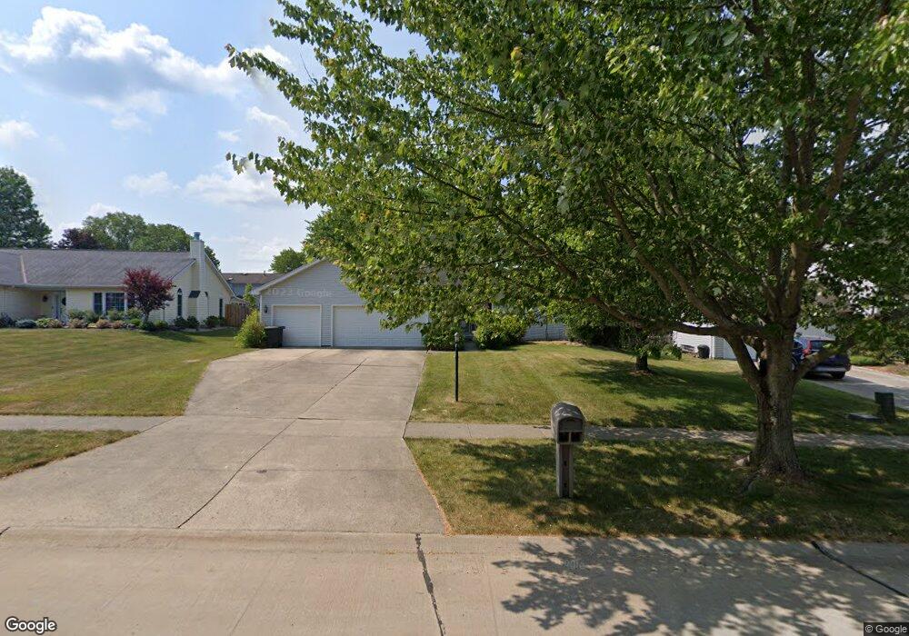
15439 Sassafras Dr Strongsville, OH 44136
Estimated Value: $297,000 - $365,000
3
Beds
2
Baths
1,736
Sq Ft
$191/Sq Ft
Est. Value
About This Home
This home is located at 15439 Sassafras Dr, Strongsville, OH 44136 and is currently estimated at $331,739, approximately $191 per square foot. 15439 Sassafras Dr is a home located in Cuyahoga County with nearby schools including Strongsville High School, Sts Joseph & John Interparochial School, and Bethel Christian Academy.
Ownership History
Date
Name
Owned For
Owner Type
Purchase Details
Closed on
Dec 29, 2014
Sold by
Panasewicz Dale
Bought by
Panasewicz Adam Anton
Current Estimated Value
Purchase Details
Closed on
Mar 2, 1994
Sold by
Panasewicz Dale and Panasewicz Mary
Bought by
Panasewicz Dale
Purchase Details
Closed on
Jan 1, 1990
Bought by
Panasewicz Dale and Panasewicz Mary
Create a Home Valuation Report for This Property
The Home Valuation Report is an in-depth analysis detailing your home's value as well as a comparison with similar homes in the area
Home Values in the Area
Average Home Value in this Area
Purchase History
| Date | Buyer | Sale Price | Title Company |
|---|---|---|---|
| Panasewicz Adam Anton | -- | None Available | |
| Panasewicz Dale | -- | -- | |
| Panasewicz Dale | -- | -- |
Source: Public Records
Tax History Compared to Growth
Tax History
| Year | Tax Paid | Tax Assessment Tax Assessment Total Assessment is a certain percentage of the fair market value that is determined by local assessors to be the total taxable value of land and additions on the property. | Land | Improvement |
|---|---|---|---|---|
| 2024 | $5,062 | $107,800 | $18,725 | $89,075 |
| 2023 | $5,019 | $89,320 | $20,720 | $68,600 |
| 2022 | $5,008 | $89,320 | $20,720 | $68,600 |
| 2021 | $4,969 | $89,320 | $20,720 | $68,600 |
| 2020 | $4,758 | $77,000 | $17,850 | $59,150 |
| 2019 | $5,210 | $220,000 | $51,000 | $169,000 |
| 2018 | $4,625 | $77,000 | $17,850 | $59,150 |
| 2017 | $4,605 | $69,410 | $15,890 | $53,520 |
| 2016 | $4,567 | $69,410 | $15,890 | $53,520 |
| 2015 | $6,934 | $69,410 | $15,890 | $53,520 |
| 2014 | $6,934 | $67,380 | $15,440 | $51,940 |
Source: Public Records
Map
Nearby Homes
- 9129 Tahoe Cir
- 9890 Webster Rd
- 10010 Chevy Chase
- 9531 Nicole Cir
- 9945 Twelve Oaks Cir
- 7685 Saratoga Rd
- 14015 Byron Blvd
- 13976 W Sprague Rd
- 10369 Council Bluff
- Buchanan Plan at The Enclave at Pine Lakes Crossing
- Belleville Plan at The Enclave at Pine Lakes Crossing
- 0 Webster Rd
- 15485 Albion Rd
- 14069 Basswood Cir
- 7664 Gerald Dr
- 14280 Pawnee Trail
- 14330 Pawnee Trail
- 18203 Broxton Dr
- 7475 Lanier Dr
- 16519 Albion Rd
- 15471 Sassafras Dr
- 15407 Sassafras Dr
- 15384 Dewitt Dr
- 15375 Sassafras Dr
- 8765 Chapman Cir
- 15440 Dewitt Dr
- 8853 Chapman Cir
- 15454 Sassafras Dr
- 15422 Sassafras Dr
- 15356 Dewitt Dr
- 15343 Sassafras Dr
- 8897 Chapman Cir
- 15390 Sassafras Dr
- 15486 Sassafras Dr
- 15328 Dewitt Dr
- 15358 Sassafras Dr
- 8941 Chapman Cir
- 15421 Dewitt Dr
- 15311 Sassafras Dr
- 15534 Sassafras Dr