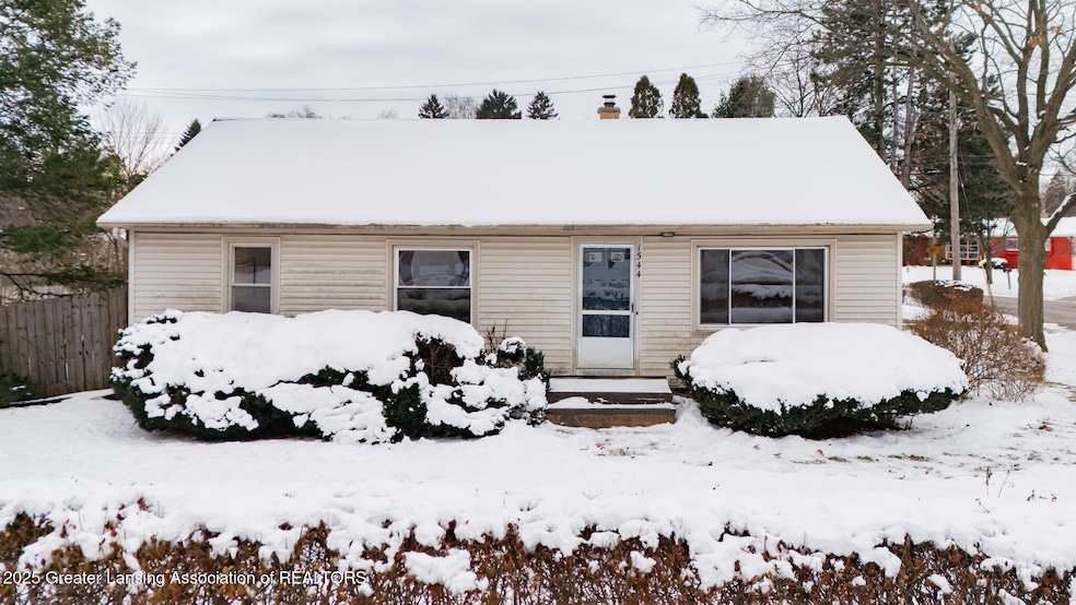
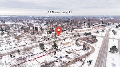
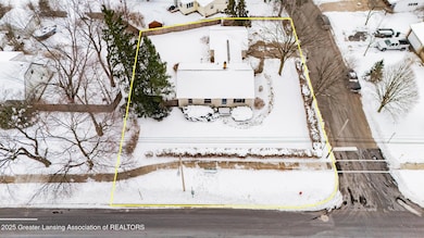
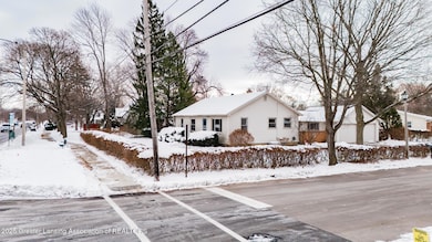
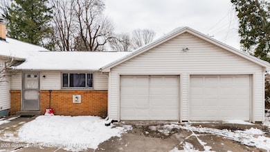
1544 Haslett Rd East Lansing, MI 48823
Estimated payment $1,412/month
Highlights
- Very Popular Property
- City View
- Wood Flooring
- Marble Elementary School Rated A-
- Ranch Style House
- Corner Lot
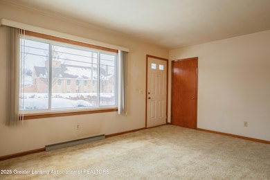
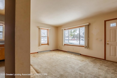
About This Home
Great Opportunity on this 3 bedroom , 1 full bath Ranch in the Heart of East Lansing. Just minutes from Michigan State University, bus route, Costco and expressway. Hardwood floors throughout most of the first floor, Heated breezeway with attached 2 car garage. Great floor plan, Lots of opportunity in this corner ranch at a great price. Great starter home. Large corner lot with fenced in backyard. Don't miss this one!
Listing Agent
Coldwell Banker Professionals -Okemos License #6501128440 Listed on: 12/08/2025

Home Details
Home Type
- Single Family
Est. Annual Taxes
- $3,746
Year Built
- Built in 1956
Lot Details
- 10,454 Sq Ft Lot
- Lot Dimensions are 100x105
- Cross Fenced
- Back Yard Fenced
- Corner Lot
Parking
- 2 Car Attached Garage
- Side Facing Garage
Home Design
- Ranch Style House
- Block Foundation
- Shingle Roof
- Vinyl Siding
Interior Spaces
- 1,292 Sq Ft Home
- Wood Flooring
- City Views
- Basement Fills Entire Space Under The House
- Range
Bedrooms and Bathrooms
- 3 Bedrooms
- 1 Full Bathroom
Laundry
- Laundry on lower level
- Washer and Dryer
Utilities
- Forced Air Heating and Cooling System
- Heating System Uses Natural Gas
- 100 Amp Service
- Cable TV Available
Community Details
- Greencrest Subdivision
Map
Home Values in the Area
Average Home Value in this Area
Tax History
| Year | Tax Paid | Tax Assessment Tax Assessment Total Assessment is a certain percentage of the fair market value that is determined by local assessors to be the total taxable value of land and additions on the property. | Land | Improvement |
|---|---|---|---|---|
| 2025 | $3,544 | $93,400 | $30,100 | $63,300 |
| 2024 | $30 | $87,900 | $27,700 | $60,200 |
| 2023 | $3,310 | $79,800 | $25,600 | $54,200 |
| 2022 | $3,171 | $73,200 | $22,200 | $51,000 |
| 2021 | $3,117 | $68,400 | $20,900 | $47,500 |
| 2020 | $3,082 | $64,500 | $19,800 | $44,700 |
| 2019 | $2,956 | $62,900 | $20,100 | $42,800 |
| 2018 | $3,233 | $58,900 | $16,800 | $42,100 |
| 2017 | $3,103 | $58,800 | $17,100 | $41,700 |
| 2016 | -- | $56,400 | $16,600 | $39,800 |
| 2015 | -- | $54,200 | $32,379 | $21,821 |
| 2014 | -- | $50,300 | $31,626 | $18,674 |
Property History
| Date | Event | Price | List to Sale | Price per Sq Ft |
|---|---|---|---|---|
| 12/08/2025 12/08/25 | For Sale | $209,900 | -- | $162 / Sq Ft |
Purchase History
| Date | Type | Sale Price | Title Company |
|---|---|---|---|
| Interfamily Deed Transfer | -- | None Available | |
| Deed | $49,500 | -- | |
| Deed | $52,000 | -- |
Mortgage History
| Date | Status | Loan Amount | Loan Type |
|---|---|---|---|
| Open | $257,000 | New Conventional |
Source: Greater Lansing Association of Realtors®
MLS Number: 292958
APN: 20-02-08-303-001
Disclaimer: Certain information contained herein is derived from information provided by parties other than Homes.com. All information provided is deemed reliable, but is not guaranteed to be accurate and should be independently verified.
![]() IDX information is provided exclusively for Consumers'
IDX information is provided exclusively for Consumers'
personal, non-commercial use, that it may not be used for any purpose other than to identify prospective properties Consumers may be interested in purchasing. Data is deemed reliable but is not guaranteed accurate by the MLS.
Copyright © 2025 Greater Lansing Association of REALTORS®
- 1719 Woodside Dr
- 933 Bedford Rd
- 1539 N Hagadorn Rd Unit 1A
- 1351 Foxcroft Rd
- 1531 Winchell Ct
- 0 Hagadorn Lot D Rd
- 5900 N Hagadorn Rd
- 0 Hagadorn Lot C Rd Unit 50193276
- 1511 Dennison Rd
- 688 Moorland Dr Unit 9
- 586 Lexington Ave
- 894 Lenna Keith Cir
- 753 E Saginaw St
- 1124 Burcham Dr
- 1232 Hitching Post Rd
- 6004 Gibson Ave
- 5604 Deville Ct
- 1522 Hitching Post Rd
- 5680 Deville Ct Unit 61
- 6072 Hart St
- 1424 Haslett Rd
- 1517 Cambria Dr
- 1224 E Saginaw St
- 5520 Timberlane St
- 1530 Snyder Rd
- 551 Lexington Ave
- 6080 Carriage Hill Dr
- 755 Burcham Dr
- 509 Walbridge Dr
- 6165 Innkeepers Ct Unit 79
- 3075 Endenhall Way
- 126 Milford St Unit 18
- 918 E Grand River Ave
- 204 E Pointe Ln
- 2720 Sirhal Dr
- 1390 E Grand River Ave
- 314 Mac Ave
- 261 Rampart Way
- 238 W Saginaw St
- 1700 E Grand River Ave