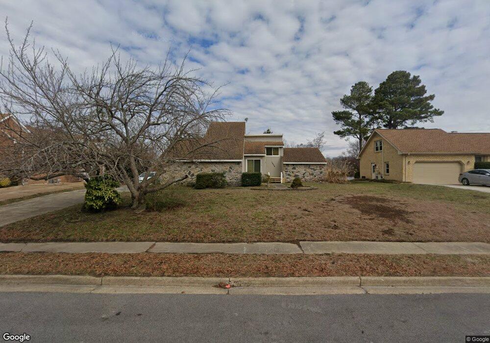
1544 Waterside Dr N Chesapeake, VA 23320
Greenbrier East NeighborhoodEstimated Value: $507,000 - $533,000
3
Beds
3
Baths
2,585
Sq Ft
$200/Sq Ft
Est. Value
About This Home
This home is located at 1544 Waterside Dr N, Chesapeake, VA 23320 and is currently estimated at $516,968, approximately $199 per square foot. 1544 Waterside Dr N is a home located in Chesapeake City with nearby schools including Greenbrier Primary School, Greenbrier Intermediate School, and Greenbrier Middle.
Ownership History
Date
Name
Owned For
Owner Type
Purchase Details
Closed on
Feb 9, 2017
Sold by
Istre Helen
Bought by
The Helen B W Istre Living Trust Dated A
Current Estimated Value
Purchase Details
Closed on
May 2, 2006
Sold by
Chertoff Paul E
Bought by
Istre Helen
Home Financials for this Owner
Home Financials are based on the most recent Mortgage that was taken out on this home.
Original Mortgage
$90,000
Interest Rate
6.34%
Mortgage Type
New Conventional
Create a Home Valuation Report for This Property
The Home Valuation Report is an in-depth analysis detailing your home's value as well as a comparison with similar homes in the area
Home Values in the Area
Average Home Value in this Area
Purchase History
| Date | Buyer | Sale Price | Title Company |
|---|---|---|---|
| The Helen B W Istre Living Trust Dated A | -- | None Available | |
| Istre Helen | $400,000 | -- |
Source: Public Records
Mortgage History
| Date | Status | Borrower | Loan Amount |
|---|---|---|---|
| Previous Owner | Istre Helen | $90,000 | |
| Previous Owner | Istre Helen | $100,000 |
Source: Public Records
Tax History Compared to Growth
Tax History
| Year | Tax Paid | Tax Assessment Tax Assessment Total Assessment is a certain percentage of the fair market value that is determined by local assessors to be the total taxable value of land and additions on the property. | Land | Improvement |
|---|---|---|---|---|
| 2025 | $3,693 | $474,800 | $180,000 | $294,800 |
| 2024 | $3,693 | $448,700 | $165,000 | $283,700 |
| 2023 | $3,661 | $404,900 | $145,000 | $259,900 |
| 2022 | $3,693 | $365,600 | $130,000 | $235,600 |
| 2021 | $3,566 | $339,600 | $120,000 | $219,600 |
| 2020 | $3,294 | $326,100 | $105,000 | $221,100 |
| 2019 | $2,306 | $326,100 | $105,000 | $221,100 |
| 2018 | $2,306 | $283,000 | $105,000 | $178,000 |
| 2017 | $3,163 | $301,200 | $105,000 | $196,200 |
| 2016 | $3,028 | $288,400 | $105,000 | $183,400 |
| 2015 | $2,972 | $283,000 | $105,000 | $178,000 |
| 2014 | $2,972 | $283,000 | $105,000 | $178,000 |
Source: Public Records
Map
Nearby Homes
- 1305 Lake Point Ct
- 2207 Shepherds Ct
- 1701 Rock Bridge Mews Unit B
- 2115 Rocky Point Run Unit A
- 1709 Stoney Creek Arch Unit D
- 1716 Rock Bridge Mews Unit D
- 2120 Rocky Point Run Unit B
- 2224 Logans Mill Trail
- 1721 Rock Bridge Mews Unit A
- 921 White Oak Ct N
- 1008 White Oak Ct S
- 1319 River Birch Run S
- 1244 Mill Stream Way
- 1916 Woodgate Arch
- 1980 Woodgate Arch
- 1206 Mabry Mill Place
- 1149 Turtle Rock Trace
- 1134 Mill Lake Quarter
- 1108 Mill Lake Quarter
- 1128 Stoney Brook Landing
- 1540 Waterside Dr N
- 1548 Waterside Dr N
- 1536 Waterside Dr N
- 1545 Waterside Dr N
- 1552 Waterside Dr N
- 1549 Waterside Dr N
- 1541 Waterside Dr N
- 1553 Waterside Dr N
- 1532 Waterside Dr N
- 1556 Waterside Dr N
- 1537 Waterside Dr N
- 1321 Forest Point Dr
- 1320 Forest Point Dr
- 1533 Waterside Dr N
- 1557 Waterside Dr N
- 1528 Waterside Dr N
- 1317 Forest Point Dr
- 1316 Forest Point Dr
- 1560 Waterside Dr N
- 1524 Woodside Ct N