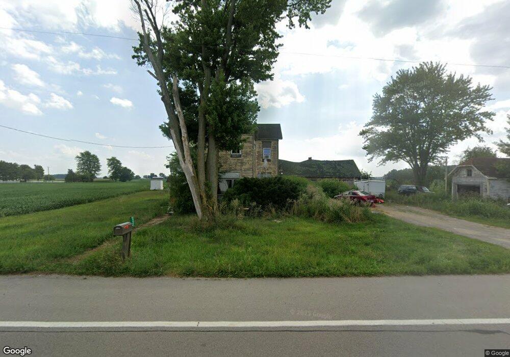
15442 State Route 116 van Wert, OH 45891
Estimated Value: $91,000 - $244,000
4
Beds
1
Bath
1,896
Sq Ft
$78/Sq Ft
Est. Value
About This Home
This home is located at 15442 State Route 116, van Wert, OH 45891 and is currently estimated at $148,581, approximately $78 per square foot. 15442 State Route 116 is a home located in Van Wert County with nearby schools including Lincolnview Elementary School, Lincolnview Junior/Senior High School, and Lifelinks Community School.
Ownership History
Date
Name
Owned For
Owner Type
Purchase Details
Closed on
Apr 10, 2013
Sold by
Fannie Mae
Bought by
Jewell Robert S
Current Estimated Value
Home Financials for this Owner
Home Financials are based on the most recent Mortgage that was taken out on this home.
Original Mortgage
$25,800
Outstanding Balance
$5,447
Interest Rate
3.46%
Mortgage Type
New Conventional
Estimated Equity
$143,134
Purchase Details
Closed on
Jan 25, 2013
Sold by
Allmandinger Aaron G
Bought by
Federal National Mortgage Association
Purchase Details
Closed on
Apr 11, 2004
Bought by
Jewell Robert S
Purchase Details
Closed on
Jan 28, 2001
Bought by
Federal National Mortgage Assoc
Purchase Details
Closed on
Nov 24, 1999
Bought by
Allmandinger Aaron G
Create a Home Valuation Report for This Property
The Home Valuation Report is an in-depth analysis detailing your home's value as well as a comparison with similar homes in the area
Home Values in the Area
Average Home Value in this Area
Purchase History
| Date | Buyer | Sale Price | Title Company |
|---|---|---|---|
| Jewell Robert S | $31,000 | None Available | |
| Federal National Mortgage Association | $26,000 | None Available | |
| Jewell Robert S | $31,000 | -- | |
| Federal National Mortgage Assoc | $26,000 | -- | |
| Allmandinger Aaron G | $60,000 | -- |
Source: Public Records
Mortgage History
| Date | Status | Borrower | Loan Amount |
|---|---|---|---|
| Open | Jewell Robert S | $25,800 |
Source: Public Records
Tax History Compared to Growth
Tax History
| Year | Tax Paid | Tax Assessment Tax Assessment Total Assessment is a certain percentage of the fair market value that is determined by local assessors to be the total taxable value of land and additions on the property. | Land | Improvement |
|---|---|---|---|---|
| 2024 | $866 | $27,770 | $9,100 | $18,670 |
| 2023 | $866 | $27,770 | $9,100 | $18,670 |
| 2022 | $880 | $20,700 | $7,020 | $13,680 |
| 2021 | $1,087 | $25,480 | $7,020 | $18,460 |
| 2020 | $1,021 | $24,420 | $7,020 | $17,400 |
| 2019 | $828 | $21,350 | $6,390 | $14,960 |
| 2018 | $756 | $19,780 | $5,720 | $14,060 |
| 2017 | $592 | $17,970 | $5,720 | $12,250 |
| 2016 | $493 | $14,580 | $5,540 | $9,040 |
| 2015 | $481 | $14,580 | $5,540 | $9,040 |
| 2014 | $499 | $14,580 | $5,540 | $9,040 |
| 2013 | $1,020 | $24,960 | $5,540 | $19,420 |
Source: Public Records
Map
Nearby Homes
- 14995 Middle Point Rd
- 14162 Overholt Rd
- 12104 Clayworth Rd
- 1049 Chippewa Dr
- 1236 E Ervin Rd
- 1057 Maxine Ln
- 8848 Boroff Rd
- 1008 Maplewood Dr
- 914 E Crawford St
- 515 S Race St
- 529 S Tyler St
- 12242 Dustman Rd
- 627 S Walnut St
- 919 E Sycamore St
- 1060 1056 S Washington St
- 142 E Raymond St
- 1026 Elm St
- 138 Logan St
- 133 Balyeat Ave
- 1120 Park St
- 11485 Ireland Rd
- 15525 St Route
- 15594 State Route 116
- 11553 Ireland Rd
- 15223 State Route 116
- 15702 State Route 116
- 15753 State Route 116
- 15525 State Route 116
- 11813 Ireland Rd
- 11820 Ireland Rd
- 15018 Ohio 116
- 15018 State Route 116
- 14990 State Route 116
- 14950 State Route 116
- 11275 Poe Rd
- TBD State Route 116
- TBD Sr 116
- TBD Sr 116
- 11956 Ireland Rd
- 11207 Poe Rd