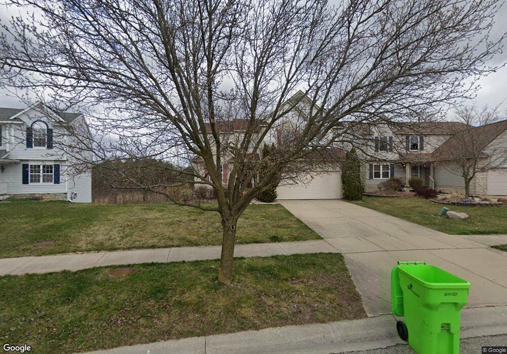
1545 Scio Ridge Rd Ann Arbor, MI 48103
Estimated Value: $494,254 - $557,000
4
Beds
3
Baths
2,126
Sq Ft
$246/Sq Ft
Est. Value
About This Home
This home is located at 1545 Scio Ridge Rd, Ann Arbor, MI 48103 and is currently estimated at $522,564, approximately $245 per square foot. 1545 Scio Ridge Rd is a home located in Washtenaw County with nearby schools including Dicken Elementary School, Slauson Middle School, and Pioneer High School.
Ownership History
Date
Name
Owned For
Owner Type
Purchase Details
Closed on
Aug 28, 2003
Sold by
Celina Szczeglik
Bought by
Wells Fargo Bank Minnesota Na
Current Estimated Value
Create a Home Valuation Report for This Property
The Home Valuation Report is an in-depth analysis detailing your home's value as well as a comparison with similar homes in the area
Home Values in the Area
Average Home Value in this Area
Purchase History
| Date | Buyer | Sale Price | Title Company |
|---|---|---|---|
| Wells Fargo Bank Minnesota Na | $270,000 | -- |
Source: Public Records
Tax History Compared to Growth
Tax History
| Year | Tax Paid | Tax Assessment Tax Assessment Total Assessment is a certain percentage of the fair market value that is determined by local assessors to be the total taxable value of land and additions on the property. | Land | Improvement |
|---|---|---|---|---|
| 2025 | -- | $223,800 | $0 | $0 |
| 2024 | $5,377 | $227,900 | $0 | $0 |
| 2023 | $5,129 | $216,300 | $0 | $0 |
| 2022 | $7,785 | $193,300 | $0 | $0 |
| 2021 | $7,416 | $189,500 | $0 | $0 |
| 2020 | $7,392 | $188,000 | $0 | $0 |
| 2019 | $6,906 | $178,100 | $178,100 | $0 |
| 2018 | $6,706 | $166,300 | $0 | $0 |
| 2017 | $6,413 | $166,000 | $0 | $0 |
| 2016 | $4,156 | $128,890 | $0 | $0 |
| 2015 | -- | $128,505 | $0 | $0 |
| 2014 | -- | $124,491 | $0 | $0 |
| 2013 | -- | $124,491 | $0 | $0 |
Source: Public Records
Map
Nearby Homes
- 1599 Scio Ridge Rd
- 1770 Harley Dr
- 2512 Jade Ct Unit 18
- 1366 N Bay Dr Unit 144
- 1419 N Bay Dr Unit 73
- 1740 S Maple Rd Unit 2
- 1929 Harley Dr
- 2126 Pauline Blvd Unit 104
- 1860 Chicory Ridge
- 1225 S Maple Rd Unit 307
- 1235 S Maple Rd Unit 202
- 2120 Pauline Blvd Unit 305
- 1265 S Maple Rd Unit 207
- 2165 Pauline Ct Unit 14
- 2147 Pauline Ct Unit 17
- 2104 Pauline Blvd Unit 305
- 2033 Pauline Ct
- 1021 Bluestem Ln Unit 29
- 813 E Summerfield Glen Cir
- 2509 W Liberty St
- 1551 Scio Ridge Rd
- 1539 Scio Ridge Rd
- 1557 Scio Ridge Rd
- 1533 Scio Ridge Rd
- 1563 Scio Ridge Rd
- 1550 Scio Ridge Rd
- 1527 Scio Ridge Rd
- 1538 Scio Ridge Rd
- 1566 Scio Ridge Rd
- 1569 Scio Ridge Rd
- 1526 Scio Ridge Rd
- 1521 Scio Ridge Rd
- 1578 Scio Ridge Rd
- 1575 Scio Ridge Rd
- 1515 Scio Ridge Rd
- 1563 Abigail Way
- 1584 Scio Ridge Rd
- 1581 Scio Ridge Rd
- 1571 Abigail Way
- 1579 Abigail Way