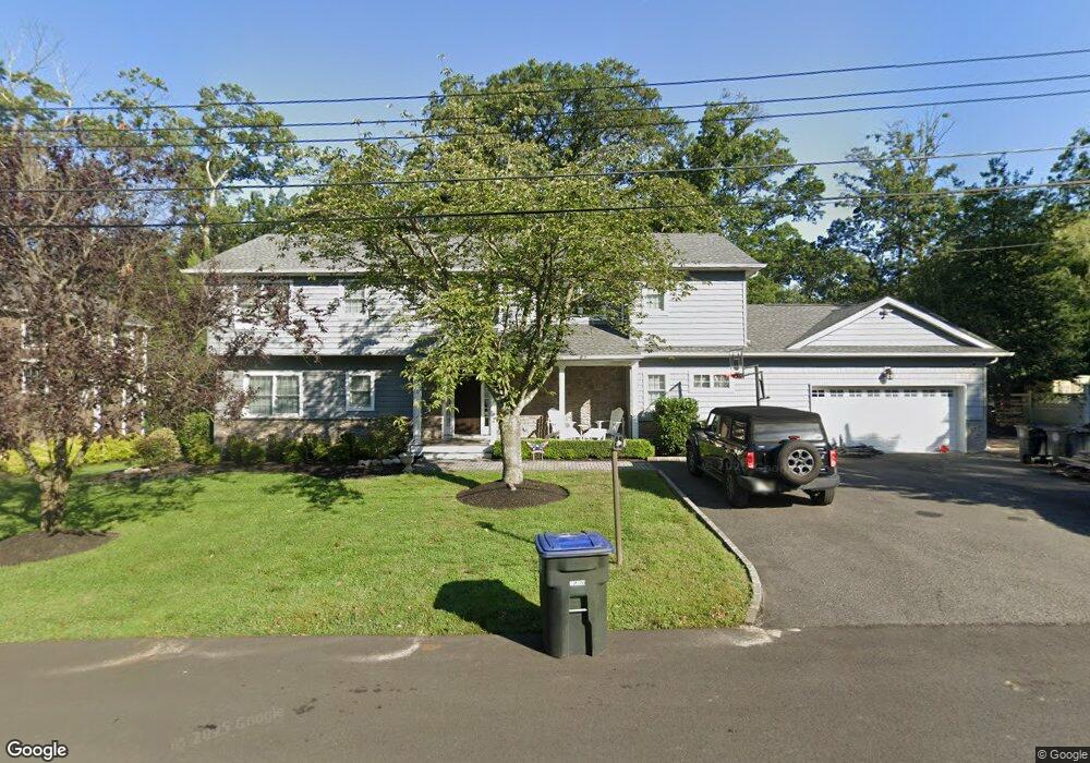
1546 Logan Dr Manasquan, NJ 08736
Estimated Value: $762,000 - $1,314,000
3
Beds
2
Baths
3,208
Sq Ft
$332/Sq Ft
Est. Value
About This Home
This home is located at 1546 Logan Dr, Manasquan, NJ 08736 and is currently estimated at $1,065,575, approximately $332 per square foot. 1546 Logan Dr is a home located in Monmouth County with nearby schools including Wall High School, St Dominic School, and The Brookside School.
Ownership History
Date
Name
Owned For
Owner Type
Purchase Details
Closed on
Dec 15, 2011
Sold by
Burns David W
Bought by
Baldasare Michael and Baldasare Susan
Current Estimated Value
Home Financials for this Owner
Home Financials are based on the most recent Mortgage that was taken out on this home.
Original Mortgage
$303,000
Outstanding Balance
$209,646
Interest Rate
4.25%
Mortgage Type
FHA
Estimated Equity
$855,929
Purchase Details
Closed on
Jul 28, 2011
Sold by
Rotolo Nicolas P and Burns David W
Bought by
Rotolo Nicholas P and Burns David W
Purchase Details
Closed on
Feb 23, 2009
Sold by
Burns David W and Burns Joyce Ann
Bought by
Burns David W
Home Financials for this Owner
Home Financials are based on the most recent Mortgage that was taken out on this home.
Original Mortgage
$279,000
Interest Rate
5.14%
Mortgage Type
Purchase Money Mortgage
Purchase Details
Closed on
May 12, 2006
Sold by
Todash Trevor A
Bought by
Burns Joyce Ann and Burns David W
Purchase Details
Closed on
Jan 15, 1999
Sold by
Bruno John
Bought by
Todash Trevor and Todash Marie
Home Financials for this Owner
Home Financials are based on the most recent Mortgage that was taken out on this home.
Original Mortgage
$193,500
Interest Rate
6.75%
Purchase Details
Closed on
Jul 2, 1998
Sold by
Frank S Walsh Inc
Bought by
Bruno John and Bruno Marilyn
Home Financials for this Owner
Home Financials are based on the most recent Mortgage that was taken out on this home.
Original Mortgage
$95,000
Interest Rate
6.92%
Purchase Details
Closed on
Sep 13, 1995
Sold by
Tichenor James
Bought by
Bruno John and Bruno Marilyn
Home Financials for this Owner
Home Financials are based on the most recent Mortgage that was taken out on this home.
Original Mortgage
$130,000
Interest Rate
7.81%
Create a Home Valuation Report for This Property
The Home Valuation Report is an in-depth analysis detailing your home's value as well as a comparison with similar homes in the area
Home Values in the Area
Average Home Value in this Area
Purchase History
| Date | Buyer | Sale Price | Title Company |
|---|---|---|---|
| Baldasare Michael | $350,000 | None Available | |
| Rotolo Nicholas P | -- | None Available | |
| Burns David W | -- | Stewart Title Guaranty Co | |
| Burns Joyce Ann | $530,000 | -- | |
| Todash Trevor | $215,000 | -- | |
| Bruno John | $100,000 | -- | |
| Bruno John | $173,500 | -- |
Source: Public Records
Mortgage History
| Date | Status | Borrower | Loan Amount |
|---|---|---|---|
| Open | Baldasare Michael | $303,000 | |
| Previous Owner | Burns David W | $279,000 | |
| Previous Owner | Todash Trevor | $193,500 | |
| Previous Owner | Bruno John | $95,000 | |
| Previous Owner | Bruno John | $130,000 |
Source: Public Records
Tax History Compared to Growth
Tax History
| Year | Tax Paid | Tax Assessment Tax Assessment Total Assessment is a certain percentage of the fair market value that is determined by local assessors to be the total taxable value of land and additions on the property. | Land | Improvement |
|---|---|---|---|---|
| 2025 | $14,662 | $694,900 | $248,300 | $446,600 |
| 2024 | $14,225 | $694,900 | $248,300 | $446,600 |
| 2023 | $14,225 | $694,900 | $248,300 | $446,600 |
| 2022 | $13,877 | $694,900 | $248,300 | $446,600 |
| 2021 | $13,877 | $694,900 | $248,300 | $446,600 |
| 2020 | $13,710 | $694,900 | $248,300 | $446,600 |
| 2019 | $7,769 | $398,600 | $248,300 | $150,300 |
| 2018 | $7,701 | $398,600 | $248,300 | $150,300 |
| 2017 | $7,549 | $398,600 | $248,300 | $150,300 |
| 2016 | $7,390 | $398,600 | $248,300 | $150,300 |
| 2015 | $7,419 | $251,500 | $147,800 | $103,700 |
| 2014 | $7,057 | $244,700 | $141,000 | $103,700 |
Source: Public Records
Map
Nearby Homes
- 1545 Harbor Rd
- 2575 Morningstar Rd
- 2567 River Rd
- 2547 River Rd
- 2619 Lantern Light Way
- 1544 Harvest Ln
- 1582 Horseshoe Dr
- 2528 River Rd
- 2531 River Rd
- 2639 River Rd
- 2511 Morningstar Rd
- 651 Oceanview Rd
- 2578 Collier Rd
- 647 Valley Rd
- 2568 Curriers Place
- 31 Mulberry Ct Unit C
- 23 Mulberry Ct Unit D
- 7 Hickory Ct Unit A
- 846 William Dr
- 604 Winding River Rd
- 1547 Deer Run Dr
- 1544 Logan Dr
- 1547 Logan Dr
- 1548 Logan Dr
- 1545 Deer Run Dr
- 1545 Logan Dr
- 1550 Logan Dr
- 1551 Deer Run Dr
- 1549 Logan Dr
- 1544 Sterling Dr
- 1548 Deer Run Dr
- 1544 Deer Run Dr
- 1546 Sterling Dr
- 1541 Logan Dr
- 1542 Sterling Dr
- 1540 Logan Dr
- 1551 Logan Dr
- 1552 Logan Dr
- 1541 Deer Run Dr
- 1553 Deer Run Dr