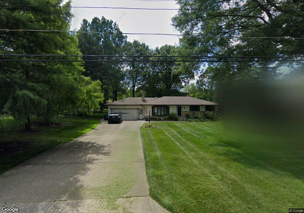
15466 Sunset Dr Strongsville, OH 44136
Estimated Value: $317,838 - $365,000
3
Beds
1
Bath
1,862
Sq Ft
$183/Sq Ft
Est. Value
About This Home
This home is located at 15466 Sunset Dr, Strongsville, OH 44136 and is currently estimated at $340,210, approximately $182 per square foot. 15466 Sunset Dr is a home located in Cuyahoga County with nearby schools including Strongsville High School and Sts Joseph & John Interparochial School.
Ownership History
Date
Name
Owned For
Owner Type
Purchase Details
Closed on
Sep 4, 2018
Sold by
Kriska Richard C
Bought by
Baker Eric A and Baker Jennifer J
Current Estimated Value
Home Financials for this Owner
Home Financials are based on the most recent Mortgage that was taken out on this home.
Original Mortgage
$206,600
Outstanding Balance
$179,796
Interest Rate
4.5%
Mortgage Type
VA
Estimated Equity
$160,414
Purchase Details
Closed on
Oct 11, 2013
Sold by
Kriska Richard C and Kriska Geraldine B
Bought by
Kriska Richard C and Richard C Kriska Trust
Purchase Details
Closed on
Mar 28, 1985
Sold by
Kriska Richard C and Kriska Geraldine
Bought by
Kriska Richard C
Purchase Details
Closed on
Jan 1, 1975
Bought by
Kriska Richard C and Kriska Geraldine
Create a Home Valuation Report for This Property
The Home Valuation Report is an in-depth analysis detailing your home's value as well as a comparison with similar homes in the area
Home Values in the Area
Average Home Value in this Area
Purchase History
| Date | Buyer | Sale Price | Title Company |
|---|---|---|---|
| Baker Eric A | $200,000 | Gateway Title Agency | |
| Kriska Richard C | -- | None Available | |
| Kriska Richard C | -- | -- | |
| Kriska Richard C | -- | -- |
Source: Public Records
Mortgage History
| Date | Status | Borrower | Loan Amount |
|---|---|---|---|
| Open | Baker Eric A | $206,600 |
Source: Public Records
Tax History Compared to Growth
Tax History
| Year | Tax Paid | Tax Assessment Tax Assessment Total Assessment is a certain percentage of the fair market value that is determined by local assessors to be the total taxable value of land and additions on the property. | Land | Improvement |
|---|---|---|---|---|
| 2024 | $4,294 | $91,455 | $28,525 | $62,930 |
| 2023 | $4,475 | $71,470 | $16,450 | $55,020 |
| 2022 | $4,443 | $71,470 | $16,450 | $55,020 |
| 2021 | $4,408 | $71,470 | $16,450 | $55,020 |
| 2020 | $4,370 | $62,690 | $14,420 | $48,270 |
| 2019 | $4,242 | $179,100 | $41,200 | $137,900 |
| 2018 | $3,847 | $62,690 | $14,420 | $48,270 |
| 2017 | $3,915 | $59,020 | $11,870 | $47,150 |
| 2016 | $3,884 | $59,020 | $11,870 | $47,150 |
| 2015 | $3,938 | $59,020 | $11,870 | $47,150 |
| 2014 | $3,938 | $59,020 | $11,870 | $47,150 |
Source: Public Records
Map
Nearby Homes
- 15639 Indianhead Ln
- 17069 Partridge Dr
- 14826 Lenox Dr
- 14703 Lenox Dr Unit 103
- 16650 Lanier Ave
- 16450 Howe Rd
- 18162 Fawn Cir
- 18630 Shurmer Rd
- 17159 Turkey Meadow Ln
- 17024 Bear Creek Ln
- 13513 Suncrest Ct
- 17289 Akita Ct Unit 4508
- 17682 Drake Rd
- 0 Mill Hollow Ln Unit 5069608
- 18294 Drake Rd
- 16486 S Red Rock Dr
- 19160 Wheelers Ln
- 19311 Bradford Ct
- 17130 Golden Star Dr
- 19513 Lunn Rd
- 15420 Sunset Dr
- 15510 Sunset Dr
- 15340 Sunset Dr
- 15556 Sunset Dr
- 15425 Sunset Dr
- 15471 Sunset Dr
- 15519 Sunset Dr
- 15379 Sunset Dr
- 15292 Sunset Dr
- 15602 Sunset Dr
- 15561 Sunset Dr
- 16955 Northview Dr
- 15250 Sunset Dr
- 16913 Northview Dr
- 17140 Shurmer Rd
- 15607 Sunset Dr
- 17220 Shurmer Rd
- 17228 Shurmer Rd
- 17094 Shurmer Rd
- 17052 Shurmer Rd