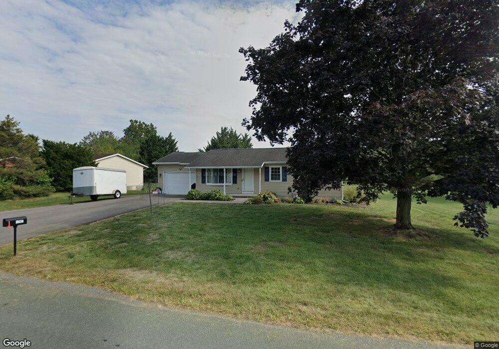
1548 Farm Ln Greencastle, PA 17225
Estimated Value: $245,000 - $295,226
--
Bed
--
Bath
1,120
Sq Ft
$236/Sq Ft
Est. Value
About This Home
This home is located at 1548 Farm Ln, Greencastle, PA 17225 and is currently estimated at $264,057, approximately $235 per square foot. 1548 Farm Ln is a home located in Franklin County with nearby schools including Greencastle-Antrim Primary School, Greencastle-Antrim Elementary School, and Greencastle-Antrim Middle School.
Ownership History
Date
Name
Owned For
Owner Type
Purchase Details
Closed on
Mar 8, 2024
Sold by
Freeman Elysia J and Freeman Jason L
Bought by
Freeman Jason L
Current Estimated Value
Purchase Details
Closed on
Sep 22, 2017
Sold by
Swain David W and Swain Dorothy A
Bought by
Freeman Jason L and Freeman Elysia J
Home Financials for this Owner
Home Financials are based on the most recent Mortgage that was taken out on this home.
Original Mortgage
$167,325
Interest Rate
3.9%
Mortgage Type
New Conventional
Create a Home Valuation Report for This Property
The Home Valuation Report is an in-depth analysis detailing your home's value as well as a comparison with similar homes in the area
Home Values in the Area
Average Home Value in this Area
Purchase History
| Date | Buyer | Sale Price | Title Company |
|---|---|---|---|
| Freeman Jason L | -- | None Listed On Document | |
| Freeman Jason L | $172,500 | None Available |
Source: Public Records
Mortgage History
| Date | Status | Borrower | Loan Amount |
|---|---|---|---|
| Previous Owner | Freeman Jason L | $167,325 |
Source: Public Records
Tax History Compared to Growth
Tax History
| Year | Tax Paid | Tax Assessment Tax Assessment Total Assessment is a certain percentage of the fair market value that is determined by local assessors to be the total taxable value of land and additions on the property. | Land | Improvement |
|---|---|---|---|---|
| 2025 | $2,779 | $16,610 | $1,120 | $15,490 |
| 2024 | $2,521 | $16,610 | $1,120 | $15,490 |
| 2023 | $2,491 | $16,610 | $1,120 | $15,490 |
| 2022 | $2,491 | $16,610 | $1,120 | $15,490 |
| 2021 | $2,443 | $16,610 | $1,120 | $15,490 |
| 2020 | $2,379 | $16,610 | $1,120 | $15,490 |
| 2019 | $2,325 | $16,610 | $1,120 | $15,490 |
| 2018 | $2,300 | $16,610 | $1,120 | $15,490 |
| 2017 | $2,242 | $16,610 | $1,120 | $15,490 |
| 2016 | $476 | $16,610 | $1,120 | $15,490 |
| 2015 | $443 | $16,610 | $1,120 | $15,490 |
| 2014 | $443 | $16,610 | $1,120 | $15,490 |
Source: Public Records
Map
Nearby Homes
- 12689 Williamsport Pike
- 10135 Jasper Dr
- 11765 Melrose Ave
- 20 Helens Dr
- 707 Shook Ct W
- 12976 Daybreak Ln
- 10937 Grant Shook Rd
- 10925 Grant Shook Rd
- 281 Toms Ln
- 763 Joy Dr
- 1223 E Pebblebrook Dr
- 11498 Nicole Dr
- 2428 Pikeside Dr
- 642 Milnor Rd
- 0 Molly Pitcher Hwy Unit PAFL178468
- 0 Molly Pitcher Hwy Unit PAFL2030380
- 270 Paradise View Dr
- 460 Paradise View Dr
- 480 S Carlisle St
- Lot # 6-36 Paradise View Dr
- 1632 Farm Ln
- 1674 Farm Ln
- 1524 Farm Ln
- 1644 Farm Ln
- 1314 Lisa Dr
- 12358 Nancy Ave
- 1697 Farm To Market
- 1510 Farm Ln
- 12331 Malissa Dr
- 12350 Nancy Ave
- 1660 Farm Ln
- 12385 Williamsport Pike
- 1326 Lisa Dr
- 1655 Farm Ln
- 12326 Nancy Ave
- 1607 Paulmark Ave
- 12299 Malissa Dr
- 12351 Williamsport Pike
- 12356 Williamsport Pike
- 1685 Farm Ln