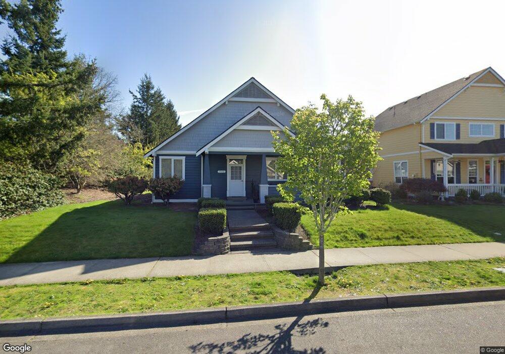
1548 Palisade Blvd Dupont, WA 98327
Estimated Value: $547,000 - $584,000
3
Beds
3
Baths
1,548
Sq Ft
$368/Sq Ft
Est. Value
About This Home
This home is located at 1548 Palisade Blvd, Dupont, WA 98327 and is currently estimated at $569,195, approximately $367 per square foot. 1548 Palisade Blvd is a home located in Pierce County with nearby schools including Chloe Clark Elementary School, Saltars Point Elementary School, and Pioneer Middle School.
Ownership History
Date
Name
Owned For
Owner Type
Purchase Details
Closed on
Nov 21, 2017
Sold by
Morris Doreen E
Bought by
Morris Doreen E
Current Estimated Value
Purchase Details
Closed on
Dec 30, 2014
Sold by
Goodhind Patricia A and Goodhind Gilbert H
Bought by
Goodhind Patricia A and The Patricia A Goodhind Living Trust
Purchase Details
Closed on
Feb 27, 1995
Sold by
Zetterberg Karl R
Bought by
Goodhind Gilbert H and Goodhind Patricia A
Purchase Details
Closed on
Sep 14, 1994
Sold by
Weyerhaeuser Real Estate Company
Bought by
Zetterberg Karl R and Zetterberg Jane E
Create a Home Valuation Report for This Property
The Home Valuation Report is an in-depth analysis detailing your home's value as well as a comparison with similar homes in the area
Home Values in the Area
Average Home Value in this Area
Purchase History
| Date | Buyer | Sale Price | Title Company |
|---|---|---|---|
| Morris Doreen E | -- | None Available | |
| Goodhind Patricia A | -- | None Available | |
| Goodhind Gilbert H | -- | Transamerica Title Ins Co | |
| Zetterberg Karl R | $43,800 | Transamerica Title Ins Co |
Source: Public Records
Tax History Compared to Growth
Tax History
| Year | Tax Paid | Tax Assessment Tax Assessment Total Assessment is a certain percentage of the fair market value that is determined by local assessors to be the total taxable value of land and additions on the property. | Land | Improvement |
|---|---|---|---|---|
| 2025 | $4,042 | $550,800 | $233,800 | $317,000 |
| 2024 | $4,042 | $527,600 | $225,300 | $302,300 |
| 2023 | $4,042 | $502,300 | $218,600 | $283,700 |
| 2022 | $4,008 | $510,900 | $218,600 | $292,300 |
| 2021 | $3,790 | $376,400 | $138,800 | $237,600 |
| 2019 | $3,384 | $344,300 | $115,700 | $228,600 |
| 2018 | $3,631 | $331,000 | $115,700 | $215,300 |
| 2017 | $3,279 | $311,100 | $101,100 | $210,000 |
| 2016 | $3,107 | $280,900 | $85,300 | $195,600 |
| 2014 | $1,355 | $276,000 | $85,300 | $190,700 |
| 2013 | $1,355 | $231,100 | $86,900 | $144,200 |
Source: Public Records
Map
Nearby Homes
- 1680 Kennedy Place Unit A4
- 1607 Kincaid St Unit E-8
- 1856 Spencer Ct Unit 12F
- 605 Louviers Ave
- 504 Dupont Ave
- 2147 Hammond Ave Unit B10
- 403 Louviers Ave
- 205 Brandywine Ave
- 2176 Palisade Blvd Unit F-3
- 2176 McDonald Ave
- 2237 Tolmie St
- 1975 Garry Oaks Ave Unit C
- 2055 Garry Oaks Ave Unit B
- 1331 Rowan Ct Unit 1331
- 1373 Hudson St Unit 1373
- 1285 Griggs St
- 1263 Hudson St
- 2699 Erwin Ave Unit 2699
- 2420 Simmons St Unit B
- 3114 Walker Rd
- 1536 Palisade Blvd
- 1524 Palisade Blvd
- 1537 Bittner Ct
- 1549 Bittner Ct
- 1541 Palisade Blvd Unit 2
- 1535 Palisade Blvd Unit 3
- 1525 Bittner Ct
- 1512 Palisade Blvd
- 1529 Palisade Blvd Unit 4
- 1521 Palisade Blvd Unit 5
- 1613 Palisade Blvd
- 1561 Bittner Ct
- 1515 Palisade Blvd Unit 6
- 1513 Bittner Ct
- 1413 Haskell St Unit 14A
- 1480 Heath Ct Unit 14B
- 1500 Palisade Blvd
- 1476 Heath Ct Unit 13A
- 1501 Palisade Blvd Unit 7
- 1501 Bittner Ct