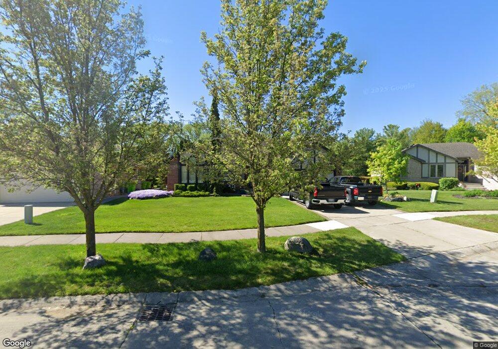
15480 Mountainside Dr Macomb, MI 48042
Estimated Value: $383,000 - $418,929
Studio
2
Baths
1,912
Sq Ft
$209/Sq Ft
Est. Value
About This Home
This home is located at 15480 Mountainside Dr, Macomb, MI 48042 and is currently estimated at $398,732, approximately $208 per square foot. 15480 Mountainside Dr is a home located in Macomb County with nearby schools including Beck Centennial Elementary School, Shelby Junior High School, and Eisenhower High School.
Ownership History
Date
Name
Owned For
Owner Type
Purchase Details
Closed on
Mar 24, 2005
Sold by
Farquhar Neal E and Farquhar Leanne L
Bought by
Farquhar Neal E
Current Estimated Value
Home Financials for this Owner
Home Financials are based on the most recent Mortgage that was taken out on this home.
Original Mortgage
$208,500
Outstanding Balance
$105,458
Interest Rate
5.88%
Mortgage Type
Stand Alone Refi Refinance Of Original Loan
Estimated Equity
$293,274
Purchase Details
Closed on
Apr 2, 1997
Sold by
Baleda J and Baleda P
Bought by
Farquhar N
Create a Home Valuation Report for This Property
The Home Valuation Report is an in-depth analysis detailing your home's value as well as a comparison with similar homes in the area
Home Values in the Area
Average Home Value in this Area
Purchase History
| Date | Buyer | Sale Price | Title Company |
|---|---|---|---|
| Farquhar Neal E | -- | Title Express Agency | |
| Farquhar N | $180,000 | -- |
Source: Public Records
Mortgage History
| Date | Status | Borrower | Loan Amount |
|---|---|---|---|
| Open | Farquhar Neal E | $208,500 |
Source: Public Records
Tax History
| Year | Tax Paid | Tax Assessment Tax Assessment Total Assessment is a certain percentage of the fair market value that is determined by local assessors to be the total taxable value of land and additions on the property. | Land | Improvement |
|---|---|---|---|---|
| 2025 | $2,321 | $197,500 | $0 | $0 |
| 2024 | $23 | $190,200 | $0 | $0 |
| 2023 | $2,139 | $166,100 | $0 | $0 |
| 2022 | $3,089 | $150,100 | $0 | $0 |
| 2021 | $3,009 | $144,400 | $0 | $0 |
| 2020 | $1,969 | $140,100 | $0 | $0 |
| 2019 | $2,760 | $132,000 | $0 | $0 |
| 2018 | $2,729 | $125,300 | $0 | $0 |
| 2017 | $2,683 | $118,110 | $32,000 | $86,110 |
| 2016 | $2,525 | $118,060 | $0 | $0 |
| 2015 | $2,494 | $111,880 | $0 | $0 |
| 2014 | $2,494 | $100,890 | $21,000 | $79,890 |
| 2013 | $3,276 | $100,890 | $0 | $0 |
Source: Public Records
Map
Nearby Homes
- 52204 Antler Dr
- 52522 Charing Way
- 52163 Heatherstone Ave
- 53456 Fitzgerald Dr
- 16767 Cobblestone West Blvd
- 52192 Southview Ridge
- 14345 24 Mile Rd
- 53428 Gregory Dr
- 13874 Grandeur Ave
- 52801 Royal Park Ave
- 16448 Trailway Dr
- 16489 Bishopsgate Dr
- 52210 Gabriella Ln Unit 39
- 17437 Westgrove Dr
- 13676 Timberwyck Dr
- 15636 Sloane St
- 13848 Woodsett Ct
- 53650 Romeo Plank Rd
- 16089 Diamante Dr
- 54680 Chickasaw Dr
- 15508 Mountainside Dr
- 15452 Mountainside Dr
- 52001 Powderhorn Dr
- 52010 Powderhorn Dr
- 15536 Mountainside Dr
- 52029 Powderhorn Dr
- 52058 Powderhorn Dr
- 52067 Powderhorn Dr
- 15564 Mountainside Dr
- 52106 Powderhorn Dr
- 52093 Powderhorn Dr
- 15434 Buckskin Dr
- 52230 Buckskin Dr
- 15559 Mountainside Dr
- 15592 Mountainside Dr
- 52058 Antoinette Dr
- 52154 Powderhorn Dr
- 52131 Powderhorn Dr
- 52242 Buckskin Dr
- 52201 Ridgeway Dr
Your Personal Tour Guide
Ask me questions while you tour the home.