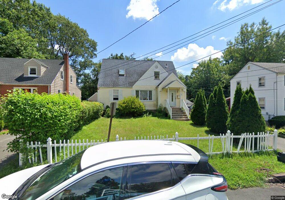
1549 Bond St Hillside, NJ 07205
Estimated Value: $486,010 - $574,000
--
Bed
--
Bath
2,116
Sq Ft
$245/Sq Ft
Est. Value
About This Home
This home is located at 1549 Bond St, Hillside, NJ 07205 and is currently estimated at $518,003, approximately $244 per square foot. 1549 Bond St is a home located in Union County with nearby schools including Abram P. Morris-Saybrook Elementary School, Ola Edwards Community School, and Hurden Looker School.
Ownership History
Date
Name
Owned For
Owner Type
Purchase Details
Closed on
Dec 13, 1999
Sold by
Williams Maditse Gwendolyn E and Williams Gwendolyn E
Bought by
Okai George
Current Estimated Value
Home Financials for this Owner
Home Financials are based on the most recent Mortgage that was taken out on this home.
Original Mortgage
$159,510
Interest Rate
7.91%
Mortgage Type
FHA
Purchase Details
Closed on
Jan 12, 1996
Sold by
Shoffel Beatrice
Bought by
Williams Gwendolyn E
Create a Home Valuation Report for This Property
The Home Valuation Report is an in-depth analysis detailing your home's value as well as a comparison with similar homes in the area
Home Values in the Area
Average Home Value in this Area
Purchase History
| Date | Buyer | Sale Price | Title Company |
|---|---|---|---|
| Okai George | $164,500 | -- | |
| Williams Gwendolyn E | $132,000 | -- |
Source: Public Records
Mortgage History
| Date | Status | Borrower | Loan Amount |
|---|---|---|---|
| Previous Owner | Okai George | $159,510 |
Source: Public Records
Tax History Compared to Growth
Tax History
| Year | Tax Paid | Tax Assessment Tax Assessment Total Assessment is a certain percentage of the fair market value that is determined by local assessors to be the total taxable value of land and additions on the property. | Land | Improvement |
|---|---|---|---|---|
| 2025 | $11,067 | $134,100 | $54,500 | $79,600 |
| 2024 | $10,745 | $134,100 | $54,500 | $79,600 |
| 2023 | $10,745 | $134,100 | $54,500 | $79,600 |
| 2022 | $10,646 | $134,100 | $54,500 | $79,600 |
| 2021 | $10,576 | $134,100 | $54,500 | $79,600 |
| 2020 | $10,515 | $134,100 | $54,500 | $79,600 |
| 2019 | $10,311 | $134,100 | $54,500 | $79,600 |
| 2018 | $10,208 | $134,100 | $54,500 | $79,600 |
| 2017 | $10,146 | $134,100 | $54,500 | $79,600 |
| 2016 | $10,134 | $134,100 | $54,500 | $79,600 |
| 2015 | $10,044 | $134,100 | $54,500 | $79,600 |
| 2014 | $9,886 | $134,100 | $54,500 | $79,600 |
Source: Public Records
Map
Nearby Homes
- 146 Williamson Ave
- 1473 Center St
- 1451 Bond St
- 1444 N Broad St
- 95 Keer Ave
- 91 Keer Ave Unit 95
- 36 Hansbury Ave Unit 38
- 86-88 Chancellor Ave
- 38 Hansbury Ave
- 1406 Maple Ave
- 86 88chancellor Ave
- 203-205 Hansbury Ave
- 207-209 Hansbury Ave
- 1167 Bergen St Unit 1169
- 124 Vassar Ave
- 1414 Boa Place Unit 2
- 23 Chancellor Ave
- 91-93 Vassar Ave
- 138-140 Goldsmith Ave
- 91 Vassar Ave Unit 93