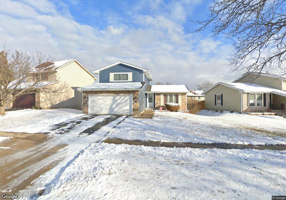
1549 Brookside Dr Hoffman Estates, IL 60169
South Hoffman Estates NeighborhoodEstimated Value: $404,000 - $486,000
3
Beds
2
Baths
1,909
Sq Ft
$224/Sq Ft
Est. Value
About This Home
This home is located at 1549 Brookside Dr, Hoffman Estates, IL 60169 and is currently estimated at $427,647, approximately $224 per square foot. 1549 Brookside Dr is a home located in Cook County with nearby schools including Neil Armstrong Elementary School, Dwight D Eisenhower Junior High School, and Hoffman Estates High School.
Ownership History
Date
Name
Owned For
Owner Type
Purchase Details
Closed on
Sep 5, 2003
Sold by
Bumatay Francis Nickson and Bumatay Chuchi L
Bought by
Shulz Steven A and Schulz Sara L
Current Estimated Value
Home Financials for this Owner
Home Financials are based on the most recent Mortgage that was taken out on this home.
Original Mortgage
$218,250
Outstanding Balance
$100,094
Interest Rate
6.43%
Mortgage Type
Unknown
Estimated Equity
$327,553
Purchase Details
Closed on
Jul 30, 1997
Sold by
Engel James R and Engel Marcia A
Bought by
Bumatay Nickson and Bumatay Chuchi L
Home Financials for this Owner
Home Financials are based on the most recent Mortgage that was taken out on this home.
Original Mortgage
$154,806
Interest Rate
7.68%
Mortgage Type
FHA
Create a Home Valuation Report for This Property
The Home Valuation Report is an in-depth analysis detailing your home's value as well as a comparison with similar homes in the area
Home Values in the Area
Average Home Value in this Area
Purchase History
| Date | Buyer | Sale Price | Title Company |
|---|---|---|---|
| Shulz Steven A | -- | Pntn | |
| Bumatay Nickson | $106,333 | -- |
Source: Public Records
Mortgage History
| Date | Status | Borrower | Loan Amount |
|---|---|---|---|
| Open | Shulz Steven A | $218,250 | |
| Previous Owner | Bumatay Nickson | $154,806 |
Source: Public Records
Tax History
| Year | Tax Paid | Tax Assessment Tax Assessment Total Assessment is a certain percentage of the fair market value that is determined by local assessors to be the total taxable value of land and additions on the property. | Land | Improvement |
|---|---|---|---|---|
| 2025 | $8,189 | $38,000 | $5,841 | $32,159 |
| 2024 | $8,189 | $30,000 | $5,310 | $24,690 |
| 2023 | $7,894 | $30,000 | $5,310 | $24,690 |
| 2022 | $7,894 | $30,000 | $5,310 | $24,690 |
| 2021 | $7,192 | $24,796 | $8,363 | $16,433 |
| 2020 | $7,098 | $24,796 | $8,363 | $16,433 |
| 2019 | $7,062 | $27,552 | $8,363 | $19,189 |
| 2018 | $7,787 | $27,316 | $7,301 | $20,015 |
| 2017 | $7,667 | $27,316 | $7,301 | $20,015 |
| 2016 | $7,394 | $27,316 | $7,301 | $20,015 |
| 2015 | $6,728 | $23,570 | $6,372 | $17,198 |
| 2014 | $6,626 | $23,570 | $6,372 | $17,198 |
| 2013 | $6,438 | $23,570 | $6,372 | $17,198 |
Source: Public Records
Map
Nearby Homes
- 1587 Brookside Dr
- 1659 Islandview Ct
- 1792 Williamsburg Dr
- 1500 Robin Cir Unit 314
- 1776 Bristol Walk Unit 1776
- 2222 Seaver Ln
- 1760 Bristol Walk Unit F
- 1722 Fayette Walk Unit E
- 1724 Fayette Walk Unit J
- 1769 Sessions Walk Unit C
- 1840 Huntington Blvd Unit BW511
- 1576 Poplar Creek Dr
- 2080 Sutherland Place Unit 1
- 1712 Fayette Walk Unit D
- 1933 Williamsburg Dr Unit 1
- 1975 Windsong Dr Unit 333E1
- 2021 Kensington Ln Unit 3004
- 2027 Kensington Ln Unit 3001
- 2025 Kensington Ln Unit 3002
- 2023 Kensington Ln Unit 3003
- 1535 Brookside Dr
- 1559 Brookside Dr
- 1970 Brookside Ln Unit 4A
- 1972 Brookside Ln
- 1569 Brookside Dr
- 1525 Brookside Dr
- 2021 Huttner Ct
- 1968 Brookside Ln
- 1530 Brookside Dr
- 1980 Brookside Ln
- 1572 Brookside Dr
- 1579 Brookside Dr
- 1990 Brookside Ln Unit 4
- 2023 Huttner Ct
- 2000 Brookside Ln
- 2020 Huttner Ct
- 1526 Brookside Dr
- 1966 Brookside Ln
- 1581 Brookside Dr
- 2022 Huttner Ct
Your Personal Tour Guide
Ask me questions while you tour the home.