NOT LISTED FOR SALE

1549 Thompson Bay Loop Scranton, AR 72863

Estimated Value: $133,000 - $288,000

1.9 Acres
$107,865 Price per Acre
82,764 Sq Ft Lot

Last Sold September 16, 2019

Last sale price $36,549

Est. 461% increase in value since last sale

Current estimated payment $1,209/month

11 Days on Market

About This Lot

As of September 2019

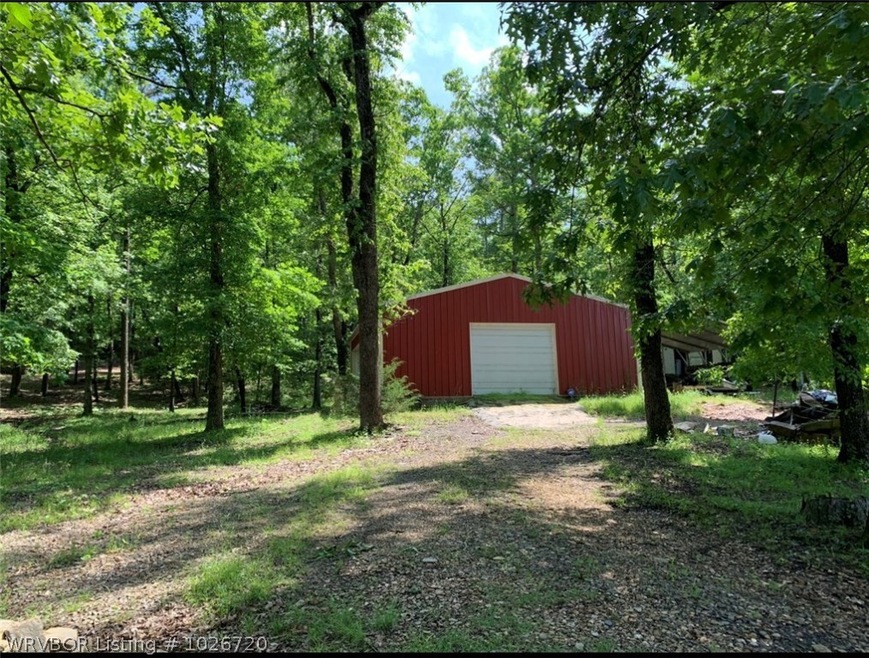
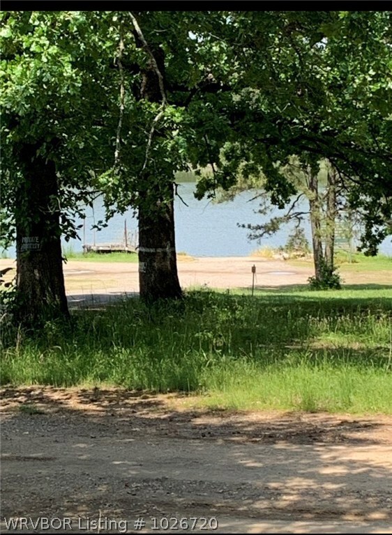
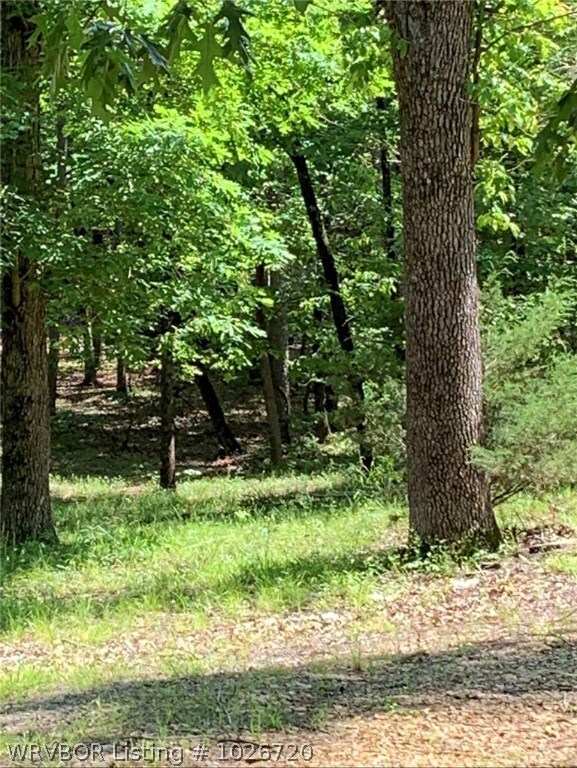
1.90 Acres complete with 900 Sq.ft building , Insulated and electric, Can be converted to a Home, workshop or for toys , double carport, property intakes part of the public ramp and bumps up to the corp.of engineers land

Last Listed By

Karen McAnally

Inactive Agents Ft. Smith License #SA00069593 Listed on: 08/05/2019

Property Details

Property Type

  • Land

Est. Annual Taxes

  • $875

Lot Details

  • 1.9 Acre Lot
  • Lot Dimensions are 225x399
  • Level Lot
  • Open Lot
  • Cleared Lot
  • Partially Wooded Lot
  • Landscaped with Trees

Home Design

  • Mixed Use

Schools

  • Scranton Elementary And Middle School
  • Scranton High School

Additional Features

  • Outside City Limits
  • Mobile Home Allowed
  • Not Connected to Water Source

Listing and Financial Details

  • Tax Lot 3
  • Assessor Parcel Number 300-00492-000

Community Details

Overview

  • Eberhart Koch Subdivision

Recreation

  • Recreational Area

Property Details

Property Type

Land

Est. Annual Taxes

$875

Lot Details

0

Listing Details

  • Reso Property Sub Type: Mixed Use
  • Prop. Type: Land
  • ResoLotFeatures: Cleared, Hardwood Trees, Level, Mobile Home Allowed, Not In Subdivision, Outside City Limits, Open Lot
  • Road Surface Type: Paved
  • Co List Office Mls Id: F3575
  • ResoSpecialListingConditions: None
  • Subdivision Name: Eberhart Koch
  • Directions: Ar.Hwy22 Walnut Street Paris 15.1 miles take a left on Old Military Rd. Scranton . Road will turn into Thompson Bay Rd. Drive about 3 miles to the bottom of a big hill Thompson Bay Loop will be on the right , turn on paved road , property is on the right
  • Property Sub Type Additional: Mixed Use
  • Special Features: VirtualTour
  • Property Sub Type: LotsLands

Exterior Features

  • Fencing: None
  • Acres: 1.9
  • Topography: Cleared

Utilities

  • Water Source: Not Connected (nearby), Public

Condo/Co-op/Association

  • Community Features: Recreation Area

Schools

  • Ninth Grade High School: Scranton
  • Middle Or Junior School: Scranton

Lot Info

  • Lot Dimensions: 225x399
  • Parcel #: 300-00492-000

Tax Info

  • Tax Annual Amount: 90.0
  • Tax Block: 0
  • Tax Lot: 3

MLS Schools

  • Elementary School: Scranton

Ownership History

Date Name Owned For Owner Type

Purchase Details

Listed on
Aug 5, 2019
Closed on
Aug 28, 2019
Sold by
Not Available From County
Bought by
Jones Francis Ray and Jones Helen
Seller's Agent
Karen McAnally
Inactive Agents Ft. Smith
Buyer's Agent
Karen McAnally
Inactive Agents Ft. Smith
List Price
$36,549
Sold Price
$36,549
Total Days on Market
11
Current Estimated Value
$204,943

Home Financials for this Owner

Home Financials are based on the most recent Mortgage that was taken out on this home.
Estimated Appreciation
$168,394
Avg. Annual Appreciation
33.78%

Purchase Details

Closed on
Jul 22, 2012
Bought by
Wagner John

Purchase Details

Closed on
May 19, 2010
Sold by
Cook James and Cook Julia
Bought by
Owers Harold and Owers Sarah

Purchase Details

Closed on
Jun 17, 2009
Bought by
Carlile Cody A and Carlile Andrea N

Purchase Details

Closed on
Sep 25, 2001
Bought by
Cook

Purchase Details

Closed on
Sep 5, 2000
Bought by
Cook

Purchase Details

Closed on
Dec 1, 1994
Bought by
Cook

Purchase Details

Closed on
Oct 1, 1991
Bought by
Fancher

Purchase Details

Closed on
Jan 1, 1988
Bought by
Cook

Range of Values:

Collateral Analytics

Collateral Analytics Collateral Analytics AVMs (Automated Valuation Model) employ a number of statistical approaches combined with neighborhood-specific comparable selection guarantees the most up-to-date and precise valuations.

Not Available

Collateral Analytics does not have data for the current month. Please view the chart for historical values.

ICE

ICE Mortgage Technology ICE Mortgage Technology’s AVM (Automated Valuation Model) is a state-of-the-art online residential property valuation tool that provides a quick and accurate estimate of the value of almost any home in the U.S.

Not Available

ICE Mortgage Technology does not have data for the current month. Please view the chart for historical values.

First American

First American First American Data & Analytics’ next-generation AVM combines unrivaled data assets with a blended ensemble of valuation models to produce highly accurate, reliable valuations you can trust.

Not Available

First American does not have data for the current month. Please view the chart for historical values.

Quantarium

Quantarium Quantarium’s valuation service, repeatedly proven the industry’s most accurate and comprehensive, is supercharged with a self-learning and auto-tuning AI engine that continually becomes smarter and more accurate as it processes daily inputs from the industry’s leading RE data lake.

Not Available

Quantarium does not have data for the current month. Please view the chart for historical values.

Average Value
Not Available
List Price
Sold Price
Create a Home Valuation Report for This Property
The Home Valuation Report is an in-depth analysis detailing your home's value as well as a comparison with similar homes in the area

Home Values in the Area

Source: Public Records

Average Home Value in this Area


Source: Public Records

Purchase History

Date Buyer Sale Price Title Company
Jones Francis Ray $37,000 --
Wagner John $30,000 --
Owers Harold -- --
Carlile Cody A $25,000 --
Cook -- --
Cook -- --
Cook $18,000 --
Fancher -- --
Cook -- --
Source: Public Records

Property History

Date Event Price Change Sq Ft Price
09/16/2019 09/16/19 Sold $36,549 0.0% --
08/17/2019 08/17/19 Pending -- -- --
08/05/2019 08/05/19 For Sale $36,549 -- --
Source: Western River Valley Board of REALTORS®

Tax History Compared to Growth

Source: Public Records

Tax History

Year Tax Paid Tax Assessment Tax Assessment Total Assessment is a certain percentage of the fair market value that is determined by local assessors to be the total taxable value of land and additions on the property. Land Improvement
2024 $875 $19,060 $1,400 $17,660
2023 $875 $19,060 $1,400 $17,660
2022 $179 $3,900 $1,400 $2,500
2021 $179 $3,900 $1,400 $2,500
2020 $179 $3,900 $1,400 $2,500
2019 $179 $5,120 $2,800 $2,320
2018 $198 $5,120 $2,800 $2,320
2017 $84 $2,920 $2,800 $120
2016 $84 $2,920 $2,800 $120
2015 -- $1,520 $1,400 $120
2014 -- $1,520 $1,400 $120
2013 -- $1,520 $1,400 $120
Source: Public Records

Agents Affiliated with this Home

See All Agents

Map

Source: Western River Valley Board of REALTORS®

MLS Number: 1026720

APN: 300-00492-000