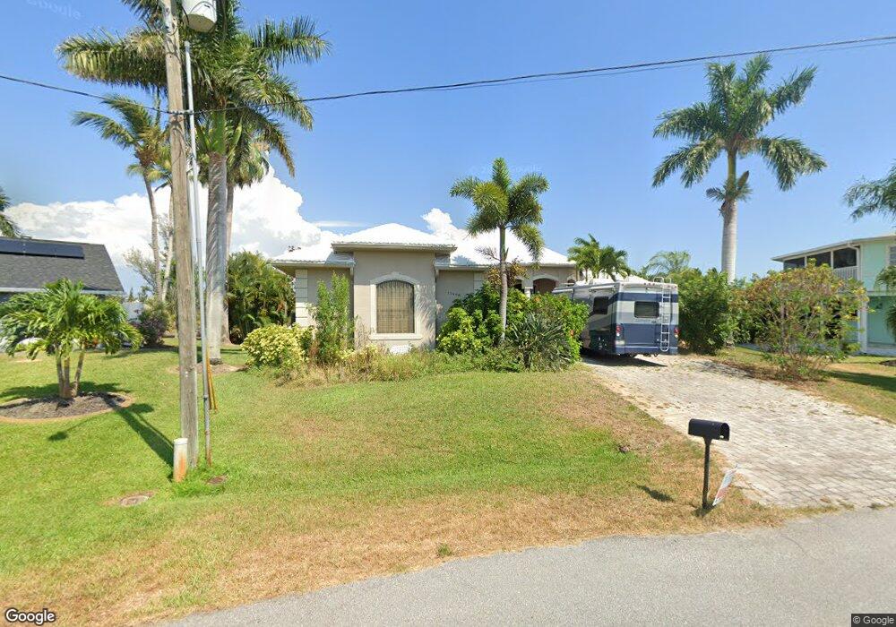
15498 Mccomb Cir Port Charlotte, FL 33981
Gulf Cove NeighborhoodEstimated Value: $1,067,162 - $1,413,000
3
Beds
2
Baths
3,803
Sq Ft
$317/Sq Ft
Est. Value
About This Home
This home is located at 15498 Mccomb Cir, Port Charlotte, FL 33981 and is currently estimated at $1,204,721, approximately $316 per square foot. 15498 Mccomb Cir is a home located in Charlotte County with nearby schools including Myakka River Elementary School, L.A. Ainger Middle School, and Lemon Bay High School.
Ownership History
Date
Name
Owned For
Owner Type
Purchase Details
Closed on
Mar 28, 2004
Sold by
Peddrick Joseph W
Bought by
Dk Llc
Current Estimated Value
Purchase Details
Closed on
Mar 25, 2003
Sold by
D K L L C
Bought by
Cook James H and Cook Wendy L
Purchase Details
Closed on
Dec 13, 2002
Sold by
Peddrick William M
Bought by
D K L L C
Home Financials for this Owner
Home Financials are based on the most recent Mortgage that was taken out on this home.
Original Mortgage
$60,000
Interest Rate
6.01%
Create a Home Valuation Report for This Property
The Home Valuation Report is an in-depth analysis detailing your home's value as well as a comparison with similar homes in the area
Home Values in the Area
Average Home Value in this Area
Purchase History
| Date | Buyer | Sale Price | Title Company |
|---|---|---|---|
| Dk Llc | -- | -- | |
| Cook James H | $149,900 | -- | |
| D K L L C | -- | -- | |
| D K L L C | -- | -- | |
| D K L L C | -- | -- | |
| D K L L C | -- | -- | |
| D K L L C | $75,000 | -- |
Source: Public Records
Mortgage History
| Date | Status | Borrower | Loan Amount |
|---|---|---|---|
| Previous Owner | D K L L C | $60,000 |
Source: Public Records
Tax History Compared to Growth
Tax History
| Year | Tax Paid | Tax Assessment Tax Assessment Total Assessment is a certain percentage of the fair market value that is determined by local assessors to be the total taxable value of land and additions on the property. | Land | Improvement |
|---|---|---|---|---|
| 2023 | $9,161 | $564,216 | $0 | $0 |
| 2022 | $9,029 | $547,783 | $0 | $0 |
| 2021 | $9,082 | $531,828 | $0 | $0 |
| 2020 | $8,177 | $524,485 | $0 | $0 |
| 2019 | $8,796 | $512,693 | $0 | $0 |
| 2018 | $8,235 | $503,133 | $0 | $0 |
| 2017 | $8,184 | $492,785 | $0 | $0 |
| 2016 | $8,154 | $481,715 | $0 | $0 |
| 2015 | $7,552 | $478,366 | $0 | $0 |
| 2014 | $7,526 | $474,569 | $0 | $0 |
Source: Public Records
Map
Nearby Homes
- 15503 Mccomb Cir
- 15483 Mccomb Cir
- 9381 St Paul Dr
- 15448 Avery Rd
- 9349 Saint Paul Dr
- 9346 St Paul Dr
- 15547 Mccomb Cir
- 15562 Mccomb Cir
- 15427 Mccomb Cir
- 15442 Mccomb Cir
- 9325 Saint Paul Dr
- 15660 Ruston Cir
- 10096 Saint Paul Dr
- 9365 Saint Paul Dr
- 10528 Saint Paul Dr
- 10072 Saint Paul Dr
- 0 Avery Rd
- 15659 Ruston Cir
- 9251 Lingle St
- 15591 Avery Rd
- 15514 Mccomb Cir
- 15503 McComb Cir Cir
- 15482 Mccomb Cir
- 9389 Saint Paul Dr
- 15522 Mccomb Cir
- 15480 Avery Rd
- 15474 Mccomb Cir
- 9405 Saint Paul Dr
- 9405 St Paul Dr
- 15488 Avery Rd
- 9373 St Paul Dr
- 15472 Avery Rd
- 9413 St Paul Dr
- 9381 Saint Paul Dr
- 15530 Mccomb Cir
- 15464 Avery Rd
- 9382 Saint Paul Dr
- 15443 Mccomb Cir
- 9421 St Paul Dr