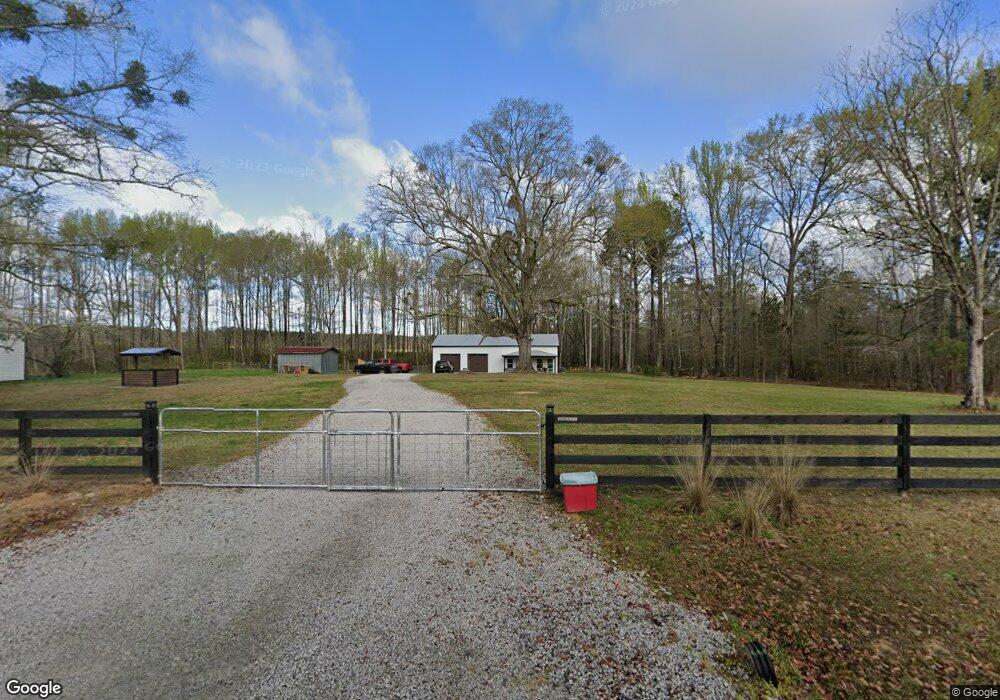
155 Bairdstown Loop Union Point, GA 30669
Estimated Value: $508,000
3
Beds
2
Baths
1,360
Sq Ft
$374/Sq Ft
Est. Value
About This Home
This home is located at 155 Bairdstown Loop, Union Point, GA 30669 and is currently estimated at $508,000, approximately $373 per square foot. 155 Bairdstown Loop is a home located in Oglethorpe County with nearby schools including Oglethorpe County Primary School, Oglethorpe County Elementary School, and Oglethorpe County Middle School.
Ownership History
Date
Name
Owned For
Owner Type
Purchase Details
Closed on
Dec 19, 2023
Sold by
Patrick Matt
Bought by
Clark Kendall Paige and Story Kendall Paige
Current Estimated Value
Purchase Details
Closed on
Oct 22, 2019
Sold by
Patrick Matt
Bought by
Story Kendall Paige
Purchase Details
Closed on
Jun 23, 2017
Sold by
Epps Hammond Linda
Bought by
Tracey Patrick Matt and Tracey Patrick
Purchase Details
Closed on
Nov 11, 2015
Sold by
Epps Lucile L
Bought by
Hammond Linda Epps and Hammond Patrick Janice
Create a Home Valuation Report for This Property
The Home Valuation Report is an in-depth analysis detailing your home's value as well as a comparison with similar homes in the area
Purchase History
| Date | Buyer | Sale Price | Title Company |
|---|---|---|---|
| Clark Kendall Paige | -- | -- | |
| Story Kendall Paige | -- | -- | |
| Tracey Patrick Matt | -- | -- | |
| Hammond Linda Epps | -- | -- |
Source: Public Records
Tax History
| Year | Tax Paid | Tax Assessment Tax Assessment Total Assessment is a certain percentage of the fair market value that is determined by local assessors to be the total taxable value of land and additions on the property. | Land | Improvement |
|---|---|---|---|---|
| 2025 | $73 | $3,048 | $1,920 | $1,128 |
| 2023 | $687 | $28,848 | $1,840 | $27,008 |
| 2022 | $591 | $23,068 | $1,840 | $21,228 |
| 2021 | $552 | $19,324 | $1,640 | $17,684 |
| 2020 | $422 | $19,324 | $1,640 | $17,684 |
| 2019 | $606 | $21,004 | $3,320 | $17,684 |
| 2018 | $168 | $5,575 | $2,859 | $2,716 |
| 2017 | $200 | $6,626 | $2,859 | $3,767 |
| 2016 | $396 | $13,416 | $2,859 | $10,557 |
| 2015 | -- | $13,416 | $2,859 | $10,557 |
| 2014 | -- | $13,416 | $2,859 | $10,557 |
| 2013 | -- | $13,416 | $2,858 | $10,557 |
Source: Public Records
Map
Nearby Homes
- 1091 Peachtree Ave E
- 0 Woodville Rd Unit 7667944
- 0 Woodville Rd Unit 10628010
- 0 Lovers Ln Unit 10690740
- 0 Lovers Ln Unit CL349036
- 5971 Penfield Rd
- 5011 Penfield Rd
- 290 Poplar Creek Rd
- 1251 Adams Rd
- 1101 Boswell Rd
- 000 Washington Hwy
- 310 Philomath Woodville Rd
- 1710 Cunningham Rd
- 0 Washington Hwy Unit 10686255
- 215 Hunter St
- 324 N Rhodes St
- 1071 Alexander St
- 181 Lower Wirebridge Rd
- 0 Lower Wirebridge Rd
- 0 Woodland Ct Unit 10543600
- 169 Bairdstown Loop
- 196 Bairdstown Loop
- 0 Bairdstown Loop Unit TRACT 3075525
- 0 Bairdstown Loop Unit CM908319
- 0 Bairdstown Loop Unit CM910301
- 0 Bairdstown Loop Unit CM312808
- 0 Bairdstown Loop Unit CM373798
- 169 Bairdstown Loop
- 3403 Union Point Rd
- 3403 Union Point Rd
- 1306 Community Dr
- 1381 Community Dr
- 1322 Community Dr
- 1328 Community Dr
- 1372 Community Dr
- 3402 Union Point Rd
- 3434 Union Point Rd
- 3434 Union Point Rd Unit 3434 Union Point Roa
- 0 Community Dr Unit 50601
- 0 Community Dr Unit 10351833
Your Personal Tour Guide
Ask me questions while you tour the home.