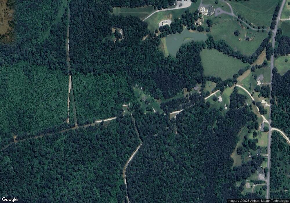
155 Bill Ploof Rd Buchanan, GA 30113
Estimated Value: $67,000 - $353,000
3
Beds
1
Bath
1,188
Sq Ft
$164/Sq Ft
Est. Value
About This Home
This home is located at 155 Bill Ploof Rd, Buchanan, GA 30113 and is currently estimated at $194,423, approximately $163 per square foot. 155 Bill Ploof Rd is a home located in Haralson County with nearby schools including Haralson County High School.
Ownership History
Date
Name
Owned For
Owner Type
Purchase Details
Closed on
Nov 4, 2024
Sold by
Wright Patrick B
Bought by
Wright Amanda Lynn and Wright Patrick Brian
Current Estimated Value
Home Financials for this Owner
Home Financials are based on the most recent Mortgage that was taken out on this home.
Original Mortgage
$178,062
Outstanding Balance
$175,900
Interest Rate
6.5%
Mortgage Type
FHA
Estimated Equity
$18,523
Purchase Details
Closed on
Sep 17, 2021
Sold by
Ezell John David
Bought by
Wright Patrick Brian and Ballew Amanda Lynn
Purchase Details
Closed on
Feb 24, 2010
Sold by
Ezell Mary Ruth Estate
Bought by
Ezell James G
Purchase Details
Closed on
Apr 24, 1981
Sold by
Ezell James G A and Ezell K
Bought by
Ezell James G
Purchase Details
Closed on
Jul 13, 1965
Sold by
Jeffers Denny C
Bought by
Ezell James G
Create a Home Valuation Report for This Property
The Home Valuation Report is an in-depth analysis detailing your home's value as well as a comparison with similar homes in the area
Purchase History
| Date | Buyer | Sale Price | Title Company |
|---|---|---|---|
| Wright Amanda Lynn | -- | -- | |
| Wright Patrick Brian | $50,000 | -- | |
| Ezell John David | -- | -- | |
| Ezell James G | -- | -- | |
| Ezell James G | -- | -- | |
| Ezell James G | -- | -- |
Source: Public Records
Mortgage History
| Date | Status | Borrower | Loan Amount |
|---|---|---|---|
| Open | Wright Amanda Lynn | $178,062 |
Source: Public Records
Tax History Compared to Growth
Tax History
| Year | Tax Paid | Tax Assessment Tax Assessment Total Assessment is a certain percentage of the fair market value that is determined by local assessors to be the total taxable value of land and additions on the property. | Land | Improvement |
|---|---|---|---|---|
| 2025 | $709 | $79,728 | $28,800 | $50,928 |
| 2024 | $709 | $27,334 | $8,342 | $18,992 |
| 2023 | $750 | $27,961 | $6,934 | $21,027 |
| 2022 | $536 | $23,108 | $6,934 | $16,174 |
| 2021 | $621 | $22,233 | $6,934 | $15,299 |
| 2020 | $645 | $22,978 | $6,934 | $16,044 |
| 2019 | $440 | $15,101 | $6,934 | $8,167 |
| 2018 | $446 | $15,101 | $6,934 | $8,167 |
| 2017 | $456 | $14,030 | $6,934 | $7,096 |
| 2016 | $658 | $21,460 | $8,492 | $12,968 |
| 2015 | $433 | $21,429 | $8,492 | $12,937 |
| 2014 | $432 | $21,706 | $8,492 | $13,214 |
Source: Public Records
Map
Nearby Homes
- 00 Coppermine Rd Trac #2
- 00 Coppermine Rd Trac #1
- 00 Coppermine Rd Trac #3
- 5960 Georgia Highway 120
- 327 Jeffers Rd
- 735 Seabreeze Lake Rd
- 818 Corinth Five Points Rd
- 0000 Corinth-Five Points Rd
- 262 Corinth-Five Points Rd
- 1225 Coppermine Rd
- 046.08 Roy Dean Rd
- 0 Roy Dean Rd Unit 10564383
- 0 Roy Dean Rd Unit 24150079
- 2404 Corinth Poseyville Rd
- 3399 Corinth Poseyville Rd
- 7082 Georgia 120
- 269 High Point Rd
- 273 High Point Rd
- 40 Red Oak Cir
- 80 Rosemary Way
- 101 Bill Ploof Rd
- 402 Coppermine Rd
- 0 Bill Ploof Rd Unit 7183112
- 386 Coppermine Rd
- 4 Bill Ploof Rd
- 268 Coppermine Rd
- 232 Coppermine Rd
- 134 Bill Ploof Rd
- 387 Coppermine Rd
- 174 Coppermine Rd
- 431 Coppermine Rd
- 102 Coppermine Rd
- 102 Coppermine Rd
- 281 Coppermine Rd
- 488 Coppermine Rd
- 5930 Georgia Highway 120
- 283 Coppermine Rd
- 1013 Seabreeze Lake Rd
- 1023 Seabreeze Lake Rd
- 1035 Seabreeze Lake Rd
