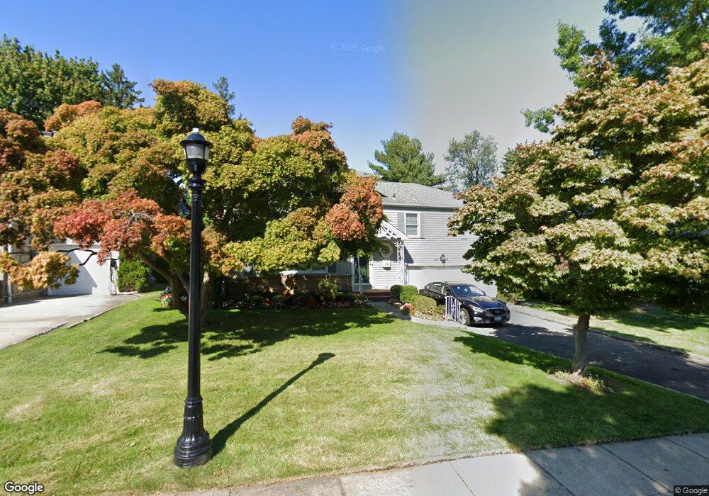
155 Bourndale Rd N Manhasset, NY 11030
Estimated Value: $1,734,000 - $1,884,066
Studio
2
Baths
2,190
Sq Ft
$826/Sq Ft
Est. Value
About This Home
This home is located at 155 Bourndale Rd N, Manhasset, NY 11030 and is currently estimated at $1,809,033, approximately $826 per square foot. 155 Bourndale Rd N is a home located in Nassau County with nearby schools including Manhasset Secondary School, St Mary's Elementary School, and Our Lady of Grace Montessori School.
Ownership History
Date
Name
Owned For
Owner Type
Purchase Details
Closed on
Dec 19, 2023
Sold by
Brincat Martha
Bought by
Brincat Martha and Martha Brincat Revocable Trust
Current Estimated Value
Purchase Details
Closed on
May 12, 2022
Sold by
Brincat Martha and Indelicato Martha
Bought by
Brincat Joseph Valentine and Brincat Martha
Purchase Details
Closed on
Sep 24, 2001
Create a Home Valuation Report for This Property
The Home Valuation Report is an in-depth analysis detailing your home's value as well as a comparison with similar homes in the area
Home Values in the Area
Average Home Value in this Area
Purchase History
| Date | Buyer | Sale Price | Title Company |
|---|---|---|---|
| Brincat Martha | -- | None Available | |
| Brincat Martha | -- | None Available | |
| Brincat Joseph Valentine | -- | None Available | |
| Brincat Joseph Valentine | -- | None Available | |
| Brincat Joseph Valentine | -- | None Available | |
| -- | -- | -- | |
| -- | -- | -- |
Source: Public Records
Tax History
| Year | Tax Paid | Tax Assessment Tax Assessment Total Assessment is a certain percentage of the fair market value that is determined by local assessors to be the total taxable value of land and additions on the property. | Land | Improvement |
|---|---|---|---|---|
| 2025 | $20,109 | $1,356 | $649 | $707 |
| 2024 | $5,327 | $1,280 | $598 | $682 |
Source: Public Records
Map
Nearby Homes
- 64 Plandome Ct
- 15 Gaynor Ave Unit 2H
- 4 Kimson Ct
- 88 Plandome Ct
- 71 Beechwood Ave
- 54 Summit Dr
- 305 Nassau Ave
- 38 Mason Dr
- 44 North Dr
- 145 Shore Rd
- 1054 Plandome Rd
- 2 Stonytown Rd
- 1270 Plandome Rd
- 44 Old ox Rd
- 539 Manhasset Woods Rd
- 59 Colonial Dr
- 42 Mora Ct
- 30 Bonnie Heights Rd
- 53 Stuart Place
- 191 Elderfields Rd
- 165 Bourndale Rd N
- 151 Bourndale Rd N
- 169 Bourndale Rd N
- 50 Heights Rd
- 50 Heights Rd
- 143 Bourndale Rd N
- 99 Brookside Dr
- 158 Bourndale Rd N
- 152 N Bourndale Rd
- 166 Bourndale Rd N
- 137 Bourndale Rd N
- 144 Bourndale Rd N
- 45 Brookwold Dr
- 181 Bourndale Rd N
- 44 Heights Rd
- 44 Heights Rd
- 131 Bourndale Rd N
- 60 Heights Rd
- 60 Heights Rd
- 138 Bourndale Rd N
Your Personal Tour Guide
Ask me questions while you tour the home.