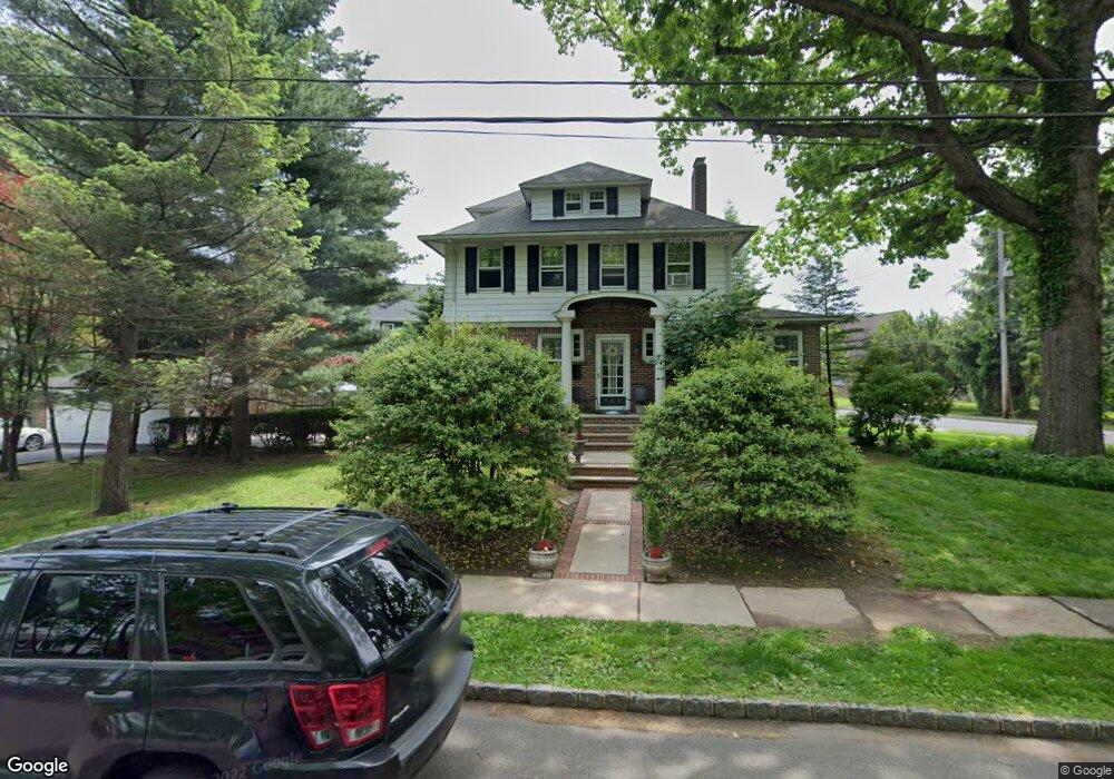
155 Bryant Ave Springfield, NJ 07081
Estimated Value: $712,389 - $861,000
Studio
--
Bath
2,194
Sq Ft
$351/Sq Ft
Est. Value
About This Home
This home is located at 155 Bryant Ave, Springfield, NJ 07081 and is currently estimated at $769,097, approximately $350 per square foot. 155 Bryant Ave is a home located in Union County with nearby schools including Jonathan Dayton High School and St James The Apostle School.
Ownership History
Date
Name
Owned For
Owner Type
Purchase Details
Closed on
Jan 3, 2019
Sold by
Springfield Center Urban Renewal Corp
Bought by
Sumo Property Management Llc
Current Estimated Value
Purchase Details
Closed on
Aug 21, 2006
Sold by
Gebhardt Ruth
Bought by
Piccolo Louis and Piccolo Danielle
Purchase Details
Closed on
May 28, 1999
Sold by
Riccio Martin J and Riccio Fay
Bought by
Quinn Paul A and Teresa Quinn M
Home Financials for this Owner
Home Financials are based on the most recent Mortgage that was taken out on this home.
Original Mortgage
$239,250
Interest Rate
6.9%
Create a Home Valuation Report for This Property
The Home Valuation Report is an in-depth analysis detailing your home's value as well as a comparison with similar homes in the area
Home Values in the Area
Average Home Value in this Area
Purchase History
| Date | Buyer | Sale Price | Title Company |
|---|---|---|---|
| Sumo Property Management Llc | -- | None Available | |
| Piccolo Louis | -- | -- | |
| Quinn Paul A | $281,500 | Chicago Title Insurance Co |
Source: Public Records
Mortgage History
| Date | Status | Borrower | Loan Amount |
|---|---|---|---|
| Previous Owner | Quinn Paul A | $239,250 |
Source: Public Records
Tax History
| Year | Tax Paid | Tax Assessment Tax Assessment Total Assessment is a certain percentage of the fair market value that is determined by local assessors to be the total taxable value of land and additions on the property. | Land | Improvement |
|---|---|---|---|---|
| 2025 | $12,319 | $518,700 | $196,200 | $322,500 |
| 2024 | $12,117 | $518,700 | $196,200 | $322,500 |
| 2023 | $12,117 | $518,700 | $196,200 | $322,500 |
| 2022 | $11,251 | $518,700 | $196,200 | $322,500 |
| 2021 | $11,108 | $149,200 | $53,400 | $95,800 |
| 2020 | $10,935 | $149,200 | $53,400 | $95,800 |
| 2019 | $10,787 | $149,200 | $53,400 | $95,800 |
| 2018 | $10,593 | $149,200 | $53,400 | $95,800 |
| 2017 | $10,302 | $149,200 | $53,400 | $95,800 |
| 2016 | $10,102 | $149,200 | $53,400 | $95,800 |
| 2015 | $9,984 | $149,200 | $53,400 | $95,800 |
| 2014 | $9,796 | $149,200 | $53,400 | $95,800 |
Source: Public Records
Map
Nearby Homes
- 66 Springbrook Rd
- 5B Troy Dr Unit 1
- 2 S Audlen Terrace
- 10A Troy Dr Unit 10A
- 28 Molter Ave
- 24 Brook St
- 14 Eton Place
- 57C Troy Dr
- 16 Tooker Ave
- 97B Troy Dr Unit B
- 294 Mountain Ave
- 46 Elmwood Place
- 8 Claremont Dr
- 20 Kew Dr
- 7 Canterbury Ln
- 119 Wellington Ave
- 65 Springfield Ave
- 45 Ocean St Unit B
- 298 Main St
- 19A Ocean St Unit A
- 192 Tooker Ave
- 190 Tooker Ave
- 145 Bryant Ave
- 142 Bryant Ave
- 188 Tooker Ave
- 139 Bryant Ave
- 170 Bryant Ave
- 193 Tooker Ave
- 184 Tooker Ave
- 138 Bryant Ave
- 135 Bryant Ave
- 116 Lyons Place
- 175 Bryant Ave
- 191 Tooker Ave
- 180 Bryant Ave
- 110 Lyons Place
- 131 Bryant Ave
- 185 Tooker Ave
- 104 Lyons Place
- 127 Bryant Ave
Your Personal Tour Guide
Ask me questions while you tour the home.