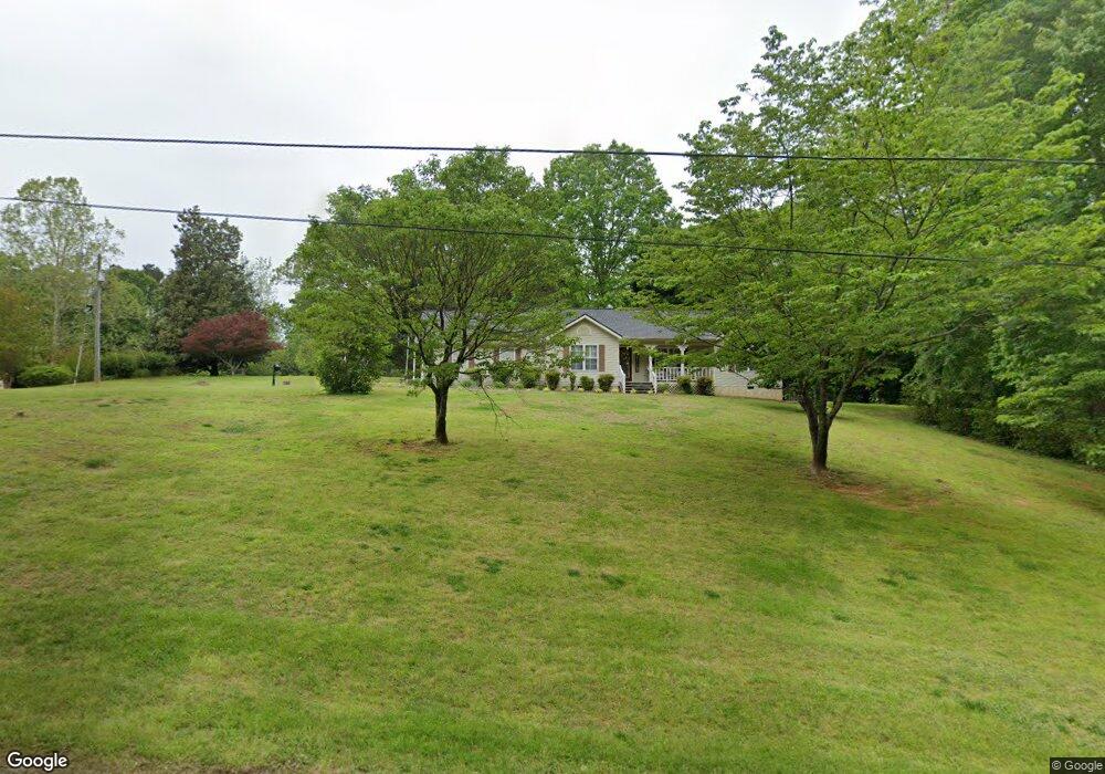
155 Cross Creek Rd Demorest, GA 30535
Estimated Value: $245,000 - $297,000
3
Beds
2
Baths
1,344
Sq Ft
$203/Sq Ft
Est. Value
About This Home
This home is located at 155 Cross Creek Rd, Demorest, GA 30535 and is currently estimated at $272,983, approximately $203 per square foot. 155 Cross Creek Rd is a home located in Habersham County with nearby schools including Demorest Elementary School, Wilbanks Middle School, and Habersham Success Academy.
Ownership History
Date
Name
Owned For
Owner Type
Purchase Details
Closed on
May 15, 2023
Sold by
Watkins Brenda C
Bought by
Jones Debi and Brenda Cash Watkins Irrev Tr
Current Estimated Value
Create a Home Valuation Report for This Property
The Home Valuation Report is an in-depth analysis detailing your home's value as well as a comparison with similar homes in the area
Home Values in the Area
Average Home Value in this Area
Purchase History
| Date | Buyer | Sale Price | Title Company |
|---|---|---|---|
| Jones Debi | -- | -- |
Source: Public Records
Tax History Compared to Growth
Tax History
| Year | Tax Paid | Tax Assessment Tax Assessment Total Assessment is a certain percentage of the fair market value that is determined by local assessors to be the total taxable value of land and additions on the property. | Land | Improvement |
|---|---|---|---|---|
| 2025 | $505 | $91,470 | $15,050 | $76,420 |
| 2024 | -- | $77,820 | $7,428 | $70,392 |
| 2023 | $288 | $65,580 | $7,428 | $58,152 |
| 2022 | $497 | $55,556 | $5,716 | $49,840 |
| 2021 | $464 | $50,140 | $5,716 | $44,424 |
| 2020 | $462 | $43,848 | $5,716 | $38,132 |
| 2019 | $462 | $43,848 | $5,716 | $38,132 |
| 2018 | $453 | $43,848 | $5,716 | $38,132 |
| 2017 | $392 | $40,400 | $5,716 | $34,684 |
| 2016 | $353 | $101,000 | $5,716 | $34,684 |
| 2015 | $341 | $101,000 | $5,716 | $34,684 |
| 2014 | $335 | $98,580 | $5,716 | $33,716 |
| 2013 | -- | $39,432 | $5,716 | $33,716 |
Source: Public Records
Map
Nearby Homes
- 243 Charlie Batson Dr
- 1040 Cannon Bridge Rd
- 1046 Cannon Bridge Rd
- 1052 Cannon Bridge Rd
- 1058 Cannon Bridge Rd
- Plan 1709 at Habersham Meadows
- Plan 1902 at Habersham Meadows
- Plan 2604 at Habersham Meadows
- Plan 1602-2 at Habersham Meadows
- Plan 3119 at Habersham Meadows
- Plan 2628 at Habersham Meadows
- Plan 2131 at Habersham Meadows
- Plan 2100 at Habersham Meadows
- Plan 2408 at Habersham Meadows
- Plan 3105 at Habersham Meadows
- Plan 2121 at Habersham Meadows
- Plan 1643 at Habersham Meadows
- Plan 2307 at Habersham Meadows
- 445 Spiral Hills Dr
- 536 Wauka Dr
- 561 Cap Fry Dr
- 0 Demorest Square Unit 7097808
- 109 Rockwind Way
- 201 Cross Creek Rd
- 0 Linbrook Dr
- 110 Rockwind Way
- 119 Rockwind Way
- 140 Linbrook Dr
- 0 Linwood Dr Unit LOT 14 3122717
- 0 Linwood Dr Unit 7568067
- 0 Linwood Dr Unit 7255417
- 0 Linwood Dr Unit 8734142
- 0 Linwood Dr Unit 8737849
- 0 Linwood Dr Unit 8775688
- 0 Linwood Dr Unit 8270193
- 0 Linwood Dr Unit 3249678
- 0 Linwood Dr Unit 3274258
- 0 Linwood Dr Unit 7179722
- 0 Linwood Dr Unit 7259598
- 0 Linwood Dr Unit 7464262