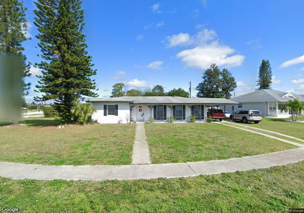
155 Dow Rd Port Charlotte, FL 33952
Estimated Value: $136,811 - $196,000
2
Beds
1
Bath
1,080
Sq Ft
$156/Sq Ft
Est. Value
About This Home
This home is located at 155 Dow Rd, Port Charlotte, FL 33952 and is currently estimated at $168,453, approximately $155 per square foot. 155 Dow Rd is a home located in Charlotte County with nearby schools including Peace River Elementary School, Port Charlotte Middle School, and Charlotte High School.
Ownership History
Date
Name
Owned For
Owner Type
Purchase Details
Closed on
Jul 8, 2021
Sold by
Velt Gene and Velt Geraldine K
Bought by
Oconnor Eugene and Oconnor Norma
Current Estimated Value
Purchase Details
Closed on
Nov 14, 1995
Sold by
Flotte Keith N
Bought by
Velt Gene and Velt Geraldine K
Home Financials for this Owner
Home Financials are based on the most recent Mortgage that was taken out on this home.
Original Mortgage
$14,900
Interest Rate
7.54%
Create a Home Valuation Report for This Property
The Home Valuation Report is an in-depth analysis detailing your home's value as well as a comparison with similar homes in the area
Home Values in the Area
Average Home Value in this Area
Purchase History
| Date | Buyer | Sale Price | Title Company |
|---|---|---|---|
| Oconnor Eugene | $115,000 | Gold Crest Title Services | |
| Velt Gene | $37,857 | -- |
Source: Public Records
Mortgage History
| Date | Status | Borrower | Loan Amount |
|---|---|---|---|
| Previous Owner | Velt Gene | $14,900 |
Source: Public Records
Tax History Compared to Growth
Tax History
| Year | Tax Paid | Tax Assessment Tax Assessment Total Assessment is a certain percentage of the fair market value that is determined by local assessors to be the total taxable value of land and additions on the property. | Land | Improvement |
|---|---|---|---|---|
| 2023 | $2,558 | $113,577 | $0 | $0 |
| 2022 | $2,335 | $103,252 | $13,600 | $89,652 |
| 2021 | $1,653 | $63,529 | $5,950 | $57,579 |
| 2020 | $1,537 | $57,310 | $4,505 | $52,805 |
| 2019 | $1,435 | $56,374 | $5,015 | $51,359 |
| 2018 | $1,285 | $54,013 | $5,015 | $48,998 |
| 2017 | $1,214 | $47,635 | $4,675 | $42,960 |
| 2016 | $1,127 | $34,260 | $0 | $0 |
| 2015 | $1,061 | $31,145 | $0 | $0 |
| 2014 | $978 | $28,314 | $0 | $0 |
Source: Public Records
Map
Nearby Homes
- 370 Weber Terrace
- 330 Weber Terrace
- 181 Duxbury Ave
- 520 Sharon Cir
- 4371 Conway Blvd
- 141 Duxbury Ave
- 471 Sharon Cir
- 4198 Gardner Dr
- 4213 Gardner Dr
- 551 Lindley Terrace
- 581 Lindley Terrace
- 3688 Brooklyn Ave
- 554 Lindley Terrace
- 400 Dalton Blvd
- 4238 Gardner Dr
- 4158 Tamiami Trail Unit S6
- 4158 Tamiami Trail Unit G1
- 4158 Tamiami Trail Unit 6
- 4158 Tamiami Trail Unit E5
- 4158 Tamiami Trail Unit U6