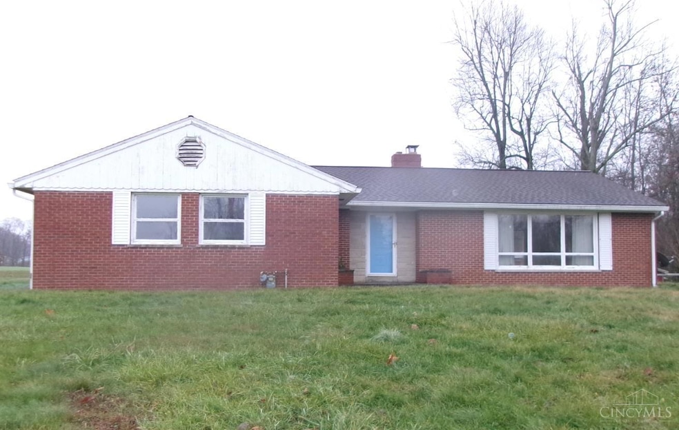

155 Free Soil Rd Georgetown, OH 45121
Estimated payment $1,419/month
Highlights
- 1.5 Acre Lot
- Ranch Style House
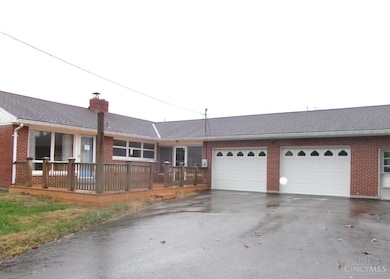
- 2 Car Attached Garage
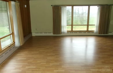
- Living Room with Fireplace
- No HOA
- Bathtub with Shower
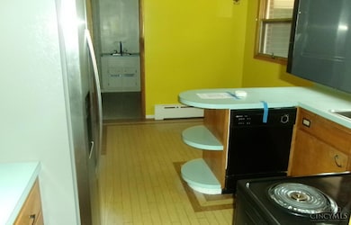
About This Home
Hud case #411-445905
Home Details
Home Type
- Single Family
Est. Annual Taxes
- $2,610
Year Built
- Built in 1961
Lot Details
- 1.5 Acre Lot
Parking
- 2 Car Attached Garage
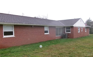
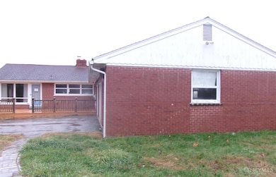
Home Design
- Ranch Style House
- Brick Exterior Construction
- Block Foundation
- Asbestos Shingle Roof
Interior Spaces
- 1,881 Sq Ft Home
- Insulated Windows
- Living Room with Fireplace
- Crawl Space
Bedrooms and Bathrooms
- 3 Bedrooms
- 2 Full Bathrooms
- Bathtub with Shower
Utilities
- Forced Air Heating and Cooling System
- Radiator
- Propane
Community Details
- No Home Owners Association
Map
Home Values in the Area
Average Home Value in this Area
Tax History
| Year | Tax Paid | Tax Assessment Tax Assessment Total Assessment is a certain percentage of the fair market value that is determined by local assessors to be the total taxable value of land and additions on the property. | Land | Improvement |
|---|---|---|---|---|
| 2024 | $2,610 | $73,560 | $11,500 | $62,060 |
| 2023 | $2,611 | $56,620 | $9,850 | $46,770 |
| 2022 | $2,188 | $56,620 | $9,850 | $46,770 |
| 2021 | $2,172 | $56,710 | $9,940 | $46,770 |
| 2020 | $1,922 | $47,260 | $8,280 | $38,980 |
| 2019 | $1,908 | $47,260 | $8,280 | $38,980 |
| 2018 | $1,890 | $47,260 | $8,280 | $38,980 |
| 2017 | $1,435 | $42,580 | $8,340 | $34,240 |
| 2016 | $1,434 | $42,580 | $8,340 | $34,240 |
| 2015 | $1,487 | $42,580 | $8,340 | $34,240 |
| 2014 | $1,487 | $41,820 | $7,580 | $34,240 |
| 2013 | $1,483 | $41,820 | $7,580 | $34,240 |
Property History
| Date | Event | Price | List to Sale | Price per Sq Ft |
|---|---|---|---|---|
| 03/23/2026 03/23/26 | Pending | -- | -- | -- |
| 03/13/2026 03/13/26 | For Sale | $225,000 | 0.0% | $120 / Sq Ft |
| 01/14/2026 01/14/26 | Pending | -- | -- | -- |
| 11/26/2025 11/26/25 | For Sale | $225,000 | -- | $120 / Sq Ft |
Purchase History
| Date | Type | Sale Price | Title Company |
|---|---|---|---|
| Special Warranty Deed | -- | None Listed On Document | |
| Special Warranty Deed | -- | None Listed On Document | |
| Warranty Deed | -- | None Available | |
| Certificate Of Transfer | -- | None Available | |
| Deed | $120,000 | -- |
Source: MLS of Greater Cincinnati (CincyMLS)
MLS Number: 1863099
APN: 33-061908-0000
Disclaimer: Certain information contained herein is derived from information provided by parties other than Homes.com. All information provided is deemed reliable, but is not guaranteed to be accurate and should be independently verified.
![]() The data relating to real estate for sale on this website comes in part from the Broker Reciprocity programs of the MLS of Greater Cincinnati, Inc.. Those listings held by brokerage firms other than Ten-X are marked with the Broker Reciprocity logo and house icon. The properties displayed may not be all of the properties available through Broker Reciprocity.
The data relating to real estate for sale on this website comes in part from the Broker Reciprocity programs of the MLS of Greater Cincinnati, Inc.. Those listings held by brokerage firms other than Ten-X are marked with the Broker Reciprocity logo and house icon. The properties displayed may not be all of the properties available through Broker Reciprocity.
IDX information is provided exclusively for personal, non-commercial use, and may not be used for any purpose other than to identify prospective properties consumers may be interested in purchasing.
Information is deemed reliable but not guaranteed.
Ten-X does not display the entire Cincinnati MLS Broker Reciprocity™ database on this web site. The listings of some real estate brokerage firms have been excluded.
Copyright 2026, MLS of Greater Cincinnati, Inc. All rights reserved
- 20 Heritage Hill Dr
- 90 Douglas Cir
- 175 Douglas Cir
- 505 S Water St
- 666 E State St
- 708 E State St
- 510 W State St
- 406 E North St
- 0 St Rt 221 & Footbridge Unit 1826509
- 200 N High St
- 405 N Main St
- 60 New St
- 399 Elmwood Ct
- 427 Kenwood Ave
- 1 N Kenwood Ave
- 2 N Kenwood Ave
- 7029 Free Soil Rd
- 3486 Barnes Rd
- 3465 Loudon Rd
- 0 Barnes Rd Unit 1851215

Ask me questions while you tour the home.