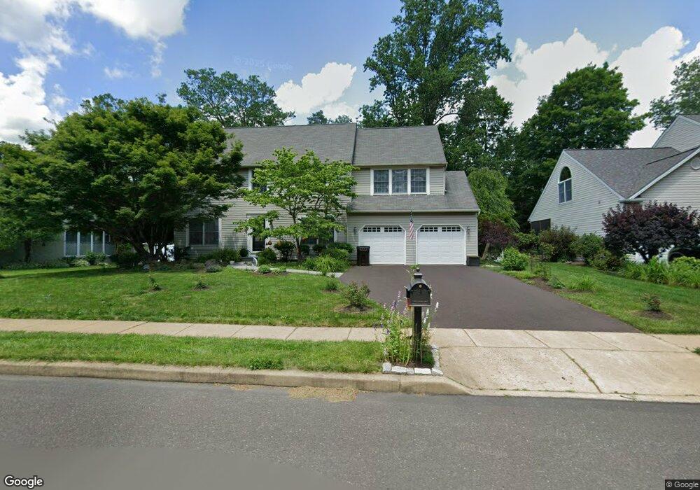
155 Hart Ave Doylestown, PA 18901
Estimated Value: $868,000 - $991,766
4
Beds
3
Baths
2,914
Sq Ft
$316/Sq Ft
Est. Value
About This Home
This home is located at 155 Hart Ave, Doylestown, PA 18901 and is currently estimated at $921,692, approximately $316 per square foot. 155 Hart Ave is a home located in Bucks County with nearby schools including Linden El School, Lenape Middle School, and Central Bucks High School-West.
Ownership History
Date
Name
Owned For
Owner Type
Purchase Details
Closed on
Aug 6, 2010
Sold by
Bradford Ellen D
Bought by
Robinson Elizabeth K
Current Estimated Value
Purchase Details
Closed on
Sep 10, 1999
Sold by
Bradford Kenneth G and Bradford Ellen D
Bought by
Bradford Ellen D
Purchase Details
Closed on
Dec 19, 1996
Sold by
Forsberg Julie
Bought by
Bradford Kenneth G and Bradford Ellen D
Home Financials for this Owner
Home Financials are based on the most recent Mortgage that was taken out on this home.
Original Mortgage
$132,000
Interest Rate
6.9%
Create a Home Valuation Report for This Property
The Home Valuation Report is an in-depth analysis detailing your home's value as well as a comparison with similar homes in the area
Home Values in the Area
Average Home Value in this Area
Purchase History
| Date | Buyer | Sale Price | Title Company |
|---|---|---|---|
| Robinson Elizabeth K | $442,500 | None Available | |
| Bradford Ellen D | -- | -- | |
| Bradford Kenneth G | $232,000 | Lawyers Title Insurance Corp |
Source: Public Records
Mortgage History
| Date | Status | Borrower | Loan Amount |
|---|---|---|---|
| Previous Owner | Bradford Kenneth G | $132,000 |
Source: Public Records
Tax History Compared to Growth
Tax History
| Year | Tax Paid | Tax Assessment Tax Assessment Total Assessment is a certain percentage of the fair market value that is determined by local assessors to be the total taxable value of land and additions on the property. | Land | Improvement |
|---|---|---|---|---|
| 2025 | $8,013 | $45,280 | $8,240 | $37,040 |
| 2024 | $8,013 | $45,280 | $8,240 | $37,040 |
| 2023 | $7,641 | $45,280 | $8,240 | $37,040 |
| 2022 | $7,555 | $45,280 | $8,240 | $37,040 |
| 2021 | $7,400 | $45,280 | $8,240 | $37,040 |
| 2020 | $7,366 | $45,280 | $8,240 | $37,040 |
| 2019 | $7,287 | $45,280 | $8,240 | $37,040 |
| 2018 | $7,264 | $45,280 | $8,240 | $37,040 |
| 2017 | $7,207 | $45,280 | $8,240 | $37,040 |
| 2016 | $7,162 | $45,280 | $8,240 | $37,040 |
| 2015 | -- | $45,280 | $8,240 | $37,040 |
| 2014 | -- | $45,280 | $8,240 | $37,040 |
Source: Public Records
Map
Nearby Homes
- 195 Lafayette St
- 3 Steeplechase Dr
- 272 Fox Chase Ln
- 403 S Main St Unit S201
- 9 Mill Creek Dr
- 89 Homestead Dr
- 236 Green St
- 37 N Clinton St
- 78 Tower Hill Rd
- 130 N Clinton St
- 110 E Ashland St
- 114 Progress Dr
- 69 E Oakland Ave
- 32 Hibiscus Ct Unit 32
- 20 E Court St
- 1 Barnes Ct
- 155 E Oakland Ave
- 2320 Turk Rd
- 146 E Court St
- 146 N Church St