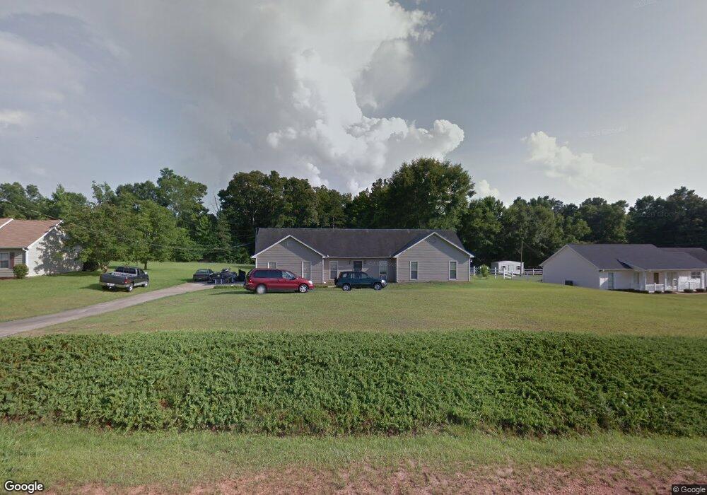
155 Hawthorne Cir Lagrange, GA 30240
Estimated Value: $216,939 - $247,000
3
Beds
2
Baths
1,455
Sq Ft
$159/Sq Ft
Est. Value
About This Home
This home is located at 155 Hawthorne Cir, Lagrange, GA 30240 and is currently estimated at $231,235, approximately $158 per square foot. 155 Hawthorne Cir is a home located in Troup County with nearby schools including Long Cane Elementary School, Berta Weathersbee Elementary School, and Whitesville Road Elementary School.
Ownership History
Date
Name
Owned For
Owner Type
Purchase Details
Closed on
Mar 30, 1990
Sold by
Wells Kelly A and Wells Cathy A
Bought by
Anderson James Kelly
Current Estimated Value
Purchase Details
Closed on
Apr 7, 1989
Sold by
Dan-Ric Inc
Bought by
Wells Kelly A and Wells Cathy A
Purchase Details
Closed on
Sep 1, 1986
Sold by
Dan-Ric Inc
Bought by
Dan-Ric Inc
Create a Home Valuation Report for This Property
The Home Valuation Report is an in-depth analysis detailing your home's value as well as a comparison with similar homes in the area
Home Values in the Area
Average Home Value in this Area
Purchase History
| Date | Buyer | Sale Price | Title Company |
|---|---|---|---|
| Anderson James Kelly | -- | -- | |
| Wells Kelly A | $73,500 | -- | |
| Dan-Ric Inc | $87,400 | -- |
Source: Public Records
Tax History Compared to Growth
Tax History
| Year | Tax Paid | Tax Assessment Tax Assessment Total Assessment is a certain percentage of the fair market value that is determined by local assessors to be the total taxable value of land and additions on the property. | Land | Improvement |
|---|---|---|---|---|
| 2024 | $1,709 | $64,640 | $14,000 | $50,640 |
| 2023 | $1,685 | $63,760 | $10,000 | $53,760 |
| 2022 | $1,577 | $58,480 | $8,000 | $50,480 |
| 2021 | $1,161 | $40,480 | $6,000 | $34,480 |
| 2020 | $1,161 | $40,480 | $6,000 | $34,480 |
| 2019 | $1,217 | $40,360 | $6,000 | $34,360 |
| 2018 | $1,165 | $38,640 | $6,000 | $32,640 |
| 2017 | $1,165 | $38,640 | $6,000 | $32,640 |
| 2016 | $1,010 | $33,472 | $7,200 | $26,272 |
| 2015 | $1,011 | $33,472 | $7,200 | $26,272 |
| 2014 | $971 | $32,090 | $7,200 | $24,890 |
| 2013 | -- | $33,592 | $7,200 | $26,392 |
Source: Public Records
Map
Nearby Homes
- 103 Hawthorne Cir
- 105 Hawthorne Cir
- 110 Hawthorne Cir
- 100 Huntcliff Ct
- 124 Foxdale Dr
- 190 Hill Rd
- 141 Plymouth Dr
- 808 S Fling Rd
- 509 Connie Dr
- 102 Franklin Place
- 119 Plymouth Dr
- 135 Planters Ridge Dr
- 37 Overbrook Dr
- 0 Bradfield Dr Unit 10568803
- 22 Freeman Rd
- 101 Ivy Springs Dr
- 61 Freeman Rd
- 0 Deming St Unit 10550189
- 474 Newton Rd
- 40 River Point Dr
- 157 Hawthorne Cir
- 153 Hawthorne Cir
- 0 Hawthorne Cir Unit 7282470
- 0 Hawthorne Cir Unit 8727012
- 0 Hawthorne Cir Unit 8660766
- 0 Hawthorne Cir Unit 8587897
- 0 Hawthorne Cir Unit 8453268
- 0 Hawthorne Cir Unit 8170922
- 0 Hawthorne Cir Unit 8170789
- 0 Hawthorne Cir Unit 8098892
- 0 Hawthorne Cir Unit 7636596
- 0 Hawthorne Cir Unit 7570268
- 0 Hawthorne Cir Unit 8130868
- 0 Hawthorne Cir Unit 8651733
- 0 Hawthorne Cir Unit 8594081
- 0 Hawthorne Cir Unit 7320005
- 0 Hawthorne Cir Unit 7151469
- 0 Hawthorne Cir Unit 8997139
- 0 Hawthorne Cir Unit 8992503
- 0 Hawthorne Cir Unit 3008409