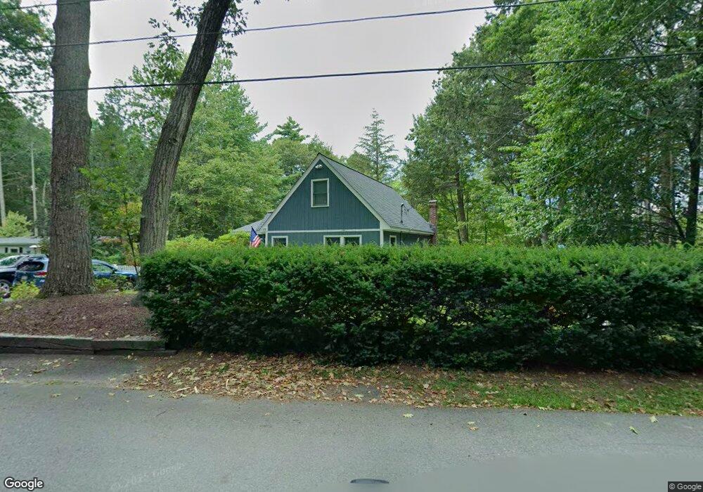
155 Hemlock Dr Lunenburg, MA 01462
Estimated Value: $618,000 - $684,000
3
Beds
2
Baths
1,504
Sq Ft
$427/Sq Ft
Est. Value
About This Home
This home is located at 155 Hemlock Dr, Lunenburg, MA 01462 and is currently estimated at $642,296, approximately $427 per square foot. 155 Hemlock Dr is a home located in Worcester County with nearby schools including Lunenburg Primary School and Lunenburg High School.
Ownership History
Date
Name
Owned For
Owner Type
Purchase Details
Closed on
Nov 18, 2025
Sold by
Ciccone Michael R and Ciccone Catherine
Bought by
Ciccone Castle T and Ciccone C
Current Estimated Value
Purchase Details
Closed on
Jun 24, 1985
Bought by
Ciccone Michael R and Page Catherine
Create a Home Valuation Report for This Property
The Home Valuation Report is an in-depth analysis detailing your home's value as well as a comparison with similar homes in the area
Home Values in the Area
Average Home Value in this Area
Purchase History
| Date | Buyer | Sale Price | Title Company |
|---|---|---|---|
| Ciccone Castle T | -- | -- | |
| Ciccone Michael R | $72,500 | -- |
Source: Public Records
Mortgage History
| Date | Status | Borrower | Loan Amount |
|---|---|---|---|
| Previous Owner | Ciccone Michael R | $60,000 | |
| Previous Owner | Ciccone Michael R | $50,000 | |
| Previous Owner | Ciccone Michael R | $20,000 |
Source: Public Records
Tax History
| Year | Tax Paid | Tax Assessment Tax Assessment Total Assessment is a certain percentage of the fair market value that is determined by local assessors to be the total taxable value of land and additions on the property. | Land | Improvement |
|---|---|---|---|---|
| 2025 | $7,996 | $556,800 | $298,500 | $258,300 |
| 2024 | $7,708 | $546,700 | $292,700 | $254,000 |
| 2023 | $10,880 | $744,200 | $511,800 | $232,400 |
| 2022 | $6,692 | $389,300 | $217,500 | $171,800 |
| 2020 | $6,643 | $366,600 | $217,600 | $149,000 |
| 2019 | $6,347 | $339,800 | $197,800 | $142,000 |
| 2018 | $6,198 | $314,600 | $188,500 | $126,100 |
| 2017 | $5,984 | $299,500 | $181,700 | $117,800 |
| 2016 | $5,606 | $285,900 | $170,400 | $115,500 |
| 2015 | $4,910 | $268,000 | $154,900 | $113,100 |
Source: Public Records
Map
Nearby Homes
- 91 Valley Rd
- 36 Gilchrest St
- 114 Chestnut St
- 63 Holman St
- 35 Leominster Rd
- 319 Highland St
- 711 Massachusetts Ave Unit 2
- 189 Electric Unit A
- 1790 Massachusetts Ave Unit 25
- 225 Leominster Rd
- 4 Koski Way
- 367 Mulpus Rd
- 756 Northfield Rd
- 00 Tyler Rd
- 12 Cortland Cir Unit 12
- 222 W Townsend Rd
- 2 Gabes Place
- 92 Prospect St
- 50 Old Farm Rd
- 12 W Townsend Rd
- 163 Hemlock Dr
- 147 Hemlock Dr
- 160 Hemlock Dr
- 148 Hemlock Dr
- 141 Hemlock Dr
- 169 Hemlock Dr
- 144 Hemlock Dr
- 2 Pine Acres Rd
- 13 Birch Island Way
- 14 Pine Acres Rd
- 173 Hemlock Dr
- 132 Hemlock Dr
- 8 Pine Acres Rd
- 179 Hemlock Dr
- 180 Hemlock Dr
- 20 Pine Acres Rd
- 20 Pine Acres Rd Unit SF
- 5 Pine Acres Rd
- 21 Birch Island Way
- 20 Birch Island Way
Your Personal Tour Guide
Ask me questions while you tour the home.