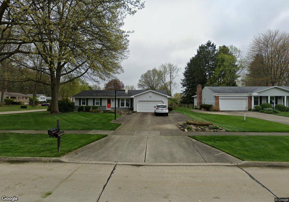
155 High Point Cir Tallmadge, OH 44278
Estimated Value: $105,000 - $283,000
3
Beds
2
Baths
1,500
Sq Ft
$154/Sq Ft
Est. Value
About This Home
This home is located at 155 High Point Cir, Tallmadge, OH 44278 and is currently estimated at $231,643, approximately $154 per square foot. 155 High Point Cir is a home located in Summit County with nearby schools including Tallmadge Middle School, Tallmadge High School, and Steel Academy.
Ownership History
Date
Name
Owned For
Owner Type
Purchase Details
Closed on
Sep 27, 2024
Sold by
Bohannon Mark C
Bought by
Bohannon Michael D
Current Estimated Value
Home Financials for this Owner
Home Financials are based on the most recent Mortgage that was taken out on this home.
Original Mortgage
$98,500
Outstanding Balance
$97,492
Interest Rate
6.49%
Mortgage Type
Seller Take Back
Estimated Equity
$134,151
Purchase Details
Closed on
Apr 12, 2003
Sold by
Bohannon J Dale S and Bohannon S Evelyn
Bought by
Bohannon J Dale and Bohannon Evelyn S
Create a Home Valuation Report for This Property
The Home Valuation Report is an in-depth analysis detailing your home's value as well as a comparison with similar homes in the area
Home Values in the Area
Average Home Value in this Area
Purchase History
| Date | Buyer | Sale Price | Title Company |
|---|---|---|---|
| Bohannon Michael D | $98,500 | None Listed On Document | |
| Bohannon J Dale | -- | -- |
Source: Public Records
Mortgage History
| Date | Status | Borrower | Loan Amount |
|---|---|---|---|
| Open | Bohannon Michael D | $98,500 |
Source: Public Records
Tax History Compared to Growth
Tax History
| Year | Tax Paid | Tax Assessment Tax Assessment Total Assessment is a certain percentage of the fair market value that is determined by local assessors to be the total taxable value of land and additions on the property. | Land | Improvement |
|---|---|---|---|---|
| 2025 | $2,978 | $68,874 | $14,032 | $54,842 |
| 2024 | $2,978 | $68,874 | $14,032 | $54,842 |
| 2023 | $2,978 | $68,874 | $14,032 | $54,842 |
| 2022 | $2,807 | $54,758 | $11,134 | $43,624 |
| 2021 | $2,819 | $54,758 | $11,134 | $43,624 |
| 2020 | $2,797 | $54,750 | $11,130 | $43,620 |
| 2019 | $2,859 | $50,790 | $11,750 | $39,040 |
| 2018 | $2,519 | $50,790 | $11,750 | $39,040 |
| 2017 | $2,272 | $50,790 | $11,750 | $39,040 |
| 2016 | $2,451 | $46,340 | $11,750 | $34,590 |
| 2015 | $2,272 | $46,340 | $11,750 | $34,590 |
| 2014 | $2,257 | $46,340 | $11,750 | $34,590 |
| 2013 | $2,225 | $46,480 | $11,750 | $34,730 |
Source: Public Records
Map
Nearby Homes
- 213 Green Hill Dr
- 353 Southeast Ave
- 331 Southeast Ave
- 185 Reserve Dr
- 313 Southeast Ave
- 288 S Munroe Rd
- 243 S Munroe Rd
- 130 Strecker Dr
- 786 Southeast Ave
- 810 Norton Dr
- 523 S Munroe Rd
- 0 East Ave
- 821 Olde Orchard Dr
- 549 S Munroe Rd
- 206 Fawnwood Dr
- 159 Waterford Way Unit 44
- 500 Dottie Ct Unit 109
- 2333 Eastwood Ave
- 2330 Eastwood Ave
- 689 Alaho St
- 167 High Point Cir
- 230 Green Hill Dr
- 202 Green Hill Dr
- 221 Green Hill Dr
- 175 High Point Cir
- 238 Green Hill Dr
- 231 Green Hill Dr
- 203 Green Hill Dr
- 201 Orchard Dr
- 192 Green Hill Dr
- 239 Green Hill Dr
- 191 High Point Cir
- 248 Green Hill Dr
- 195 Green Hill Dr
- 441 Green Meadow Dr
- 191 Orchard Dr
- 435 Green Meadow Dr
- 445 Green Meadow Dr
- 205 High Point Cir
- 249 Green Hill Dr