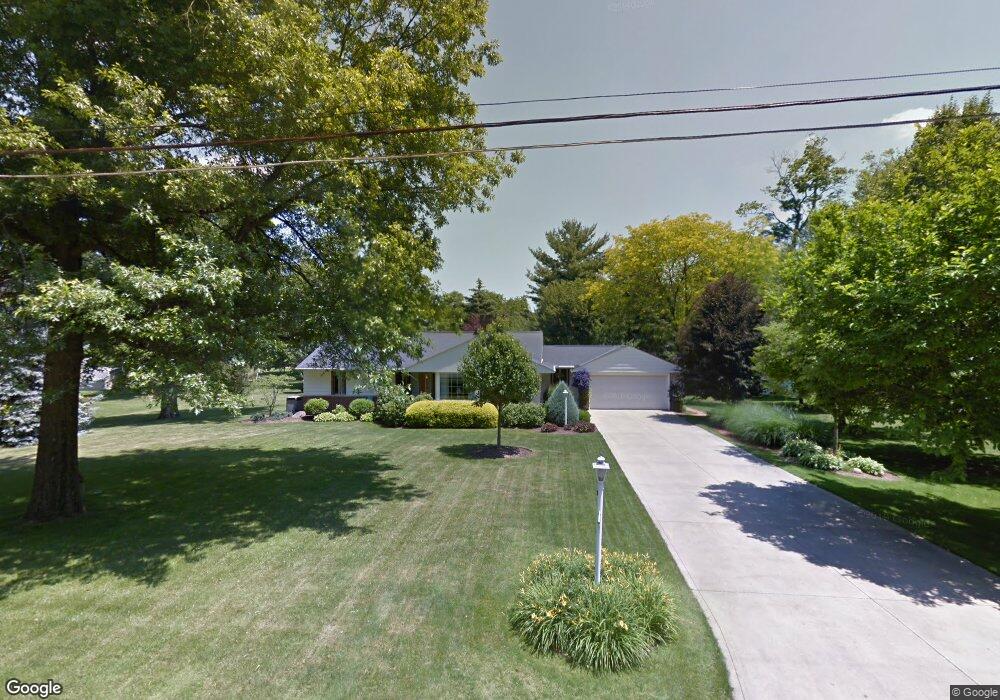
155 Maple Ln Ontario, OH 44906
Estimated Value: $210,001 - $249,000
3
Beds
2
Baths
1,856
Sq Ft
$123/Sq Ft
Est. Value
About This Home
This home is located at 155 Maple Ln, Ontario, OH 44906 and is currently estimated at $229,000, approximately $123 per square foot. 155 Maple Ln is a home located in Richland County with nearby schools including Stingel Elementary School, Ontario Middle School, and Ontario High School.
Ownership History
Date
Name
Owned For
Owner Type
Purchase Details
Closed on
Nov 11, 2022
Sold by
Lewis Ronald A and Lewis Lorri L
Bought by
R & I Properties And Maintenance Llc
Current Estimated Value
Purchase Details
Closed on
Jul 23, 2021
Sold by
Lewis Ronald Allen
Bought by
Lewis Ronald A and Lewis Lorri L
Purchase Details
Closed on
Jun 7, 2021
Sold by
Lawrence Kimberle Gene and Robert E Weaver Living Trust
Bought by
Lewis Ronald Allen
Purchase Details
Closed on
May 26, 2016
Sold by
Weaver Robert E and Beverly J Weaver Living Trust
Bought by
Weaver Robert E and Robert E Weaver Living Trust
Create a Home Valuation Report for This Property
The Home Valuation Report is an in-depth analysis detailing your home's value as well as a comparison with similar homes in the area
Home Values in the Area
Average Home Value in this Area
Purchase History
| Date | Buyer | Sale Price | Title Company |
|---|---|---|---|
| R & I Properties And Maintenance Llc | $125 | -- | |
| Lewis Ronald A | -- | None Available | |
| Lewis Ronald Allen | $105,000 | None Available | |
| Weaver Robert E | -- | None Available |
Source: Public Records
Tax History Compared to Growth
Tax History
| Year | Tax Paid | Tax Assessment Tax Assessment Total Assessment is a certain percentage of the fair market value that is determined by local assessors to be the total taxable value of land and additions on the property. | Land | Improvement |
|---|---|---|---|---|
| 2024 | $3,298 | $64,750 | $17,510 | $47,240 |
| 2023 | $3,298 | $64,750 | $17,510 | $47,240 |
| 2022 | $2,777 | $47,950 | $13,920 | $34,030 |
| 2021 | $2,782 | $47,950 | $13,920 | $34,030 |
| 2020 | $2,969 | $47,950 | $13,920 | $34,030 |
| 2019 | $2,782 | $40,650 | $11,800 | $28,850 |
| 2018 | $2,362 | $40,650 | $11,800 | $28,850 |
| 2017 | $1,840 | $40,650 | $11,800 | $28,850 |
| 2016 | $1,855 | $41,010 | $14,360 | $26,650 |
| 2015 | $1,854 | $41,010 | $14,360 | $26,650 |
| 2014 | $1,857 | $41,010 | $14,360 | $26,650 |
| 2012 | $844 | $41,020 | $15,120 | $25,900 |
Source: Public Records
Map
Nearby Homes
- 175 Maple Ln
- 99 Scotland Blvd
- 405 Maple Ln Unit 405 & 407
- 1996 Park Ave W
- 1431 Silver Ln
- 2585 Deerfield Ln
- 0 Millsboro Rd Unit 9067349
- 0 Millsboro Rd Unit 9066844
- 147 Wimbledon Dr
- 204 Lasalle St
- 2281 Park Ave W
- 1496 W 4th St
- 143 Buckeye Ave
- 142 Grasmere Ave
- 720 Lindaire Ln E
- 2000 Matthes Dr
- 230 Clare Rd
- 1157 Deer Run Rd
- 0 Deer Run Rd
- 125 Hilltop Rd
- 145 Maple Ln
- 154 Woodbine Dr
- 164 Woodbine Dr
- 144 Woodbine Dr
- 131 Maple Ln
- 150 Maple Ln
- 174 Woodbine Dr
- 170 Maple Ln
- 125 Maple Ln
- 140 Maple Ln
- 126 Woodbine Dr
- 185 Maple Ln Unit 187
- 184 Woodbine Dr
- 130 Maple Ln
- 116 Woodbine Dr
- 180 Maple Ln
- 105 Maple Ln
- 157 Woodbine Dr
- 145 Woodbine Dr
- 157 Scotland Blvd Unit 161