155 Riverside Dr Wrentham, MA 02093
Estimated Value: $1,191,661 - $1,456,000
5
Beds
5
Baths
4,190
Sq Ft
$311/Sq Ft
Est. Value
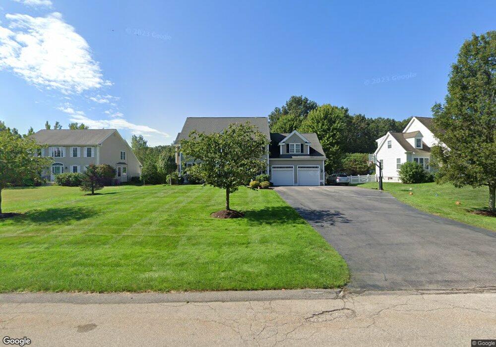
About This Home
This home is located at 155 Riverside Dr, Wrentham, MA 02093 and is currently estimated at $1,301,915, approximately $310 per square foot. 155 Riverside Dr is a home located in Norfolk County with nearby schools including Delaney Elementary School and Charles E Roderick.
Ownership History
Date
Name
Owned For
Owner Type
Purchase Details
Closed on
Apr 12, 2002
Sold by
Diplacido Dev
Bought by
Murphy Craig P and Murphy Tracey B
Current Estimated Value
Home Financials for this Owner
Home Financials are based on the most recent Mortgage that was taken out on this home.
Original Mortgage
$365,400
Outstanding Balance
$150,273
Interest Rate
6.84%
Mortgage Type
Purchase Money Mortgage
Estimated Equity
$1,151,642
Create a Home Valuation Report for This Property
The Home Valuation Report is an in-depth analysis detailing your home's value as well as a comparison with similar homes in the area
Purchase History
| Date | Buyer | Sale Price | Title Company |
|---|---|---|---|
| Murphy Craig P | $456,780 | -- |
Source: Public Records
Mortgage History
| Date | Status | Borrower | Loan Amount |
|---|---|---|---|
| Open | Murphy Craig P | $365,400 |
Source: Public Records
Tax History
| Year | Tax Paid | Tax Assessment Tax Assessment Total Assessment is a certain percentage of the fair market value that is determined by local assessors to be the total taxable value of land and additions on the property. | Land | Improvement |
|---|---|---|---|---|
| 2025 | $12,557 | $1,083,400 | $319,200 | $764,200 |
| 2024 | $11,867 | $988,900 | $319,200 | $669,700 |
| 2023 | $11,942 | $946,300 | $290,100 | $656,200 |
| 2022 | $11,574 | $846,700 | $263,800 | $582,900 |
| 2021 | $11,277 | $801,500 | $263,800 | $537,700 |
| 2020 | $11,433 | $802,300 | $216,800 | $585,500 |
| 2019 | $9,837 | $696,700 | $216,800 | $479,900 |
| 2018 | $9,035 | $634,500 | $217,200 | $417,300 |
| 2017 | $8,865 | $622,100 | $213,000 | $409,100 |
| 2016 | $8,682 | $608,000 | $206,800 | $401,200 |
| 2015 | $7,751 | $517,400 | $198,800 | $318,600 |
| 2014 | $7,624 | $498,000 | $191,200 | $306,800 |
Source: Public Records
Map
Nearby Homes
- 10 Earle Stewart Ln Unit Lot 5
- 12 Earle Stewart Ln
- 2 Earle Stewart Ln
- 3 Earle Stewart Ln
- 440 Chestnut St
- 500 Franklin St
- 10 Nature View Dr
- 15 Nature View Dr
- 613 West St
- 1222 South St
- 955 Summer St
- 287 Park St
- 50 Reed Fulton Ave Unit Lot 61
- 0 Fall Ln
- 0 Berry St
- 20 Field Cir
- 18 Huntington Ave
- 19 Chestnut Lot 0
- 75 Jordan Rd
- 3 Oak View Terrace Unit 3
- 145 Riverside Dr
- 165 Riverside Dr
- 175 Riverside Dr
- 135 Riverside Dr
- 124 Riverside Dr
- 120 Riverside Dr
- 125 Riverside Dr
- 185 Riverside Dr
- 5 Pokanoket Path
- 5 Weetamoo Way
- 115 Riverside Dr
- 130 Riverside Dr
- 15 Weetamoo Way
- 195 Riverside Dr
- 10 Weetamoo Way
- 15 Pokanoket Path
- 30 Pokanoket Path
- 25 Pokanoket Path
- 105 Riverside Dr
- 25 Weetamoo Way
Your Personal Tour Guide
Ask me questions while you tour the home.