Estimated Value: $145,170 - $177,000
--
Bed
1
Bath
1,200
Sq Ft
$133/Sq Ft
Est. Value
About This Home
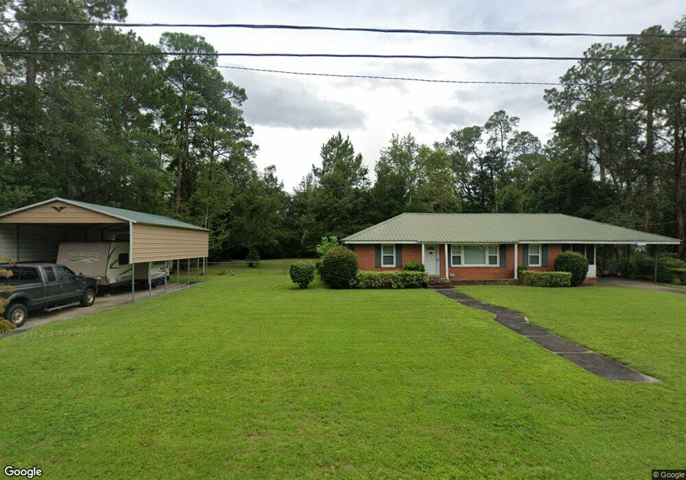
This home is located at 155 S 9th St, Jesup, GA 31545 and is currently estimated at $159,043, approximately $132 per square foot. 155 S 9th St is a home located in Wayne County with nearby schools including Bacon Elementary School, Martha Puckett Middle School, and Wayne County High School.
Ownership History
Date
Name
Owned For
Owner Type
Purchase Details
Closed on
Apr 10, 2007
Sold by
Fulford Lisa C
Bought by
Linder Franklin M and Linder Kristin L
Current Estimated Value
Home Financials for this Owner
Home Financials are based on the most recent Mortgage that was taken out on this home.
Original Mortgage
$86,000
Outstanding Balance
$51,855
Interest Rate
6.1%
Mortgage Type
New Conventional
Estimated Equity
$107,188
Purchase Details
Closed on
Jul 1, 1997
Bought by
Fulford Lisa C
Purchase Details
Closed on
Feb 1, 1994
Purchase Details
Closed on
Feb 1, 1962
Create a Home Valuation Report for This Property
The Home Valuation Report is an in-depth analysis detailing your home's value as well as a comparison with similar homes in the area
Home Values in the Area
Average Home Value in this Area
Purchase History
| Date | Buyer | Sale Price | Title Company |
|---|---|---|---|
| Linder Franklin M | $86,000 | -- | |
| Fulford Lisa C | $60,000 | -- | |
| -- | $40,000 | -- | |
| -- | -- | -- |
Source: Public Records
Mortgage History
| Date | Status | Borrower | Loan Amount |
|---|---|---|---|
| Open | Linder Franklin M | $86,000 |
Source: Public Records
Tax History Compared to Growth
Tax History
| Year | Tax Paid | Tax Assessment Tax Assessment Total Assessment is a certain percentage of the fair market value that is determined by local assessors to be the total taxable value of land and additions on the property. | Land | Improvement |
|---|---|---|---|---|
| 2024 | $1,193 | $43,350 | $3,558 | $39,792 |
| 2023 | $1,365 | $38,597 | $3,537 | $35,060 |
| 2022 | $626 | $24,869 | $3,537 | $21,332 |
| 2021 | $846 | $30,103 | $3,537 | $26,566 |
| 2020 | $876 | $30,103 | $3,537 | $26,566 |
| 2019 | $902 | $30,103 | $3,537 | $26,566 |
| 2018 | $902 | $30,103 | $3,537 | $26,566 |
| 2017 | $776 | $30,103 | $3,537 | $26,566 |
| 2016 | $751 | $30,103 | $3,537 | $26,566 |
| 2014 | $753 | $30,103 | $3,537 | $26,566 |
| 2013 | -- | $30,102 | $3,537 | $26,565 |
Source: Public Records
Map
Nearby Homes
- 173 S 9th St
- 163 S 9th St
- 124 9th St
- 1065 W Orange St
- 148 Persimmon St
- 119 Black St
- 162 Persimmon St
- 1117 W Orange St
- 1063 W Orange St
- 192 Black St
- 147 Black St
- 1061 W Orange St
- 1061 W Orange St Unit n
- 1137 W Orange St
- 122 S 9th St
- 105 Dreamland St
- 138 Jones St
- 185 S 9th St
- 1124 W Orange St
- 194 Black St