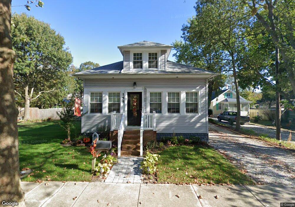
155 W Johnson Ave Somers Point, NJ 08244
Estimated Value: $335,000 - $479,000
--
Bed
--
Bath
1,108
Sq Ft
$353/Sq Ft
Est. Value
About This Home
This home is located at 155 W Johnson Ave, Somers Point, NJ 08244 and is currently estimated at $390,654, approximately $352 per square foot. 155 W Johnson Ave is a home located in Atlantic County with nearby schools including Mainland Regional High School, ChARTer TECH High School for the Performing Arts, and Saint Joseph Regional School.
Ownership History
Date
Name
Owned For
Owner Type
Purchase Details
Closed on
Dec 14, 2007
Sold by
Baldwin Iii Francis J and Baldwin Renee D
Bought by
Capasso Anthony and Capasso Jessica
Current Estimated Value
Home Financials for this Owner
Home Financials are based on the most recent Mortgage that was taken out on this home.
Original Mortgage
$222,400
Interest Rate
6.18%
Mortgage Type
Purchase Money Mortgage
Purchase Details
Closed on
Feb 5, 2007
Sold by
Groen & Mincer Llc
Bought by
Baldwin Francis and Baldwin Renee
Purchase Details
Closed on
Mar 23, 1989
Sold by
Kempjack Sec Of H U D
Bought by
Floyd Theodore A
Purchase Details
Closed on
Sep 8, 1988
Sold by
Floriani Mario F Sheriff
Bought by
Housing & Urban Dev The Sec Of
Create a Home Valuation Report for This Property
The Home Valuation Report is an in-depth analysis detailing your home's value as well as a comparison with similar homes in the area
Home Values in the Area
Average Home Value in this Area
Purchase History
| Date | Buyer | Sale Price | Title Company |
|---|---|---|---|
| Capasso Anthony | $222,400 | Township Title Agency Llc | |
| Baldwin Francis | $160,000 | -- | |
| Floyd Theodore A | $75,000 | -- | |
| Housing & Urban Dev The Sec Of | $100 | -- |
Source: Public Records
Mortgage History
| Date | Status | Borrower | Loan Amount |
|---|---|---|---|
| Previous Owner | Capasso Anthony | $222,400 |
Source: Public Records
Tax History Compared to Growth
Tax History
| Year | Tax Paid | Tax Assessment Tax Assessment Total Assessment is a certain percentage of the fair market value that is determined by local assessors to be the total taxable value of land and additions on the property. | Land | Improvement |
|---|---|---|---|---|
| 2025 | $6,701 | $187,400 | $69,300 | $118,100 |
| 2024 | $6,701 | $187,400 | $69,300 | $118,100 |
| 2023 | $6,261 | $187,400 | $69,300 | $118,100 |
| 2022 | $6,261 | $187,400 | $69,300 | $118,100 |
| 2021 | $6,167 | $187,400 | $69,300 | $118,100 |
| 2020 | $6,042 | $187,400 | $69,300 | $118,100 |
| 2019 | $5,871 | $187,400 | $69,300 | $118,100 |
| 2018 | $5,883 | $191,800 | $69,300 | $122,500 |
| 2017 | $5,672 | $191,800 | $69,300 | $122,500 |
| 2016 | $5,415 | $191,800 | $69,300 | $122,500 |
| 2015 | $5,359 | $191,800 | $69,300 | $122,500 |
| 2014 | $5,179 | $191,800 | $69,300 | $122,500 |
Source: Public Records
Map
Nearby Homes
- 137 W Johnson Ave
- 1102 Jesse Dr
- 2102 Angelina Ln
- 25 W Pierson Ave
- 421 Shore Rd
- 226 Bethel Rd
- 33 W Meyran Ave
- 29 E Pierson Ave
- 101 E Johnson Ave
- 109 E Cedar Ave
- 112 E Pierson Ave
- 114 E Pierson Ave
- 123 E Cedar Ave
- 426 7th St
- 223 W Wilmont Ave
- 116 W Ocean Ave
- 301 Bliss Ave
- 303 Garden Terrace
- 206 Philadelphia Ave
- 98 New Rd
- 163 W Johnson Ave
- 151 W Johnson Ave
- 147 W Johnson Ave
- 169 W Johnson Ave
- 158 W Pierson Ave
- 160 W Pierson Ave
- 134 W Pierson Ave
- 162 W Johnson Ave
- 140 W Johnson Ave
- 164 W Johnson Ave
- 162 W Pierson Ave
- 132 W Pierson Ave
- 138 W Johnson Ave
- 130 W Pierson Ave
- 168 W Johnson Ave
- 134 W Johnson Ave
- 171 W Johnson Ave
- 121 W Cedar Ave
- 388 Bethel Rd
- 123 W Cedar Ave