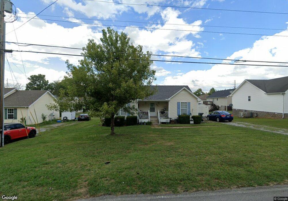
1550 17th Ave E Springfield, TN 37172
Estimated Value: $252,129 - $274,000
Studio
2
Baths
1,267
Sq Ft
$207/Sq Ft
Est. Value
About This Home
This home is located at 1550 17th Ave E, Springfield, TN 37172 and is currently estimated at $262,532, approximately $207 per square foot. 1550 17th Ave E is a home located in Robertson County with nearby schools including Krisle Elementary School, Innovation Academy, and Springfield High School.
Ownership History
Date
Name
Owned For
Owner Type
Purchase Details
Closed on
Oct 8, 2012
Sold by
Federal National Mortgage Association
Bought by
Hargrove Brandi N
Current Estimated Value
Home Financials for this Owner
Home Financials are based on the most recent Mortgage that was taken out on this home.
Original Mortgage
$84,150
Outstanding Balance
$57,605
Interest Rate
3.42%
Mortgage Type
Commercial
Estimated Equity
$204,927
Purchase Details
Closed on
Jul 17, 2012
Sold by
Kirian Josie J
Bought by
Federal National Mortgage Association
Purchase Details
Closed on
Aug 17, 2004
Sold by
Hilliard James H
Bought by
Kirian Josie J
Home Financials for this Owner
Home Financials are based on the most recent Mortgage that was taken out on this home.
Original Mortgage
$71,920
Interest Rate
5.97%
Create a Home Valuation Report for This Property
The Home Valuation Report is an in-depth analysis detailing your home's value as well as a comparison with similar homes in the area
Home Values in the Area
Average Home Value in this Area
Purchase History
| Date | Buyer | Sale Price | Title Company |
|---|---|---|---|
| Hargrove Brandi N | $82,500 | -- | |
| Federal National Mortgage Association | $72,125 | -- | |
| Kirian Josie J | $89,900 | -- |
Source: Public Records
Mortgage History
| Date | Status | Borrower | Loan Amount |
|---|---|---|---|
| Open | Hargrove Brandi N | $84,150 | |
| Previous Owner | Kirian Josie J | $71,920 |
Source: Public Records
Tax History
| Year | Tax Paid | Tax Assessment Tax Assessment Total Assessment is a certain percentage of the fair market value that is determined by local assessors to be the total taxable value of land and additions on the property. | Land | Improvement |
|---|---|---|---|---|
| 2025 | -- | $53,975 | $15,000 | $38,975 |
| 2024 | -- | $53,975 | $15,000 | $38,975 |
| 2023 | $1,353 | $53,975 | $15,000 | $38,975 |
| 2022 | $1,030 | $28,225 | $3,450 | $24,775 |
| 2021 | $1,030 | $28,225 | $3,450 | $24,775 |
| 2020 | $1,030 | $28,225 | $3,450 | $24,775 |
| 2019 | $31,027 | $28,225 | $3,450 | $24,775 |
| 2018 | $1,030 | $28,225 | $3,450 | $24,775 |
| 2017 | $1,113 | $25,975 | $5,000 | $20,975 |
| 2016 | $1,113 | $25,975 | $5,000 | $20,975 |
| 2015 | $1,081 | $25,975 | $5,000 | $20,975 |
| 2014 | $1,081 | $25,975 | $5,000 | $20,975 |
Source: Public Records
Map
Nearby Homes
- 1800 Meadowbrook Dr
- 633 E 17th Ave
- 342 Crescent Dr
- 113 Golf Club Ln Unit 13
- 2511 Queen Anne Ct
- 103 Shannon Ln
- 2302 Ruth St
- 805 8th Ave E
- 2209 Ruth St
- 2116 Mockingbird Ln Unit C
- 5295 Matthews St
- 2115 Mockingbird Ln Unit A
- 54 Hunters Ln
- 600 10th Ave E
- 129 Dimaggio Dr
- 1055 Mustang Ct
- 1183 Hangar Rd
- 703 Hayes St
- 331 Tivoli Trail
- 1309 Batts Blvd
- 1350 17th Ave E
- 1750 17th Ave E
- 317 Reeves Ct
- 107 Park Meadow Point
- 1700 Martindale Dr
- 318 Reeves Ct
- 1150 17th Ave E
- 1701 Martindale Dr
- 309 Reeves Ct
- 111 Park Meadow Point
- 1702 Martindale Dr
- 314 Reeves Ct
- 102 Park Meadow Point
- 102 Park Meadow Pointe
- 1017 E 17th Ave
- 115 Park Meadow Pointe
- 1701 Woodside Dr
- 106 Park Meadow Point
- 115 Park Meadow Point
- 310 Reeves Ct
Your Personal Tour Guide
Ask me questions while you tour the home.