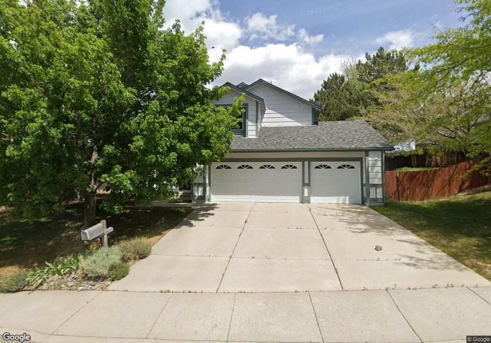
1550 Butterfly Dr Reno, NV 89523
Mae Anne Avenue NeighborhoodEstimated Value: $621,000 - $726,000
3
Beds
3
Baths
1,833
Sq Ft
$364/Sq Ft
Est. Value
About This Home
This home is located at 1550 Butterfly Dr, Reno, NV 89523 and is currently estimated at $667,906, approximately $364 per square foot. 1550 Butterfly Dr is a home located in Washoe County with nearby schools including Sarah Winnemucca Elementary School, B D Billinghurst Middle School, and Robert McQueen High School.
Ownership History
Date
Name
Owned For
Owner Type
Purchase Details
Closed on
Oct 27, 1998
Sold by
Sandberg Randy E and Sandberg Michele A
Bought by
Nebes Wayne and Stubbs Evelyn J
Current Estimated Value
Home Financials for this Owner
Home Financials are based on the most recent Mortgage that was taken out on this home.
Original Mortgage
$140,800
Outstanding Balance
$30,760
Interest Rate
6.6%
Estimated Equity
$637,146
Create a Home Valuation Report for This Property
The Home Valuation Report is an in-depth analysis detailing your home's value as well as a comparison with similar homes in the area
Home Values in the Area
Average Home Value in this Area
Purchase History
| Date | Buyer | Sale Price | Title Company |
|---|---|---|---|
| Nebes Wayne | $176,000 | Stewart Title |
Source: Public Records
Mortgage History
| Date | Status | Borrower | Loan Amount |
|---|---|---|---|
| Open | Nebes Wayne | $140,800 |
Source: Public Records
Tax History Compared to Growth
Tax History
| Year | Tax Paid | Tax Assessment Tax Assessment Total Assessment is a certain percentage of the fair market value that is determined by local assessors to be the total taxable value of land and additions on the property. | Land | Improvement |
|---|---|---|---|---|
| 2025 | $2,938 | $114,968 | $57,512 | $57,456 |
| 2024 | $2,938 | $112,166 | $53,690 | $58,476 |
| 2023 | $2,854 | $112,620 | $57,012 | $55,608 |
| 2022 | $2,770 | $93,582 | $46,956 | $46,626 |
| 2021 | $2,690 | $78,786 | $32,078 | $46,708 |
| 2020 | $2,611 | $80,634 | $33,534 | $47,100 |
| 2019 | $2,473 | $74,727 | $30,667 | $44,060 |
| 2018 | $2,400 | $70,932 | $27,552 | $43,380 |
| 2017 | $2,330 | $69,376 | $25,704 | $43,672 |
| 2016 | $2,271 | $70,928 | $25,088 | $45,840 |
| 2015 | $2,268 | $70,170 | $24,185 | $45,985 |
| 2014 | $2,202 | $66,465 | $21,560 | $44,905 |
| 2013 | -- | $62,114 | $17,815 | $44,299 |
Source: Public Records
Map
Nearby Homes
- 1705 Sierra Highlands Dr
- 0 Simons Dr
- 1708 Kristin Way
- 1659 Shadow Park Dr
- 1689 Shadow Park Dr
- 1500 Backer Way
- 5849 Morgan Horse St
- 5721 Royal Vista Way
- 5830 Blue Horizon Dr
- 1627 Prancer St Unit Lot 50
- 1627 Prancer St
- 1615 Prancer St Unit Lot 53
- Walker Plan at Monarch
- Humboldt Plan at Monarch
- 1639 Prancer St Unit Lot 47
- 5882 Grand Row Way Unit Lot 61
- 1618 Icelandic Way Unit Lot 67
- 1618 Icelandic Way
- 1626 Icelandic Way
- 5878 Grand Row Way
- 1540 Butterfly Dr
- 5272 Simons Dr
- 1530 Butterfly Dr
- 1555 Butterfly Dr
- 5290 Simons Dr
- 5266 Simons Dr
- 1565 Butterfly Dr
- 5282 Simons Dr
- 5305 Butterfly Ct
- 5262 Simons Dr
- 1575 Butterfly Dr
- 1520 Butterfly Dr
- 5335 Butterfly Ct
- 1585 Butterfly Dr
- 1620 Pinecrest Ct
- 5258 Simons Dr
- 5355 Butterfly Ct
- 5302 Butterfly Ct
- 1595 Butterfly Dr
- 1500 Butterfly Dr