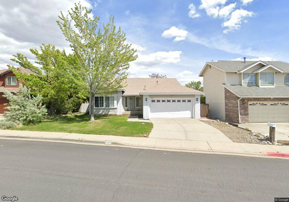
1550 Grand Point Way Reno, NV 89523
Mae Anne Avenue NeighborhoodEstimated Value: $533,267 - $620,000
3
Beds
2
Baths
1,700
Sq Ft
$334/Sq Ft
Est. Value
About This Home
This home is located at 1550 Grand Point Way, Reno, NV 89523 and is currently estimated at $567,567, approximately $333 per square foot. 1550 Grand Point Way is a home located in Washoe County with nearby schools including Sarah Winnemucca Elementary School, B D Billinghurst Middle School, and Robert McQueen High School.
Ownership History
Date
Name
Owned For
Owner Type
Purchase Details
Closed on
Nov 16, 2021
Sold by
Lowe Jon H and Lowe Sharon Y
Bought by
Lowe Jon H and Lowe Sharon Y
Current Estimated Value
Purchase Details
Closed on
Nov 9, 2021
Sold by
Lowe Jon H and Lowe Sharon Y
Bought by
Lowe Jon H and Lowe Sharon Y
Purchase Details
Closed on
Mar 23, 2018
Sold by
Swank James S and Swank Crystal E
Bought by
Lowe Jon H and Lowe Sharon Y
Create a Home Valuation Report for This Property
The Home Valuation Report is an in-depth analysis detailing your home's value as well as a comparison with similar homes in the area
Home Values in the Area
Average Home Value in this Area
Purchase History
| Date | Buyer | Sale Price | Title Company |
|---|---|---|---|
| Lowe Jon H | -- | None Available | |
| Lowe Jon H | -- | None Available | |
| Lowe Jon H | $340,000 | First Centennial Reno |
Source: Public Records
Tax History Compared to Growth
Tax History
| Year | Tax Paid | Tax Assessment Tax Assessment Total Assessment is a certain percentage of the fair market value that is determined by local assessors to be the total taxable value of land and additions on the property. | Land | Improvement |
|---|---|---|---|---|
| 2025 | $2,680 | $97,273 | $42,028 | $55,245 |
| 2024 | $2,680 | $95,156 | $39,235 | $55,921 |
| 2023 | $2,606 | $94,906 | $41,662 | $53,244 |
| 2022 | $2,529 | $78,928 | $34,314 | $44,615 |
| 2021 | $2,455 | $68,057 | $23,441 | $44,616 |
| 2020 | $2,303 | $68,939 | $24,505 | $44,434 |
| 2019 | $2,194 | $65,499 | $22,411 | $43,088 |
| 2018 | $2,094 | $58,701 | $16,359 | $42,342 |
| 2017 | $2,010 | $57,822 | $15,262 | $42,560 |
| 2016 | $1,960 | $58,573 | $14,896 | $43,677 |
| 2015 | $1,956 | $56,585 | $13,001 | $43,584 |
| 2014 | $1,900 | $52,586 | $10,507 | $42,079 |
| 2013 | -- | $50,194 | $8,612 | $41,582 |
Source: Public Records
Map
Nearby Homes
- 5895 Blue Horizon Dr
- 5870 Blue Horizon Dr
- 5830 Blue Horizon Dr
- 5878 Grand Row Way
- 5882 Grand Row Way Unit Lot 61
- 1500 Backer Way
- 1659 Shadow Park Dr
- 1627 Prancer St Unit Lot 50
- 1627 Prancer St
- 1615 Prancer St Unit Lot 53
- 1618 Icelandic Way Unit Lot 67
- 1618 Icelandic Way
- Walker Plan at Monarch
- Humboldt Plan at Monarch
- 1626 Icelandic Way
- 1639 Prancer St Unit Lot 47
- 1689 Shadow Park Dr
- 5849 Morgan Horse St
- 1770 Amarak Way
- 1708 Kristin Way
- 1540 Grand Point Way
- 1560 Grand Point Way
- 1545 Corona Ct
- 5865 Blue Horizon Dr
- 1544 Corona Ct
- 1545 Grand Point Way
- 5825 Blue Horizon Dr
- 5905 Blue Horizon Ct
- 5880 Blue Horizon Dr
- 5860 Blue Horizon Dr
- 1555 Backer Way
- 1545 Backer Way
- 1510 Grand Point Way
- 5850 Blue Horizon Dr
- 1535 Backer Way
- 5840 Blue Horizon Dr
- 5909 Blue Horizon Ct
- 5875 Simons Dr
- 5885 Simons Dr
- 5865 Simons Dr