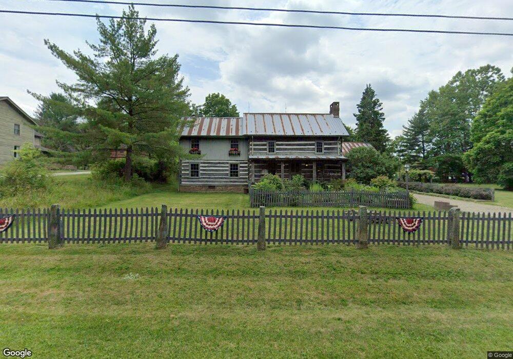
1550 Mill St E Peninsula, OH 44264
Estimated Value: $348,000 - $532,000
3
Beds
3
Baths
2,528
Sq Ft
$172/Sq Ft
Est. Value
About This Home
This home is located at 1550 Mill St E, Peninsula, OH 44264 and is currently estimated at $434,849, approximately $172 per square foot. 1550 Mill St E is a home located in Summit County with nearby schools including Woodridge Middle School, Woodridge High School, and Heritage Classical Academy - Peninsula.
Ownership History
Date
Name
Owned For
Owner Type
Purchase Details
Closed on
Feb 23, 2018
Sold by
Brunswick Nancy K
Bought by
Brunswick Robert F
Current Estimated Value
Purchase Details
Closed on
Jun 5, 1997
Sold by
Kelnhofer Gary
Bought by
Brunswick Robert F and Brunswick Nancy H
Home Financials for this Owner
Home Financials are based on the most recent Mortgage that was taken out on this home.
Original Mortgage
$316,000
Outstanding Balance
$43,357
Interest Rate
7.5%
Mortgage Type
New Conventional
Estimated Equity
$391,492
Create a Home Valuation Report for This Property
The Home Valuation Report is an in-depth analysis detailing your home's value as well as a comparison with similar homes in the area
Purchase History
| Date | Buyer | Sale Price | Title Company |
|---|---|---|---|
| Brunswick Robert F | -- | None Available | |
| Brunswick Nancy K | -- | None Available | |
| Brunswick Robert F | $395,000 | -- |
Source: Public Records
Mortgage History
| Date | Status | Borrower | Loan Amount |
|---|---|---|---|
| Open | Brunswick Robert F | $316,000 |
Source: Public Records
Tax History
| Year | Tax Paid | Tax Assessment Tax Assessment Total Assessment is a certain percentage of the fair market value that is determined by local assessors to be the total taxable value of land and additions on the property. | Land | Improvement |
|---|---|---|---|---|
| 2024 | $6,393 | $115,060 | $12,688 | $102,372 |
| 2023 | $6,393 | $115,060 | $12,688 | $102,372 |
| 2022 | $7,312 | $115,060 | $12,688 | $102,372 |
| 2021 | $7,373 | $115,060 | $12,688 | $102,372 |
| 2020 | $7,208 | $115,060 | $12,690 | $102,370 |
| 2019 | $7,868 | $113,490 | $12,230 | $101,260 |
| 2018 | $7,146 | $102,500 | $12,230 | $90,270 |
| 2017 | $5,803 | $102,330 | $12,230 | $90,100 |
| 2016 | $5,925 | $88,470 | $10,550 | $77,920 |
| 2015 | $5,803 | $88,470 | $10,550 | $77,920 |
| 2014 | $5,481 | $88,470 | $10,550 | $77,920 |
| 2013 | $5,476 | $88,750 | $10,550 | $78,200 |
Source: Public Records
Map
Nearby Homes
- 6184 Riverview Rd
- 6196 Riverview Rd
- 0 Olde Eight Rd Unit 5156367
- 3175 W Streetsboro Rd
- 4017 Bellaire Ln
- 3123 Aviemore Way
- 6607 Regal Woods Dr
- 3797 Stewart Ct
- 6559 Rosewood Trail
- 155 Granite Dr
- 7314 Forest Cove Ln Unit B
- 4954 Lake View Dr
- 5752 Bridgewater Blvd
- 53 Privet Ln Unit 62
- 50 Quartz Ave
- 235 Bridgewater Cir
- 28 Boulder Blvd
- 52 Boulder Blvd
- 5469 Sullivan Rd
- 4850 State Rd
- 1540 Mill St E
- 1563 Mill St E
- 1557 Main St
- 1565 Main St
- 6089 N Locust St
- 1537 Mill St E
- 6109 N Locust St
- 52 Preserve Cir
- 35 Salt Creek Run
- 1531 Main St
- 1521 Dell Rd
- 1542 Main St
- 1564 Main St
- 6090 N Locust St
- 6084 N Locust St
- 6117 N Locust St
- 1593 Main St
- 6133 N Locust St
- 1599 Main St
- 6112 N Locust St
Your Personal Tour Guide
Ask me questions while you tour the home.