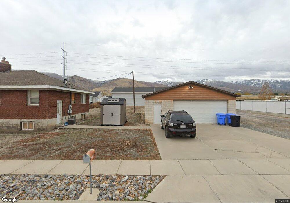
1550 N 550 W West Bountiful, UT 84087
Estimated Value: $516,000 - $560,516
3
Beds
2
Baths
1,266
Sq Ft
$422/Sq Ft
Est. Value
About This Home
This home is located at 1550 N 550 W, West Bountiful, UT 84087 and is currently estimated at $534,379, approximately $422 per square foot. 1550 N 550 W is a home located in Davis County with nearby schools including West Bountiful Elementary School, Bountiful Junior High School, and Viewmont High School.
Ownership History
Date
Name
Owned For
Owner Type
Purchase Details
Closed on
Nov 21, 2022
Sold by
Broderick Danny R
Bought by
Broderick Construction Inc
Current Estimated Value
Purchase Details
Closed on
May 15, 2003
Sold by
Devereaux Bradley J
Bought by
Broderick Danny R and Broderick Kevin K
Create a Home Valuation Report for This Property
The Home Valuation Report is an in-depth analysis detailing your home's value as well as a comparison with similar homes in the area
Home Values in the Area
Average Home Value in this Area
Purchase History
| Date | Buyer | Sale Price | Title Company |
|---|---|---|---|
| Broderick Construction Inc | -- | -- | |
| Broderick Danny R | -- | Founders Title Co |
Source: Public Records
Tax History Compared to Growth
Tax History
| Year | Tax Paid | Tax Assessment Tax Assessment Total Assessment is a certain percentage of the fair market value that is determined by local assessors to be the total taxable value of land and additions on the property. | Land | Improvement |
|---|---|---|---|---|
| 2025 | $3,311 | $270,600 | $123,165 | $147,435 |
| 2024 | $3,060 | $257,399 | $102,534 | $154,865 |
| 2023 | $2,948 | $252,450 | $101,851 | $150,598 |
| 2022 | $2,950 | $468,000 | $174,361 | $293,639 |
| 2021 | $2,771 | $371,000 | $143,694 | $227,306 |
| 2020 | $2,598 | $344,000 | $121,981 | $222,019 |
| 2019 | $2,572 | $338,000 | $114,875 | $223,125 |
| 2018 | $2,374 | $306,000 | $103,222 | $202,778 |
| 2016 | $2,006 | $141,680 | $47,001 | $94,679 |
| 2015 | $1,974 | $133,815 | $47,001 | $86,814 |
| 2014 | $1,608 | $111,915 | $55,295 | $56,620 |
| 2013 | -- | $142,598 | $52,931 | $89,667 |
Source: Public Records
Map
Nearby Homes
- Carson Plan at Amberly Place
- 2050 Farmhouse Plan at Amberly Place
- Pasadena Plan at Amberly Place
- Portland Plan at Amberly Place
- 280 N 1100 W
- 1084 W Audrey Ln Unit 20
- 1084 W Audrey Ln
- 825 W 1320 N
- 767 W 220 N
- 988 W 1950 N Unit 134
- Swiss 2 - Urban Plan at The Audrey - theAUDREY
- Swiss 3 - Urban Plan at The Audrey - theAUDREY
- Swiss 1 - Cottage Plan at The Audrey - theAUDREY
- Swiss 4 - Cottage Plan at The Audrey - theAUDREY
- Swiss 2 - Cottage Plan at The Audrey - theAUDREY
- Swiss 3 - Cottage Plan at The Audrey - theAUDREY
- Swiss 4 - Urban Plan at The Audrey - theAUDREY
- Swiss 1 - Urban Plan at The Audrey - theAUDREY
- 1075 W Audrey Ln Unit 6
- 1067 W Audrey Ln Unit 8
- 1550 N 550 W Unit 12
- 1550 N 550 W Unit 13
- 702 N 1425 W Unit 84
- 702 N 1425 W Unit 85
- 815 Jessis Meadow Dr
- 1814 S 400 E
- 767 Jessis Meadow Dr
- 855 Jessi's Meadow Dr
- 855 Jessis Meadow Dr
- 840 Jessis Meadow Dr
- 830 Jessis Meadow Dr
- 1140 W Jessis Meadow Way Unit 21
- 1255 W Jessis Meadow Way Unit 29
- 1205 W Jessis Meadow Way Unit 26
- 766 Jessis Meadow Dr W
- 1270 Jessis Meadow Way
- 725 Jessis Meadow Dr
- 695 Jessis Meadow Dr
- 1260 Jessis Meadow Way
- 695 Jessis Meadow Dr W