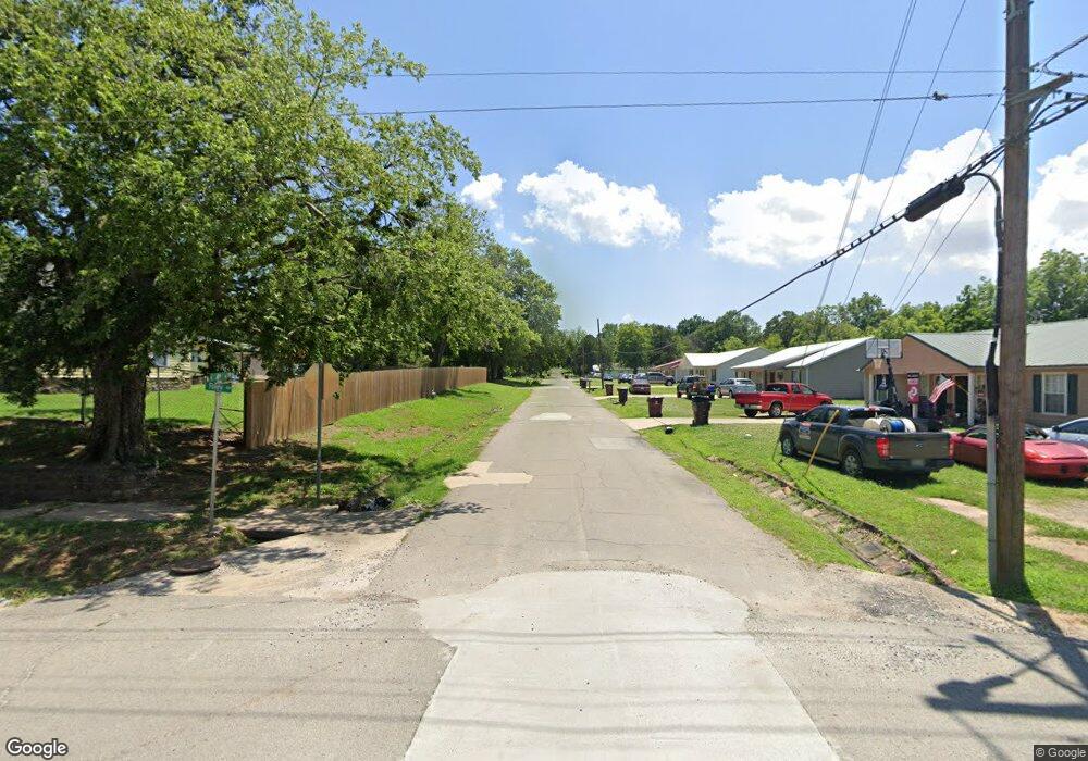
1550 Rr 4 Eufaula, OK 74432
Estimated Value: $254,000 - $286,000
2
Beds
2
Baths
1,176
Sq Ft
$231/Sq Ft
Est. Value
About This Home
This home is located at 1550 Rr 4, Eufaula, OK 74432 and is currently estimated at $272,230, approximately $231 per square foot. 1550 Rr 4 is a home located in McIntosh County with nearby schools including Eufaula Elementary School, Eufaula Middle School, and Eufaula High School.
Ownership History
Date
Name
Owned For
Owner Type
Purchase Details
Closed on
Feb 6, 2018
Sold by
Murdock Clifford D and Murdock Kristen H
Bought by
The Thomas E Morris And Paula S Morris R
Current Estimated Value
Purchase Details
Closed on
Jul 20, 2012
Sold by
Smith James A
Bought by
Murdock Clifford Dale and Murdock Kristen H
Home Financials for this Owner
Home Financials are based on the most recent Mortgage that was taken out on this home.
Original Mortgage
$120,000
Interest Rate
3.7%
Mortgage Type
New Conventional
Purchase Details
Closed on
Aug 5, 2010
Sold by
Three L Properties
Bought by
Smith James A
Home Financials for this Owner
Home Financials are based on the most recent Mortgage that was taken out on this home.
Original Mortgage
$103,017
Interest Rate
4.69%
Mortgage Type
Future Advance Clause Open End Mortgage
Purchase Details
Closed on
Mar 30, 2005
Sold by
Leonard Doris M
Bought by
Three L Properties Llc
Create a Home Valuation Report for This Property
The Home Valuation Report is an in-depth analysis detailing your home's value as well as a comparison with similar homes in the area
Purchase History
| Date | Buyer | Sale Price | Title Company |
|---|---|---|---|
| The Thomas E Morris And Paula S Morris R | $120,000 | None Available | |
| Murdock Clifford Dale | $150,000 | None Available | |
| Smith James A | $65,000 | None Available | |
| Three L Properties Llc | -- | None Available |
Source: Public Records
Mortgage History
| Date | Status | Borrower | Loan Amount |
|---|---|---|---|
| Previous Owner | Murdock Clifford Dale | $120,000 | |
| Previous Owner | Smith James A | $103,017 |
Source: Public Records
Tax History
| Year | Tax Paid | Tax Assessment Tax Assessment Total Assessment is a certain percentage of the fair market value that is determined by local assessors to be the total taxable value of land and additions on the property. | Land | Improvement |
|---|---|---|---|---|
| 2025 | $2,131 | $24,341 | $3,791 | $20,550 |
| 2024 | $2,025 | $23,838 | $3,080 | $20,758 |
| 2023 | $2,025 | $22,078 | $3,080 | $18,998 |
| 2022 | $1,744 | $21,027 | $3,080 | $17,947 |
| 2021 | $1,384 | $16,484 | $3,080 | $13,404 |
| 2020 | $1,384 | $16,484 | $3,080 | $13,404 |
| 2019 | $1,396 | $16,484 | $3,080 | $13,404 |
| 2018 | $1,372 | $16,484 | $3,080 | $13,404 |
| 2017 | $1,373 | $16,484 | $3,080 | $13,404 |
| 2016 | $1,380 | $16,484 | $3,080 | $13,404 |
| 2015 | $1,461 | $17,686 | $4,620 | $13,066 |
| 2014 | $1,432 | $17,457 | $4,620 | $12,837 |
Source: Public Records
Map
Nearby Homes
- 421874 E 1155 Rd
- 116565 S 4213 Rd
- 421355 E 1168 Rd
- 421842 E 1155 Rd
- 421317 E 1168 Rd
- 001 Siers Rd
- 421298 E 1168 Rd
- 001 E 1168 Rd
- 002 E 1168 Rd
- 1 E 1167 Rd
- 421171 E 1168 Rd
- 116965 S 4164
- 115292 S Forsman
- 116307 S 4209 Rd
- 9 Sandy Bass Bay
- 420707 E 1166 Rd
- 117720 S 4214 Rd
- 117525 S 4209 Rd
- 123 S 4214 Loop
- 20 S 4207 Rd
- 420687 E 1161 Cir
- 420937 E 1161 Cir
- 421830 E 1162 Rd
- 21701 NE 108th St
- 11100 N Harrah Rd
- 111 Kandy Ln
- 421897 E 1162 Rd
- 421524 E 1161 Cir
- 421880 E 1163 Rd
- 116394 S 4220 Rd
- 15 Brookridge
- 827 Rr 4
- 1164 E Rd Rd
- 5 S 4215 Rd
- 421461 E 1164 Rd
- 4 S 4215 Rd
- 421472 E 1164
- 421435 E 1158 Rd
- 421722 E 1158 Rd
- 116519 S 4215 Rd
