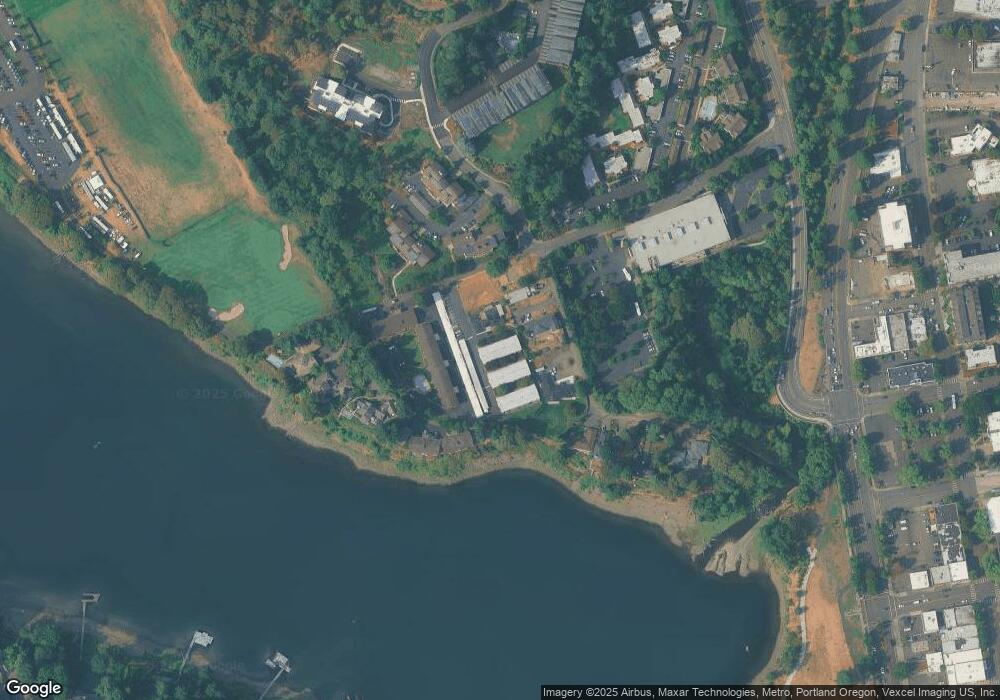
1550 SE Lava Dr Unit 19 Portland, OR 97222
Historic Milwaukie NeighborhoodEstimated Value: $326,000 - $444,000
2
Beds
2
Baths
1,184
Sq Ft
$317/Sq Ft
Est. Value
About This Home
This home is located at 1550 SE Lava Dr Unit 19, Portland, OR 97222 and is currently estimated at $375,076, approximately $316 per square foot. 1550 SE Lava Dr Unit 19 is a home located in Clackamas County with nearby schools including Milwaukie Elementary School, Rowe Middle School, and Milwaukie High School.
Ownership History
Date
Name
Owned For
Owner Type
Purchase Details
Closed on
Jun 24, 2013
Sold by
Rasmussen Frederick A
Bought by
Forni Melody
Current Estimated Value
Home Financials for this Owner
Home Financials are based on the most recent Mortgage that was taken out on this home.
Original Mortgage
$121,600
Outstanding Balance
$86,167
Interest Rate
3.48%
Mortgage Type
Commercial
Estimated Equity
$288,909
Purchase Details
Closed on
Apr 29, 2004
Sold by
Foster William M
Bought by
Foster William Michael and The William Michael Foster Revocable Tr
Purchase Details
Closed on
Feb 29, 1996
Sold by
Fountain David E and Fountain Oma J
Bought by
Foster William M
Create a Home Valuation Report for This Property
The Home Valuation Report is an in-depth analysis detailing your home's value as well as a comparison with similar homes in the area
Home Values in the Area
Average Home Value in this Area
Purchase History
| Date | Buyer | Sale Price | Title Company |
|---|---|---|---|
| Forni Melody | $152,000 | Fidelity Natl Title Co Of Or | |
| Foster William Michael | -- | -- | |
| Foster William M | $125,000 | Ticor Title Insurance |
Source: Public Records
Mortgage History
| Date | Status | Borrower | Loan Amount |
|---|---|---|---|
| Open | Forni Melody | $121,600 |
Source: Public Records
Tax History Compared to Growth
Tax History
| Year | Tax Paid | Tax Assessment Tax Assessment Total Assessment is a certain percentage of the fair market value that is determined by local assessors to be the total taxable value of land and additions on the property. | Land | Improvement |
|---|---|---|---|---|
| 2025 | $4,094 | $186,074 | -- | -- |
| 2024 | $3,954 | $180,655 | -- | -- |
| 2023 | $3,954 | $175,394 | $0 | $0 |
| 2022 | $3,652 | $170,286 | $0 | $0 |
| 2021 | $3,524 | $165,327 | $0 | $0 |
| 2020 | $3,414 | $160,512 | $0 | $0 |
| 2019 | $3,363 | $155,837 | $0 | $0 |
| 2018 | $2,991 | $151,298 | $0 | $0 |
| 2017 | $2,905 | $146,891 | $0 | $0 |
| 2016 | $2,808 | $142,613 | $0 | $0 |
| 2015 | $2,674 | $138,459 | $0 | $0 |
| 2014 | $2,536 | $134,426 | $0 | $0 |
Source: Public Records
Map
Nearby Homes
- 10606 SE Main St Unit 212
- 11385 S Riverwood Rd
- 1621 SE McBrod Ave
- 1686 SE McBrod Ave Unit 3
- 11175 S Riverwood Rd
- 11859 S Riverwood Rd
- 1500 SE Waverly Dr
- 11800 S Breyman Ave
- 629 SE Saint Andrews Dr
- 11000 S Collina Ave
- 1856 SE Saint Andrews Dr
- 1803 S Riverdale Rd
- 10150 S Riverside Dr
- 12225 SE 19th Ave
- 11265 SE 30th Ave
- 10505 S Hedlund Ave
- 1819 S Radcliffe Rd
- 604 SE Andover Place
- 1329 S Palatine Hill Rd
- 10845 SE Myrtle St
- 1550 SE Lava Dr Unit 7
- 1550 SE Lava Dr Unit 10
- 1550 SE Lava Dr Unit 20
- 1550 SE Lava Dr Unit 17
- 1550 SE Lava Dr Unit 12
- 1550 SE Lava Dr Unit 1
- 1550 SE Lava Dr Unit 18
- 1550 SE Lava Dr Unit 4
- 1550 SE Lava Dr Unit 11
- 1550 SE Lava Dr Unit 5
- 1550 SE Lava Dr Unit 16
- 1550 SE Lava Dr Unit 15
- 1550 SE Lava Dr Unit 14
- 1550 SE Lava Dr Unit 21
- 1550 SE Lava Dr Unit 8
- 1552 SE Lava Dr
- 1400 SE Lava Dr Unit 2
- 1400 SE Lava Dr Unit 3
- 1400 SE Lava Dr Unit 18
- 1400 SE Lava Dr Unit 12
