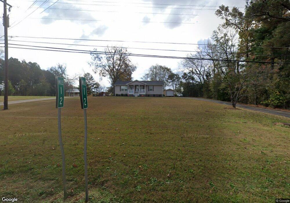
1551 E Broad St Greensboro, GA 30642
Estimated Value: $163,856 - $247,000
2
Beds
2
Baths
1,035
Sq Ft
$205/Sq Ft
Est. Value
About This Home
This home is located at 1551 E Broad St, Greensboro, GA 30642 and is currently estimated at $212,464, approximately $205 per square foot. 1551 E Broad St is a home located in Greene County with nearby schools including Greene County High School.
Ownership History
Date
Name
Owned For
Owner Type
Purchase Details
Closed on
Apr 7, 2021
Sold by
Bradley Edward Eugene
Bought by
Thackston Renee Bradley
Current Estimated Value
Purchase Details
Closed on
Nov 25, 1992
Sold by
Bradley Alvin Eugene
Bought by
Easement Deed
Purchase Details
Closed on
Nov 17, 1992
Sold by
Bradley Gene E and Bradley Audrey M
Bought by
Bradley Alvin Eugene
Purchase Details
Closed on
Jan 1, 1974
Sold by
Higdon Robert G and Higdon Jonnell K
Bought by
Bradley Gene E and Bradley Audrey M
Purchase Details
Closed on
Jan 1, 1971
Sold by
Finch Edgar B
Bought by
Higdon Robert G and Higdon Jonnell K
Purchase Details
Closed on
Jan 1, 1947
Bought by
Finch Edgar B
Create a Home Valuation Report for This Property
The Home Valuation Report is an in-depth analysis detailing your home's value as well as a comparison with similar homes in the area
Home Values in the Area
Average Home Value in this Area
Purchase History
| Date | Buyer | Sale Price | Title Company |
|---|---|---|---|
| Thackston Renee Bradley | -- | -- | |
| Thackston Renee Bradley | -- | -- | |
| Easement Deed | -- | -- | |
| Bradley Alvin Eugene | -- | -- | |
| Bradley Gene E | -- | -- | |
| Higdon Robert G | -- | -- | |
| Finch Edgar B | -- | -- |
Source: Public Records
Tax History Compared to Growth
Tax History
| Year | Tax Paid | Tax Assessment Tax Assessment Total Assessment is a certain percentage of the fair market value that is determined by local assessors to be the total taxable value of land and additions on the property. | Land | Improvement |
|---|---|---|---|---|
| 2024 | $862 | $38,680 | $13,600 | $25,080 |
| 2023 | $382 | $36,760 | $13,600 | $23,160 |
| 2022 | $635 | $28,960 | $8,000 | $20,960 |
| 2021 | $404 | $26,640 | $8,000 | $18,640 |
| 2020 | $365 | $11,920 | $6,800 | $5,120 |
| 2019 | $374 | $11,920 | $6,800 | $5,120 |
| 2018 | $351 | $11,920 | $6,800 | $5,120 |
| 2017 | $338 | $11,935 | $6,800 | $5,135 |
| 2016 | $338 | $11,935 | $6,800 | $5,135 |
| 2015 | $308 | $11,935 | $6,800 | $5,135 |
| 2014 | $306 | $11,597 | $6,800 | $4,797 |
Source: Public Records
Map
Nearby Homes
- 1531 E Broad St
- 0 Railroad St Unit 218854
- 0 Railroad St Unit 10578007
- 0 Railroad St Unit 531919
- LOT 1 Penfield
- 1020 Horton Dr
- 1060 Twin Pines Cir
- 301 N East St
- 1131 Planing Mill Rd
- 1141 Planing Mill Rd
- 15 South St Unit Siloam Road
- 504 Martin Luther King Junior Dr
- 0 Canaan St
- 314 W South St
- 109 Reynolds Dr
- 105 Wilson St
- 805 S West St
- 0 Maple Cir
- 1141 Armour Cir
- 1311 Lighthouse Cir
- 1531 E Broad St Unit 10, 11
- 1571 E Broad St
- 1731 E Broad St
- 1550 E Broad St
- 1540 E Broad St
- 1561 E Broad St
- 1530 E Broad St
- 1511 E Broad St
- 1520 E Broad St
- 1082 Heritage Dr
- 1084 Heritage Dr
- 1080 Heritage Dr
- 1086 Heritage Dr
- 1088 Heritage Dr
- 1570 E Broad St
- 1090 Heritage Dr
- 1070 Heritage Dr
- 1081 Heritage Dr
- 1030 Heritage Dr
- 1079 Heritage Dr