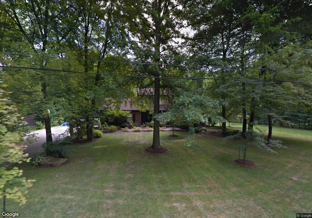
1551 Maple Dr Hubbard, OH 44425
Estimated Value: $332,000 - $345,000
4
Beds
3
Baths
2,760
Sq Ft
$123/Sq Ft
Est. Value
About This Home
This home is located at 1551 Maple Dr, Hubbard, OH 44425 and is currently estimated at $338,511, approximately $122 per square foot. 1551 Maple Dr is a home located in Trumbull County with nearby schools including Hubbard Elementary School, Hubbard Middle School, and Hubbard High School.
Ownership History
Date
Name
Owned For
Owner Type
Purchase Details
Closed on
Jun 27, 2001
Sold by
Winchester Calvin C and Winchester Carmella R
Bought by
Wittenauer Gary S and Wittenauer Elaine Y
Current Estimated Value
Home Financials for this Owner
Home Financials are based on the most recent Mortgage that was taken out on this home.
Original Mortgage
$125,000
Outstanding Balance
$48,312
Interest Rate
7.18%
Mortgage Type
New Conventional
Estimated Equity
$290,199
Purchase Details
Closed on
Jan 1, 1990
Bought by
Calvin C Winchester
Create a Home Valuation Report for This Property
The Home Valuation Report is an in-depth analysis detailing your home's value as well as a comparison with similar homes in the area
Home Values in the Area
Average Home Value in this Area
Purchase History
| Date | Buyer | Sale Price | Title Company |
|---|---|---|---|
| Wittenauer Gary S | $179,000 | -- | |
| Calvin C Winchester | -- | -- |
Source: Public Records
Mortgage History
| Date | Status | Borrower | Loan Amount |
|---|---|---|---|
| Open | Wittenauer Gary S | $125,000 |
Source: Public Records
Tax History Compared to Growth
Tax History
| Year | Tax Paid | Tax Assessment Tax Assessment Total Assessment is a certain percentage of the fair market value that is determined by local assessors to be the total taxable value of land and additions on the property. | Land | Improvement |
|---|---|---|---|---|
| 2024 | $5,311 | $93,660 | $10,220 | $83,440 |
| 2023 | $5,311 | $93,660 | $10,220 | $83,440 |
| 2022 | $4,872 | $76,580 | $9,590 | $66,990 |
| 2021 | $4,892 | $76,580 | $9,590 | $66,990 |
| 2020 | $4,911 | $76,580 | $9,590 | $66,990 |
| 2019 | $4,544 | $67,130 | $8,890 | $58,240 |
| 2018 | $4,409 | $67,130 | $8,890 | $58,240 |
| 2017 | $4,397 | $67,130 | $8,890 | $58,240 |
| 2016 | $4,141 | $64,580 | $8,890 | $55,690 |
| 2015 | $4,155 | $64,580 | $8,890 | $55,690 |
| 2014 | $4,077 | $64,580 | $8,890 | $55,690 |
| 2013 | $4,070 | $64,580 | $8,890 | $55,690 |
Source: Public Records
Map
Nearby Homes
- 5910 Chestnut Ridge Rd
- 1441 Warner Rd
- 5683 Chestnut Ridge Rd
- 1472 Warner Rd
- 1975 Warner Rd
- 6855 Stewart Sharon Rd
- 256 Warner Rd
- 5950 Mount Everett Rd
- 7111 Pine Grove Dr
- 0 Appaloosa Trail
- 0 Smith Stewart Rd Unit 5120727
- 2675 Seifert-Lewis Rd
- 550 Warner Rd
- 1911 Hubbard Thomas Rd
- 6130 Warren Sharon Rd
- 6220 Warren Sharon Rd
- 6333 Warren Sharon Rd
- 132 Drummond Ave
- 60 Warner Rd
- 1354 Stevenson Rd
- 1531 Maple Dr
- 1571 Maple Dr
- 1546 Maple Dr
- 1532 Maple Dr
- 1576 Maple Dr
- 6140 Everett East Rd
- 1564 Greensleave Cir
- 1581 Maple Dr
- 1584 Greensleave Cir
- 1524 Greensleave Cir
- 1541 Lake Dr
- 6116 Everett East Rd
- 1533 Lake Dr
- 1575 Lake Dr
- 1516 Greensleaves Cir W
- 1516 Greensleave Cir
- 1590 Greensleave Cir
- 6100 Everett East Rd
- 1595 Lake Dr
- 1557 Greensleave Cir