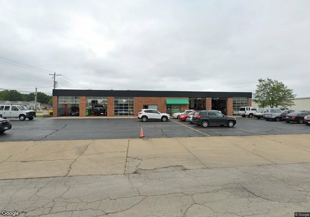
1552 Huston Dr Decatur, IL 62526
Estimated Value: $319,324
--
Bed
--
Bath
5,400
Sq Ft
$59/Sq Ft
Est. Value
About This Home
This home is located at 1552 Huston Dr, Decatur, IL 62526 and is currently estimated at $319,324, approximately $59 per square foot. 1552 Huston Dr is a home located in Macon County with nearby schools including Argenta-Oreana Elementary School, Argenta Oreana High School, and Argenta-Oreana Middle School.
Ownership History
Date
Name
Owned For
Owner Type
Purchase Details
Closed on
Feb 10, 2020
Sold by
Billingsley Holdings Llc
Bought by
Wathan Holdings Llc
Current Estimated Value
Purchase Details
Closed on
Sep 13, 2016
Sold by
Rawlings Kevin
Bought by
Billingsley Holdings Llc
Purchase Details
Closed on
Dec 14, 2007
Sold by
Speed Lube 10 Minute Oil Change Shopes I
Bought by
Rawlings Kevin
Create a Home Valuation Report for This Property
The Home Valuation Report is an in-depth analysis detailing your home's value as well as a comparison with similar homes in the area
Home Values in the Area
Average Home Value in this Area
Purchase History
| Date | Buyer | Sale Price | Title Company |
|---|---|---|---|
| Wathan Holdings Llc | $212,500 | None Available | |
| Billingsley Holdings Llc | $200,000 | Attorney | |
| Rawlings Kevin | $200,000 | None Available |
Source: Public Records
Tax History Compared to Growth
Tax History
| Year | Tax Paid | Tax Assessment Tax Assessment Total Assessment is a certain percentage of the fair market value that is determined by local assessors to be the total taxable value of land and additions on the property. | Land | Improvement |
|---|---|---|---|---|
| 2024 | $7,782 | $85,215 | $15,723 | $69,492 |
| 2023 | $7,341 | $78,337 | $14,454 | $63,883 |
| 2022 | $7,007 | $72,655 | $13,406 | $59,249 |
| 2021 | $6,765 | $67,936 | $12,535 | $55,401 |
| 2020 | $6,713 | $66,531 | $12,276 | $54,255 |
| 2019 | $6,713 | $66,531 | $12,276 | $54,255 |
| 2018 | $6,707 | $67,007 | $12,364 | $54,643 |
| 2017 | $6,754 | $67,380 | $12,433 | $54,947 |
| 2016 | $6,837 | $67,542 | $12,463 | $55,079 |
| 2015 | $6,622 | $66,741 | $12,315 | $54,426 |
| 2014 | $6,296 | $66,741 | $12,315 | $54,426 |
| 2013 | $6,308 | $66,741 | $12,315 | $54,426 |
Source: Public Records
Map
Nearby Homes
- 3443 N Charles St
- 1585 E North Port Rd
- 2555 Hedrick Ct
- 3454 N Christine Dr
- 274 E Christine Dr
- 3160 N Holly Dr
- 2221 E Mound Rd
- 34 N Court Dr
- 1159 E Mueller Ave
- 2078 N Charles St
- 45 Larry Dr
- 26 Colorado Dr
- 93 Colorado Dr
- 4065 N Neely Ave
- 363 E Pierson Ave
- 24 Greenridge Dr
- 20 Whippoorwill Dr
- 12 East Dr
- 19 Central Dr
- 26 South Dr
- 3180 N Woodford St
- 3201 N Woodford St
- 3190 N Woodford St
- 3130 N Woodford St
- 3241 N Woodford St
- 1690 Huston Dr
- 1635 Huston Dr
- 1720 Huston Dr
- 3125 N Kandy Ln
- 3080 N Woodford St
- 3085 N Kandy Ln
- 3130 N Kandy Ln
- 3133 N Woodford St
- 3133 N Woodford St
- 3345 N Woodford St
- 3030 & 3040 N Woodford St
- 3270 N Woodford St
- 3342 N Charles St
- 3373 N Woodford St
- 3070 N Kandy Ln