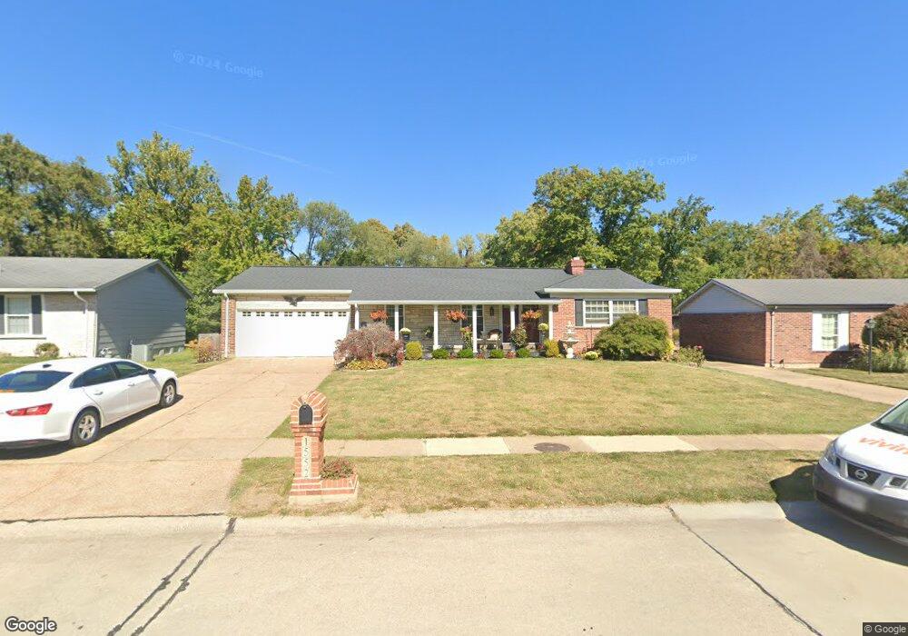
1552 Langholm Dr Florissant, MO 63031
Estimated Value: $236,313 - $267,000
3
Beds
3
Baths
1,674
Sq Ft
$147/Sq Ft
Est. Value
About This Home
This home is located at 1552 Langholm Dr, Florissant, MO 63031 and is currently estimated at $246,078, approximately $147 per square foot. 1552 Langholm Dr is a home located in St. Louis County with nearby schools including North Middle School, Hazelwood Central High School, and Oak Bridge.
Ownership History
Date
Name
Owned For
Owner Type
Purchase Details
Closed on
Aug 12, 2011
Sold by
Harris Verdell and Harris Willa L
Bought by
Hunt Reginald P and Hunt Pamela M
Current Estimated Value
Home Financials for this Owner
Home Financials are based on the most recent Mortgage that was taken out on this home.
Original Mortgage
$110,135
Outstanding Balance
$76,007
Interest Rate
4.5%
Mortgage Type
FHA
Estimated Equity
$170,071
Purchase Details
Closed on
Apr 30, 1997
Sold by
Ruf John J and Ruf Polly A
Bought by
Harris Verdell and Harris Willa L
Home Financials for this Owner
Home Financials are based on the most recent Mortgage that was taken out on this home.
Original Mortgage
$98,940
Interest Rate
8%
Mortgage Type
VA
Create a Home Valuation Report for This Property
The Home Valuation Report is an in-depth analysis detailing your home's value as well as a comparison with similar homes in the area
Home Values in the Area
Average Home Value in this Area
Purchase History
| Date | Buyer | Sale Price | Title Company |
|---|---|---|---|
| Hunt Reginald P | $115,000 | Investors Title Co Clayton | |
| Harris Verdell | -- | First American Title Ins Co |
Source: Public Records
Mortgage History
| Date | Status | Borrower | Loan Amount |
|---|---|---|---|
| Open | Hunt Reginald P | $110,135 | |
| Previous Owner | Harris Verdell | $98,940 |
Source: Public Records
Tax History Compared to Growth
Tax History
| Year | Tax Paid | Tax Assessment Tax Assessment Total Assessment is a certain percentage of the fair market value that is determined by local assessors to be the total taxable value of land and additions on the property. | Land | Improvement |
|---|---|---|---|---|
| 2025 | $3,473 | $45,640 | $7,110 | $38,530 |
| 2024 | $3,473 | $39,840 | $2,850 | $36,990 |
| 2023 | $3,469 | $39,840 | $2,850 | $36,990 |
| 2022 | $2,729 | $27,880 | $4,640 | $23,240 |
| 2021 | $2,690 | $27,880 | $4,640 | $23,240 |
| 2020 | $2,967 | $28,660 | $7,110 | $21,550 |
| 2019 | $2,922 | $28,660 | $7,110 | $21,550 |
| 2018 | $2,441 | $21,980 | $2,200 | $19,780 |
| 2017 | $2,438 | $21,980 | $2,200 | $19,780 |
| 2016 | $2,494 | $22,190 | $2,580 | $19,610 |
| 2015 | $2,441 | $22,190 | $2,580 | $19,610 |
| 2014 | $2,229 | $20,860 | $4,310 | $16,550 |
Source: Public Records
Map
Nearby Homes
- 1638 Matlock Dr
- 1455 Burnside Ct
- 1807 Kilmory Dr
- 3645 Woodman Dr
- 3660 Woodman Dr
- 1522 Sherwood Forest Dr
- 1641 Sherwood Forest Dr
- 1323 Woodpath Dr
- 3035 Matlock Dr
- 16787 River Stone Dr
- 2 Aspen II at Riverstone
- 2 Ashford at Riverstone
- 2 Berwick at Riverstone
- 16804 River Stone Dr
- 2 Maple at Riverstone
- 3828 Sonora Stone Dr
- 3819 Sonora Stone Dr
- 3840 Sonora Stone Dr
- 3844 Rapids Dr
- 3849 Secretariat Dr
- 1562 Langholm Dr
- 1542 Langholm Dr
- 1572 Langholm Dr
- 1532 Langholm Dr
- 3295 Brocton Common Dr
- 1541 Langholm Dr
- 1522 Langholm Dr
- 1582 Langholm Dr
- 1531 Langholm Dr
- 3285 Brocton Common Dr
- 1581 Langholm Dr
- 1633 Norberg Dr
- 1623 Norberg Dr
- 1643 Norberg Dr
- 1512 Langholm Dr
- 3280 Brocton Common Dr
- 1613 Norberg Dr
- 1521 Langholm Dr
- 1653 Norberg Dr
- 1592 Langholm Dr