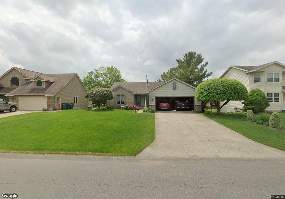
1552 Springbrook Dr Jenison, MI 49428
Estimated Value: $384,487 - $440,000
4
Beds
3
Baths
1,300
Sq Ft
$317/Sq Ft
Est. Value
About This Home
This home is located at 1552 Springbrook Dr, Jenison, MI 49428 and is currently estimated at $412,372, approximately $317 per square foot. 1552 Springbrook Dr is a home located in Ottawa County with nearby schools including Bauerwood Elementary School, Jenison Junior High School, and Jenison High School.
Ownership History
Date
Name
Owned For
Owner Type
Purchase Details
Closed on
Sep 4, 2013
Sold by
Deal Terry J
Bought by
Sherman Susan and Sherman Nborma
Current Estimated Value
Home Financials for this Owner
Home Financials are based on the most recent Mortgage that was taken out on this home.
Original Mortgage
$145,600
Outstanding Balance
$108,608
Interest Rate
4.39%
Mortgage Type
New Conventional
Estimated Equity
$303,764
Create a Home Valuation Report for This Property
The Home Valuation Report is an in-depth analysis detailing your home's value as well as a comparison with similar homes in the area
Home Values in the Area
Average Home Value in this Area
Purchase History
| Date | Buyer | Sale Price | Title Company |
|---|---|---|---|
| Sherman Susan | $182,000 | None Available |
Source: Public Records
Mortgage History
| Date | Status | Borrower | Loan Amount |
|---|---|---|---|
| Open | Sherman Susan | $145,600 |
Source: Public Records
Tax History
| Year | Tax Paid | Tax Assessment Tax Assessment Total Assessment is a certain percentage of the fair market value that is determined by local assessors to be the total taxable value of land and additions on the property. | Land | Improvement |
|---|---|---|---|---|
| 2025 | $2,762 | $173,600 | $0 | $0 |
| 2024 | $27 | $172,900 | $0 | $0 |
| 2023 | $2,535 | $158,300 | $0 | $0 |
| 2022 | $2,767 | $133,800 | $0 | $0 |
| 2021 | $2,687 | $128,600 | $0 | $0 |
| 2020 | $2,657 | $122,700 | $0 | $0 |
| 2019 | $2,659 | $113,400 | $0 | $0 |
| 2018 | $2,480 | $104,200 | $0 | $0 |
| 2017 | $2,437 | $100,600 | $0 | $0 |
| 2016 | $2,422 | $99,000 | $0 | $0 |
| 2015 | $2,311 | $88,800 | $0 | $0 |
| 2014 | $2,311 | $85,200 | $0 | $0 |
Source: Public Records
Map
Nearby Homes
- 1468 Maplewood Dr Unit 9
- 8148 Greenridge Dr
- 7951 Engelhurst Ct
- 1951 Mulberry Ln
- 1215 Sycamore Dr
- 8252 Lamplight Dr
- 9067 Hollace Ct
- 3270 Hollace Dr
- 8099 Weatherwax Dr Unit 38
- 2550 Willow View Dr
- 7528 Pinegrove Dr
- 8081 Weatherwax Dr Unit 44
- 7425 Boulder Bluff Dr Unit 112
- 932 Village Ln Unit 52
- 7763 Coachman Ln
- 636 Village Ln Unit 94
- 7373 Pinegrove Dr Unit 109
- 7391 Terrace Ln
- 2143 Sandstone Dr
- 2934 Parkside Dr Unit 54
- 1566 Springbrook Dr
- 8546 Corsica Dr
- 1528 Springbrook Dr
- 8536 Corsica Dr
- 1553 Springbrook Dr
- 1565 Springbrook Dr
- 1543 Springbrook Dr
- 1575 Springbrook Dr
- 1518 Springbrook Dr
- 8526 Corsica Dr
- 1531 Springbrook Dr
- 8559 Corsica Dr
- 1587 Springbrook Dr
- 8543 Corsica Dr
- 1523 Springbrook Dr
- 8516 Corsica Dr
- 1506 Springbrook Dr
- 1599 Springbrook Dr
- 8529 Corsica Dr
- 1511 Springbrook Dr
Your Personal Tour Guide
Ask me questions while you tour the home.