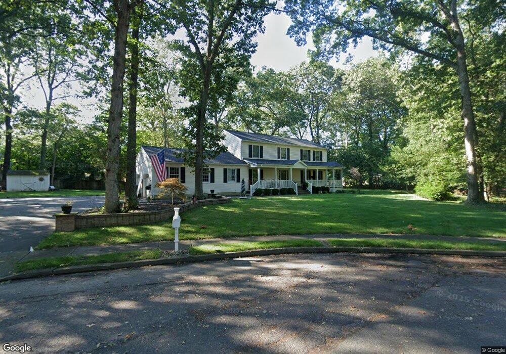
1553 Harbor Rd Manasquan, NJ 08736
Estimated Value: $1,029,000 - $1,215,000
4
Beds
3
Baths
2,542
Sq Ft
$443/Sq Ft
Est. Value
About This Home
This home is located at 1553 Harbor Rd, Manasquan, NJ 08736 and is currently estimated at $1,124,934, approximately $442 per square foot. 1553 Harbor Rd is a home located in Monmouth County with nearby schools including Wall High School, St Dominic School, and The Brookside School.
Ownership History
Date
Name
Owned For
Owner Type
Purchase Details
Closed on
Jun 16, 2006
Sold by
Davis Donald D
Bought by
Hansen Robert and Hansen Kerri
Current Estimated Value
Home Financials for this Owner
Home Financials are based on the most recent Mortgage that was taken out on this home.
Original Mortgage
$300,000
Outstanding Balance
$176,573
Interest Rate
6.59%
Mortgage Type
Purchase Money Mortgage
Estimated Equity
$948,361
Purchase Details
Closed on
May 19, 2003
Sold by
Ocone Loius
Bought by
Davis Donald and Davis Margaret
Home Financials for this Owner
Home Financials are based on the most recent Mortgage that was taken out on this home.
Original Mortgage
$300,000
Interest Rate
5.86%
Mortgage Type
Purchase Money Mortgage
Create a Home Valuation Report for This Property
The Home Valuation Report is an in-depth analysis detailing your home's value as well as a comparison with similar homes in the area
Home Values in the Area
Average Home Value in this Area
Purchase History
| Date | Buyer | Sale Price | Title Company |
|---|---|---|---|
| Hansen Robert | $700,000 | -- | |
| Davis Donald | $495,000 | -- |
Source: Public Records
Mortgage History
| Date | Status | Borrower | Loan Amount |
|---|---|---|---|
| Open | Hansen Robert | $300,000 | |
| Previous Owner | Davis Donald | $300,000 |
Source: Public Records
Tax History Compared to Growth
Tax History
| Year | Tax Paid | Tax Assessment Tax Assessment Total Assessment is a certain percentage of the fair market value that is determined by local assessors to be the total taxable value of land and additions on the property. | Land | Improvement |
|---|---|---|---|---|
| 2025 | $13,753 | $649,900 | $354,000 | $295,900 |
| 2024 | $13,342 | $651,800 | $354,000 | $297,800 |
| 2023 | $13,342 | $651,800 | $354,000 | $297,800 |
| 2022 | $13,016 | $651,800 | $354,000 | $297,800 |
| 2021 | $13,016 | $651,800 | $354,000 | $297,800 |
| 2020 | $12,860 | $651,800 | $354,000 | $297,800 |
| 2019 | $12,704 | $651,800 | $354,000 | $297,800 |
| 2018 | $12,593 | $651,800 | $354,000 | $297,800 |
| 2017 | $12,345 | $651,800 | $354,000 | $297,800 |
| 2016 | $12,084 | $651,800 | $354,000 | $297,800 |
| 2015 | $10,856 | $368,000 | $151,900 | $216,100 |
| 2014 | $11,046 | $383,000 | $166,900 | $216,100 |
Source: Public Records
Map
Nearby Homes
- 1545 Harbor Rd
- 2567 River Rd
- 2547 River Rd
- 2575 Morningstar Rd
- 2528 River Rd
- 2531 River Rd
- 2619 Lantern Light Way
- 1544 Harvest Ln
- 1582 Horseshoe Dr
- 2639 River Rd
- 2511 Morningstar Rd
- 651 Oceanview Rd
- 2578 Collier Rd
- 647 Valley Rd
- 2568 Curriers Place
- 604 Winding River Rd
- 31 Mulberry Ct Unit C
- 127 Riviera Dr
- 47 Marina Ln Unit 182
- 1008 Sunset Dr
- 1556 Deer Run Dr
- 1554 Deer Run Dr
- 1555 Harbor Rd
- 1558 Deer Run Dr
- 1551 Harbor Rd
- 2550 Ramshorn Dr
- 2548 Ramshorn Dr
- 1554 Harbor Rd
- 1550 Deer Run Dr
- 1555 Deer Run Dr
- 2550A Ramshorn Dr
- 2552 Ramshorn Dr
- 2546 Ramshorn Dr
- 1557 Deer Run Dr
- 1553 Deer Run Dr
- 1557 Harbor Rd
- 2544 Ramshorn Dr
- 1550 Harbor Rd
- 2603 Woodchuck Ln
- 1551 Deer Run Dr