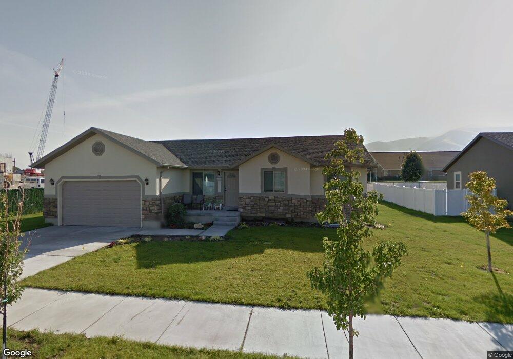
1553 S 1030 W Payson, UT 84651
Estimated Value: $510,110 - $543,000
3
Beds
2
Baths
2,802
Sq Ft
$187/Sq Ft
Est. Value
About This Home
This home is located at 1553 S 1030 W, Payson, UT 84651 and is currently estimated at $525,028, approximately $187 per square foot. 1553 S 1030 W is a home located in Utah County with nearby schools including Spring Lake Elementary, Payson Junior High School, and Payson High School.
Ownership History
Date
Name
Owned For
Owner Type
Purchase Details
Closed on
Dec 24, 2013
Sold by
Davis Robert M and Davis Christine
Bought by
Smith Nathalie
Current Estimated Value
Home Financials for this Owner
Home Financials are based on the most recent Mortgage that was taken out on this home.
Original Mortgage
$201,875
Outstanding Balance
$151,540
Interest Rate
4.32%
Mortgage Type
New Conventional
Estimated Equity
$373,488
Purchase Details
Closed on
Oct 6, 2009
Sold by
Rural Housing Development Corporation
Bought by
Davis Robert M and Davis Christine
Home Financials for this Owner
Home Financials are based on the most recent Mortgage that was taken out on this home.
Original Mortgage
$197,605
Interest Rate
5.02%
Mortgage Type
Purchase Money Mortgage
Purchase Details
Closed on
Apr 15, 2009
Sold by
Kriser Development Inc
Bought by
Rural Housing Development Corporation
Home Financials for this Owner
Home Financials are based on the most recent Mortgage that was taken out on this home.
Original Mortgage
$330,000
Interest Rate
5.17%
Mortgage Type
Purchase Money Mortgage
Create a Home Valuation Report for This Property
The Home Valuation Report is an in-depth analysis detailing your home's value as well as a comparison with similar homes in the area
Home Values in the Area
Average Home Value in this Area
Purchase History
| Date | Buyer | Sale Price | Title Company |
|---|---|---|---|
| Smith Nathalie | -- | None Available | |
| Davis Robert M | -- | Backman Orem | |
| Rural Housing Development Corporation | -- | Backmen Title Services Ltd |
Source: Public Records
Mortgage History
| Date | Status | Borrower | Loan Amount |
|---|---|---|---|
| Open | Smith Nathalie | $201,875 | |
| Previous Owner | Davis Robert M | $197,605 | |
| Previous Owner | Rural Housing Development Corporation | $330,000 |
Source: Public Records
Tax History Compared to Growth
Tax History
| Year | Tax Paid | Tax Assessment Tax Assessment Total Assessment is a certain percentage of the fair market value that is determined by local assessors to be the total taxable value of land and additions on the property. | Land | Improvement |
|---|---|---|---|---|
| 2025 | $2,379 | $257,785 | $168,000 | $300,700 |
| 2024 | $2,379 | $242,110 | $0 | $0 |
| 2023 | $2,430 | $247,995 | $0 | $0 |
| 2022 | $2,459 | $246,840 | $0 | $0 |
| 2021 | $2,081 | $335,000 | $110,300 | $224,700 |
| 2020 | $1,973 | $310,700 | $100,300 | $210,400 |
| 2019 | $1,817 | $293,400 | $83,000 | $210,400 |
| 2018 | $1,655 | $257,600 | $72,600 | $185,000 |
| 2017 | $1,557 | $130,295 | $0 | $0 |
| 2016 | $1,470 | $122,265 | $0 | $0 |
| 2015 | $1,413 | $116,710 | $0 | $0 |
| 2014 | $1,245 | $103,565 | $0 | $0 |
Source: Public Records
Map
Nearby Homes
- 1597 S 1100 W
- 1605 S 1100 W
- 1579 S 910 W
- 1002 W Temple Rim Ln
- 922 W 1620 S
- 1733 S 1100 W Unit 12
- 1582 S 790 W
- 1592 S 790 W
- 1763 S 1100 W Unit 14
- 802 Brookside Ct
- 1338 S 1150 W
- 1287 S 1080 W
- 588 W 1450 S
- 598 W Saddlebrook Dr
- 1216 S 1150 W Unit 19
- 1172 S 880 W
- 1128 W 1150 S Unit 9
- 4125 W 12000 S
- 1192 W 1130 St S Unit 202
- 1163 S 730 W
- 1561 S 1030 W
- 1558 S 1030 W
- 1567 S 1030 W
- 1564 S 1030 W
- 1014 W 1580 S
- 1572 S 1030 W
- 1557 S 1100 W
- 1557 S 1100 W Unit 1
- 1563 S 1100 W
- 1563 S 1100 W Unit 2
- 1578 S 1030 W
- 1015 W 1580 S
- 1001 W 1580 S
- 1579 S 1100 W
- 1579 S 1100 W Unit 4
- 1586 S 1030 W
- 985 W 1580 S
- 971 W 1580 S
- 1585 S 1100 W
- 1585 S 1100 W Unit 5