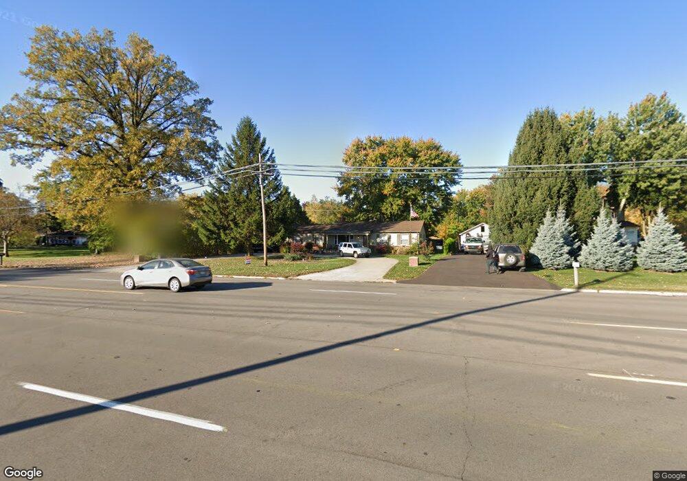
15533 Merriman Rd Livonia, MI 48154
Estimated Value: $321,680 - $337,000
--
Bed
1
Bath
1,218
Sq Ft
$270/Sq Ft
Est. Value
About This Home
This home is located at 15533 Merriman Rd, Livonia, MI 48154 and is currently estimated at $328,420, approximately $269 per square foot. 15533 Merriman Rd is a home located in Wayne County with nearby schools including Riley Upper Elementary School, Buchanan Elementary School, and Holmes Middle School.
Ownership History
Date
Name
Owned For
Owner Type
Purchase Details
Closed on
Apr 6, 2006
Sold by
Woodhouse Lawrence E and Woodhouse Sandra J
Bought by
Poster Terry L
Current Estimated Value
Purchase Details
Closed on
Jul 31, 2003
Sold by
Woodhouse Lawrence E and Woodhouse Sandra J
Bought by
Wasaya Danny A
Home Financials for this Owner
Home Financials are based on the most recent Mortgage that was taken out on this home.
Original Mortgage
$198,000
Interest Rate
7%
Mortgage Type
Seller Take Back
Create a Home Valuation Report for This Property
The Home Valuation Report is an in-depth analysis detailing your home's value as well as a comparison with similar homes in the area
Home Values in the Area
Average Home Value in this Area
Purchase History
| Date | Buyer | Sale Price | Title Company |
|---|---|---|---|
| Poster Terry L | -- | None Available | |
| Wasaya Danny A | -- | Multiple | |
| Wasaya Danny A | $218,000 | Multiple |
Source: Public Records
Mortgage History
| Date | Status | Borrower | Loan Amount |
|---|---|---|---|
| Previous Owner | Wasaya Danny A | $198,000 |
Source: Public Records
Tax History Compared to Growth
Tax History
| Year | Tax Paid | Tax Assessment Tax Assessment Total Assessment is a certain percentage of the fair market value that is determined by local assessors to be the total taxable value of land and additions on the property. | Land | Improvement |
|---|---|---|---|---|
| 2025 | $2,532 | $154,500 | $0 | $0 |
| 2024 | $2,532 | $143,100 | $0 | $0 |
| 2023 | $2,415 | $131,000 | $0 | $0 |
| 2022 | $4,241 | $129,100 | $0 | $0 |
| 2021 | $4,119 | $123,600 | $0 | $0 |
| 2019 | $3,952 | $115,400 | $0 | $0 |
| 2018 | $2,042 | $108,400 | $0 | $0 |
| 2017 | $3,614 | $104,200 | $0 | $0 |
| 2016 | $3,404 | $94,500 | $0 | $0 |
| 2015 | $8,240 | $90,450 | $0 | $0 |
| 2012 | -- | $78,830 | $35,000 | $43,830 |
Source: Public Records
Map
Nearby Homes
- 15600 Auburndale St
- 31005 Roycroft St
- 15345 Bainbridge St
- 15040 Berwick St
- 31069 Munger Dr
- 15075 Hubbard St Unit 5
- 32651 5 Mile Rd Unit 15
- 14677 Auburndale St
- 14879 Fairfield St
- 14563 Melrose St
- 32136 Lyndon St
- 31221 Lyndon St
- 31126 Grennada St
- 30425 Munger Dr
- 14327 Arden St
- 15873 Shadyside Dr
- 30831 Lyndon St
- 29760 Hoy St
- 16966 Fairfield St
- 30115 Munger Dr
- 15545 Merriman Rd
- 15521 Merriman Rd
- 15560 Auburndale St
- 15540 Auburndale St
- 15807 Merriman Rd
- 15431 Merriman Rd
- 15520 Auburndale St
- 15620 Auburndale St
- 0000 Dorais St
- 0 Dorais St
- 15660 Auburndale St
- 15810 Auburndale St
- 15809 Merriman Rd
- 15500 Auburndale St
- 15815 Merriman Rd
- 31337 Dorais St
- 31336 Dorais St
- 15440 Auburndale St
- 31338 Roycroft St
- 31365 Rayburn St